Three stones installed during the rule ofMaharaja Chandrakriti in the mid-19th century, to mark the eastern boundary of the then Manipur kingdomwith Burma, have “disappeared”, a senior official said on Monday.
Keithellakpam Dinamani, joint director of the arts and culture department, told PTI that the matter came to light when a nine-member team went on a research tour to the interior Kamjong district.
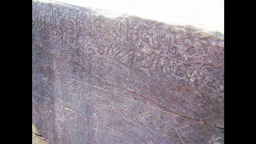
“The team found two stone engravings of Chandrakriti Maharaj earlier found at the confluence of Sanalok and Namphalok rivers have disappeared.
“These stones had an inscription in Bengali script and engravings of Chandrakriti footprints.
“Another boulder at nearby Chatric Khullen village with the image of Hanuman was also found missing,” Dinamani said.
The team was on a three-day tour to the area, nearly 150km from here, beginning April 7.
These stones stood as the historical boundaries of the then erstwhile Manipur kingdom with Burma (now Myanmar), he said.
The team appealed to the local villagers to return the stones with the engravings and even offered a monetary award, Dinamani said.
The site from where the stones had “disappeared” is uninhabited and is surrounded by thick forests. The nearest village is at least 4 or 5 km away.
Back in 2011, archaeological teams had found that the stone inscriptions had been dislodged from their original position, he said.
“The team could retrieve the stones and put them in the original places at that time,” Dinamani said.
Noting that inscribed stones were used by erstwhile Manipur rulers to demarcate boundaries, Dinamani said inscriptions at Behiang in Churachandpur district, at Tipaimukh at the confluence of Tuivai and Barak rivers in the southern part of the state, and the Kohima stone bear testimony to it.