At less than 400 years old, Calcutta is a young city compared to others such as Benares and Delhi, which have existed for thousands of years. But what it lacks in years, the city makes up in complexity, variety and a riveting history.
Three small villages by the Hooghly river metamorphosed, somewhat haphazardly, first into a British trading post and then a colossal colonial capital towards the end of the 17th century. Large parts of the city, once dotted with lowlands, tanks, mangroves and creeks, gave way to majestic buildings and a web of streets and lanes.
Calcutta chronicler P.T. Nair agreed that the evolution of streets has been a fascinating chapter in the growth of this metropolis. In his seminal book History of Calcutta’s Streets, he wrote, “...bewildering is the nomenclature used in Calcutta for designating its streets”. Nair noted that there were 31 terms — avenue, lane, road, gully, terrace, range and so on and so forth — to describe the thoroughfares of the city.
In an early map of Calcutta created by engraver and surveyor Aaron Upjohn and published in 1794, the roads are identified thus — “road leading to eastward” or “road to the court house”. This map was far from perfect and Upjohn was criticised for producing it in haste. Barely 20 thoroughfares had names signposted.
Among the oldest streets of the city are Chitpore Road and Bagbazar Street, both named after neighbourhoods. In colonial Calcutta, many roads were also named after landmarks — Church Lane, Darga Road or Old Post Office Road, for instance.
Some lanes, bylanes and rows were named after local vegetation — for example, Amratola Street, Bakulbagan Row and Taltala Avenue. Then there were roads named after creeks and ditches — Creek Row, Maratha Ditch Lane. Circular Road, later renamed, was built in the 19th century by covering a greater part of a ditch that was dug in the 1740s by the East India Company to protect Calcutta from Maratha invaders.
The pattern of street names changed drastically in imperial Calcutta — after the British Crown took over following the brutal crushing of the first concerted armed revolt against the East India Company. Many roads were named after governors-general (Lord Wellesley), viceroys (Lord Canning, Lord Mayo and so on) and royalty (Albert Road).
Jagannath Sur Lane.
After India’s independence, and with subsequent governments helming West Bengal, these thoroughfares got newer names, many of them obscuring the history, myths and legends associated with them. In 1982, 27 streets of Calcutta were renamed by the Left Front government.
If one looks up one of the oldest maps of the city created by Lieutenant Colonel Mark Wood in 1784-85, it will be evident how striking the changes have been. The city has grown and extended far beyond the limits demarcated for the Europeans and the natives in the old map.
Many buildings have been demolished and many new ones constructed. But many lanes and streets have managed to survive the relentless march of time, their old names intact, their stories, myths, legends and anecdotes waiting to be discovered.
Here are some that await your footfall and attention.
Gumghar Lane
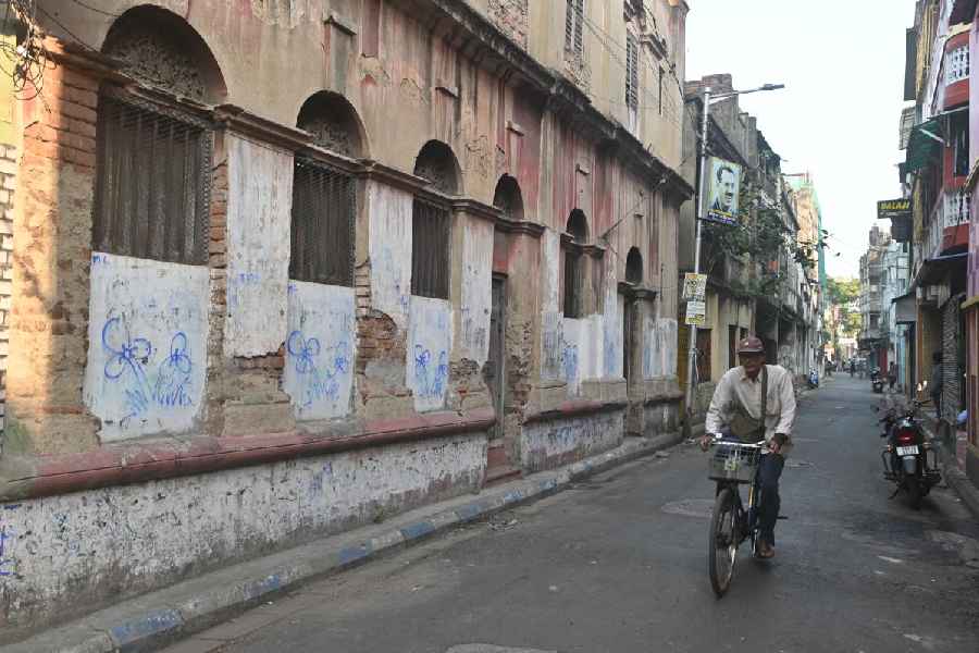
Barely 300 metres long, it branches out from Chandni Chowk Street in central Calcutta, opposite Sabir restaurant and ends abruptly at Temple Street. The otherwise nondescript lane is a kind of extension of the crowded electronics market of Chandni Chowk. Most of the houses along it are crumbling. The lane takes its name from the sinister Bengali word gum, meaning kidnapped or carried off. In Hindi, the word means lost.
There is a reference to “Gumghar Lane, north side of the native hospital, Durrumtollah” in The Bengal & Agra Directory of 1850. Those were the days when pestilences such as kala azar, cholera and smallpox were rampant in the city. British administrators had initially established a “native hospital” on Chitpore Road in 1796. But they later decided to remove it to “the open airy road of Durrumtollah”, which did not have too many houses in those days. This lane housed the hospital and that is how it got its name.
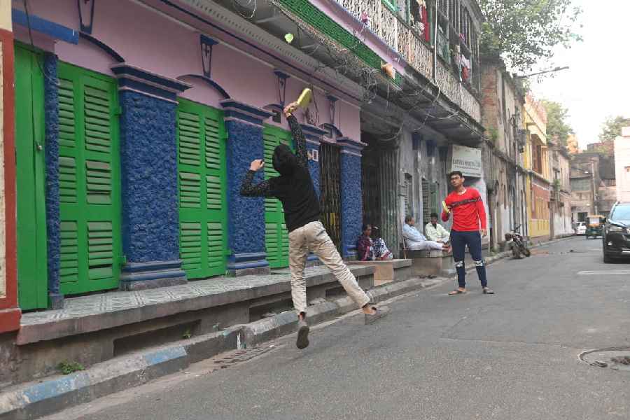
Serpentine Lane
The British named many of the streets after their curious shapes. So there is a Crooked Lane (off Dacres Lane), a CorkScrew Lane (Government Place North) — both long renamed — and a Serpentine Lane. In A Jaywalker’s Guide to Calcutta, Soumitra Das, writes about Serpentine Lane, “True to its name this lane is circumlocution turned into a pathway.” A journey through it still offers glimpses of a quintessential Calcutta.
Gulu Ostagar Lane
This lane in the Sovabazar area — more precisely Darjipara in central Calcutta — was apparently named after Gulu, an ostagar or master tailor. There used to be a neighbouring lane named after Lalu ostagar, now known as Abinash Mitra Street. Both Gulu and Lalu were tailors of the family of Nabakrishna Deb of the Sovabazar Rajbari. There is a Budhu Ostagar Lane close to the Sealdah Railway station, inside the bylanes of Baithakkhana neighbourhood, and a Miajan Ostagar Lane in the Ballygunge area.
Gulu Ostagar Lane
The naming of lanes and bylanes after working-class people was not uncommon in colonial Calcutta. There were khansamas or cooks, laundry owners and even sweepers who had lanes named after them. For example, Chhaku Khansama Lane in Sealdah, Chamru Khansama Lane in the Park Circus area and Karim Bux Lane in Taltala. But Nimu Khansama Lane beside the Medical College is now Eden Hospital Road and Miajaan Khansama Lane near Taltala is now Nawab Abdur Rahman Street. “Many of the khansamas served their British masters and impressed them with their culinary skills. The sahibs happily allowed municipal officials to name streets after them,” says Somnath Ghosh, who was formerly with the heritage committee of the Calcutta Corporation and is an expert on the history of Calcutta’s streets. Among the names of working-class people, the most surprising one is Panchi Dhopani Lane in Burrabazar named after a laundress.
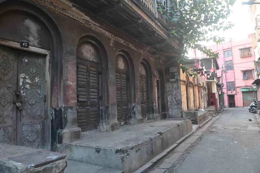
Raja Woodmund Street
This street off Strand Road was named after Raja Udmanta or Udyanta Singh, the nephew of Devi Sinha, a dewan of the East India Company and founder of the royal family of Nashipur in Murshidabad. Although Devi Sinha had gained notoriety as a ruthless revenue collector, his nephew and descendants had undertaken various charitable works such as building temples and roads, and welfare programmes. Udyanta started this good work, which was carried on by his son and sustained by his grandsons. His son Ramchandra — or Cowar Ram Chand — offered a huge tract of land near the Hooghly Bridge to the board of municipal commissioners to build a road. This was in 1856, and he spent as much as ₹35,000 on the project. The anglicised name of the road is Raja Woodmund Street.
Hari Ghosh Street
Hari Ghosh Street.
Near Sovabazar in north Calcutta is this street named after the benevolent trader Hari Ghosh. As a dewan of the East India Company’s Monghyr Fort (now Munger, and in Bihar), he had earned millions. Such was his generosity that he turned one
of his houses into a shelter for relatives, friends and acquaintances in need. That is how the Bengali language came to have the idiom “Hari Ghosher gowal”, suggesting a crowded cowshed. But in the end, the man with the large heart could not repay his loans and was forced to sell his property. He spent his last days in Benares.