The Netaji Subhas Chandra Bose International Airport will shut flight operations from 1200 IST on May 26 to 0900 IST on Monday due to predicted heavy winds and heavy to very heavy rainfall in Calcutta in the wake of cyclone Remal, the airport authorities posted on X (formerly Twitter) on Saturday evening.
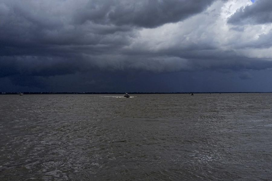
Earlier, a hot and sultry Calcutta on Saturday morning moved towards a slightly more tolerable afternoon with localised showers reported in some parts of the city, as the Bengal state administration braced for cyclone Remal that is likely to hit the coast by Sunday midnight.
The India Meteorological Department has forecast heavy to very heavy rainfall in Calcutta, West Midnapore, East Burdwan, South 24-Parganas, North 24-Parganas, Howrah and Hooghly in the wake of the severe cyclonic storm.
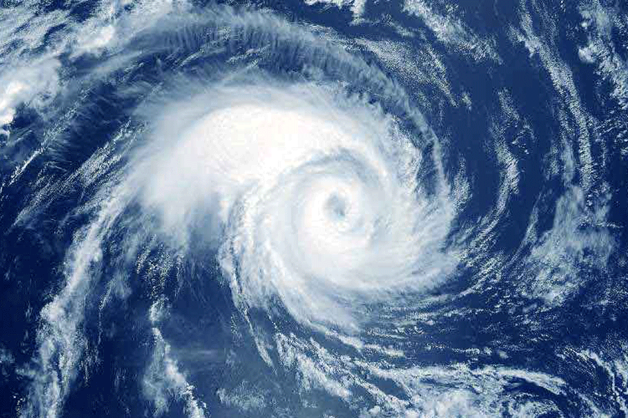
A bulletin issued by the IMD at 3pm on Saturday confirmed that the depression over the Bay of Bengal had converted into a deep depression. By Saturday evening it is expected to intensify into a severe cyclonic storm with wind speeds of 110-120 kmph while it keeps travelling northwards.
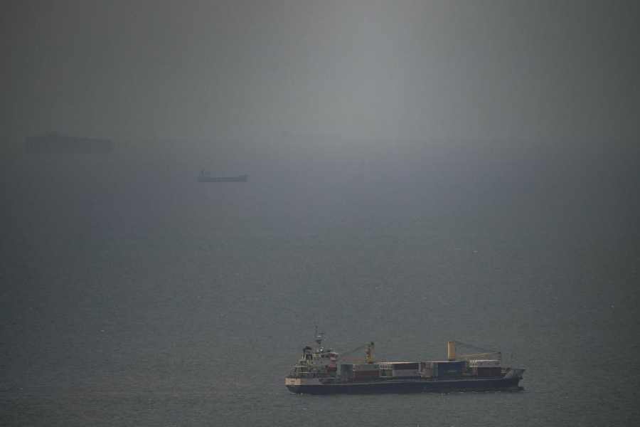
On Saturday morning, the formation was around 420 km south of Khepupara in Bangladesh and at an equal distance from the Sagar Islands on this side of the border in a South-South East direction and is moving northwards.
The landfall is expected to be around Sunday midnight – between 11pm on Sunday and 1am on Monday – between Bangladesh’s Khepupara and Sagar Islands in West Bengal. The two points are around 400 km apart and the closer the landfall is to Sagar, the more Calcutta and Bengal will be affected.
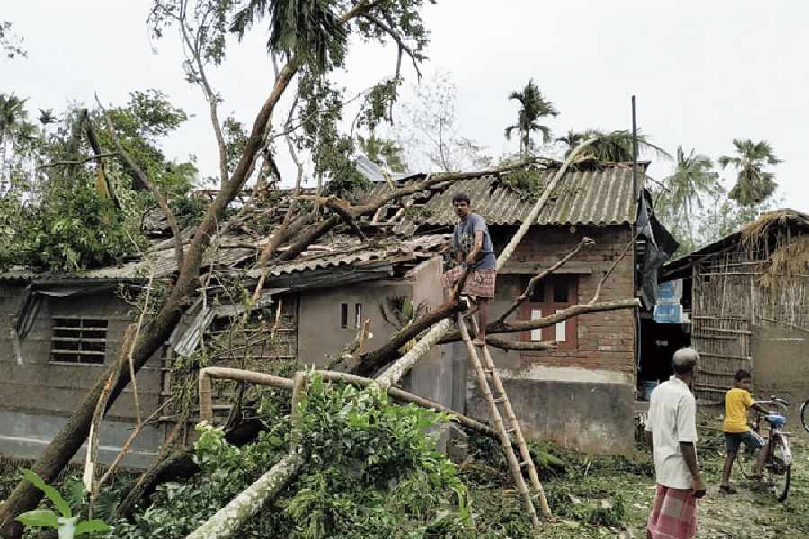
When the landfall happens on Sunday night, cyclone Remal is expected to have a storm surge of up to 1.5 m. That could inundate the low-lying areas in coastal West Bengal and neighbouring Bangladesh.
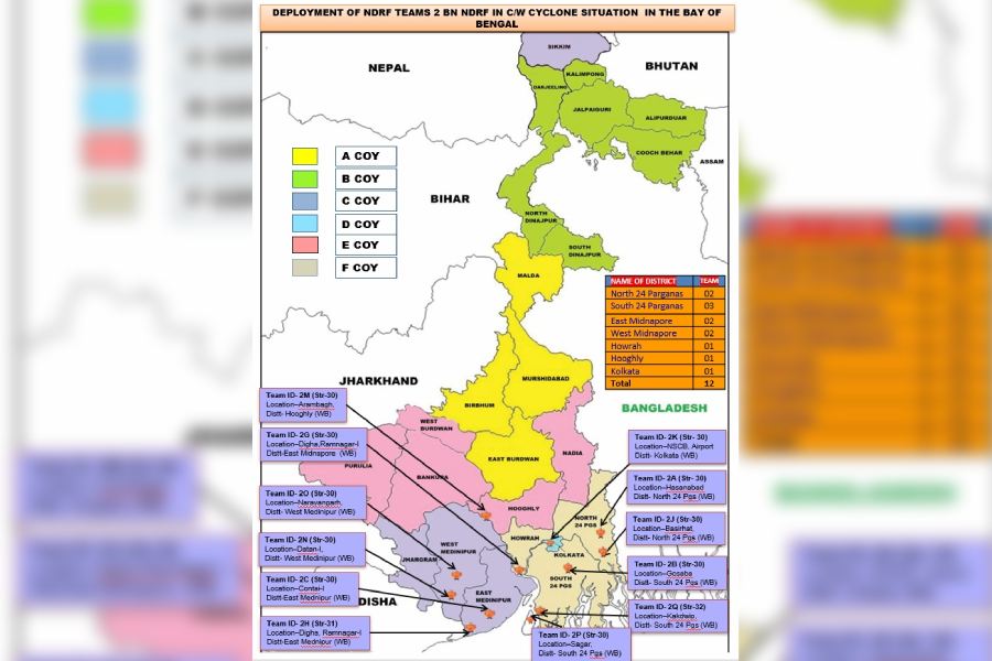
The National Disaster Response Force has stationed 12 teams: At Arambagh in Hooghly, Digha (two teams) and Contai in East Midnapore, Narayangarh and Dantan in West Midnapore, Hasnabad and Basirhat in North 24-Parganas, Kakdwip, Gosaba and Sagar Islands in South 24 Parganas and another team at the Netaji Subhas Chandra Bose International Airport in Calcutta.
“Fishing [in the sea] has been prohibited,” said a senior official in the South 24 Parganas district administration. “We have also received an advisory from the state transport department and ferry services are likely to be suspended from Sunday onwards till the cyclonic storm passes. Evacuation of residents from the low-lying areas and near the coast is being carried out.”
Senior officials of the National Crisis Management Committee held a meeting with Bengal chief secretary BP Gopalika on Friday to assess the preparations of the state administration in meeting the cyclonic disaster.
The state government has set up control rooms in the districts where the cyclonic storm is likely to have the heaviest impact.
According to the IMD bulletin at 3 pm on Saturday, these are the kind of damages Remal could cause in South & North 24 Parganas, Howrah, Hoogly, Kolkata & adjoining East Medinipur districts of West Bengal:
- Major damage to thatched houses/ huts. Possibilities of damage to vulnerable structure.
- Unattached metal sheets may fly.
- Breaking of tree branches, uprooting of trees. Major damage to banana and papaya trees. Dead limbs may blow off from trees.
- Damage to power and communication lines due to breaking of branches and uprooting of trees.
- Damage to kutcha and minor damage to pucca roads due to heavy rain.
- Damage to paddy crops, horticultural crops and orchards.
- Inundation of low-lying areas and localised flooding
- Occasional reduction in visibility due to heavy rainfall.
- Disruption of traffic due to water logging and squally winds.