An extremely severe cyclone packing winds of up to 190 kmph on Wednesday rampaged through coastal Odisha and West Bengal, dumping heavy rain, swamping homes and farmland, and leaving at least three people dead, officials said.
While man and a woman were reported killed when trees came crashing down on them in North 24 Parganas district of West Bengal, a 13-year-old girl died in a similar incident in adjoining Howrah. No casualties have been reported from Odisha yet.
West Bengal chief minister Mamata Banerjee, who is monitoring the situation from Nabanna, the state secretariat, however, claimed at least 10-12 people lost their lives.
'Area after area has been ruined. I have experienced a war-like situation today. At least 10-12 people have died. Nandigram, Ramnagar....the two districts of North and South 24 Parganas are destroyed,' she said.
After making landfall at 2.30 pm between Digha in West Bengal and Hatiya island in Bangladesh, cyclone Amphan cut a swathe through the coastal areas, flattening fragile dwellings, uprooting trees and electric poles. At least 6.58 lakh people were evacuated in West Bengal and Odisha before the cyclone struck.
'The forward sector of the wall cloud region is entering into land in West Bengal. The intensity of the cyclone near its centre as the landfall process started was recorded at 160-170 kmph, reaching up to 190 kmph,' the weather department said.
Roofs blown away
Reports arriving in Calcutta from North and South 24 Parganas and East Midnapore said roofs of thatched houses were blown away, electric poles got twisted and hundreds of trees broken and uprooted.
Streets and homes in low lying areas of Calcutta were swamped with rainwater. A video clip of an under-construction Calcutta skyscraper showed huge aluminium sheets flying like bird feathers in air.
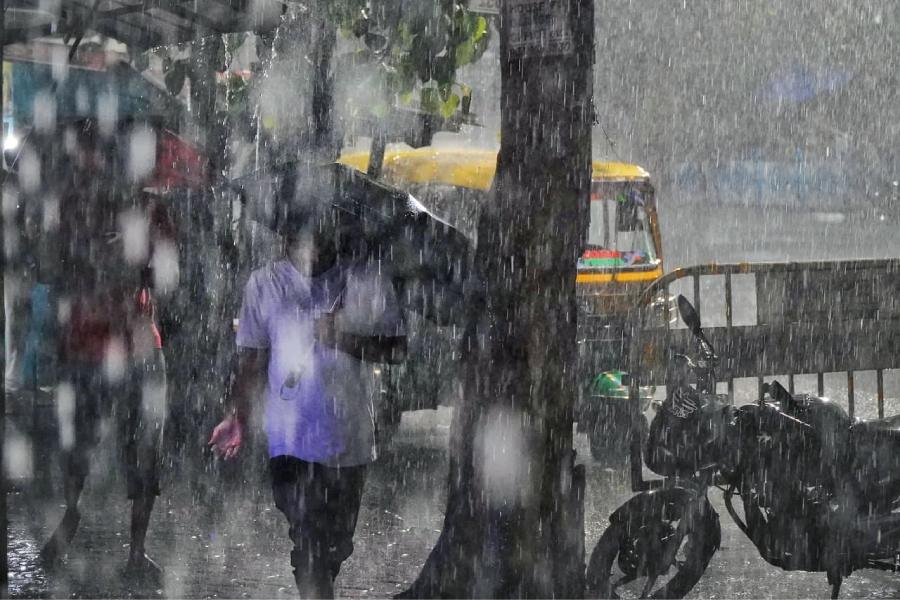
Alipore in central Calcutta recorded a massive 222 mm of rainfall and Dum Dum 194 mm between 8am and 8:30 pm. Even when the rain stopped in most parts of the city after 9 pm, high-velocity winds continued to sweep the metropolis and its satellite towns.
No power, poor mobile connectivity
Almost the entire city was plunged into darkness since the evening as electric supply either got snapped due to rain and wind or was suspended as a precautionary measure. Cellphone services were disrupted in many places.
NDRF chief S N Pradhan told a press conference in New Delhi that 20 teams of the federal disaster response force had already begun road clearing operations in Odisha, while the 19 units deployed in West Bengal were shifting people to safety.
Quoting figures made available by the two states, Pradhan said over 5 lakh people were evacuated in West Bengal and more than 1.58 lakh in Odisha.
Gigantic tidal waves in Digha
TV footage showed gigantic tidal waves crashing into a seawall in Digha, close to the landfall site. Thick sheets of rain blurred the vast coastline in the two states and surging waters engulfed mud-and-thatch houses, flattening them in a trice.
Heavy machinery was moved in to clear the roads blocked by falling trees.
India Meteorological Department (IMD) Director General Mrityunjay Mohapatra, who jointly addressed the media with Pradhan, said gale-strength winds speeding at 160-170 kmph were pounding South and North 24 Parganas and East Midnapore districts and could be gusting up to 185 kmph.
He said the wall of the eye of the monster cyclone, the most explosive part of a cyclonic system, triggered copious rain in the three districts. The eye of the storm itself was 30 km in diameter, he said.
Mohapatra said the intensity of the rain and winds accompanying it could deceptively look like ebbing away briefly, but will surge afresh once the rear sector of the storm has reached the landmass.
The whole cyclonic system reached the landmass by 7pm, before moving forward in fury.
Amphan second strongest
Despite losing its force a bit since Tuesday, the storm, which was categorised as super cyclone at one point of time, left the two eastern states on edge as it hollered on its destructive path.
Amphan is the second strongest storm on the Bay of Bengal since the 1999 Odisha super cyclone, said Mohapatra who led the tracking efforts that began in the second week of May, focused on what was then a low-pressure zone near the South Andaman Sea.
At one point on Monday night, Amphan had become the only super cyclone after the Odisha one over 20 years ago.
“The 1999 super cyclone had generated sustained wind speeds of 260-280kmph. Amphan had winds blowing at 230-240kmph,” Mohapatra said.
Enormity of devastation
Mamata Banerjee said the enormity of the devastation will become clearer by Thursday when the storm will have passed over the state.
In Odisha, intense rainfall was recorded in several areas of Puri, Khurda, Jagatsinghpur, Cuttack, Kendrapara, Jajpur, Ganjam, Ganjam, Bhadrak and Balasore districts since Tuesday.
The rains and high-velocity winds ebbed away by late Wednesday night but not before causing massive damage to standing crops, plantations and infrastructure.
Tidal surge of up to five metres occurred in North and South 24 Parganas and East Midnapore districts of West Bengal, inundating vast tracts of land, officials said.
The turbulence will likely extend to Assam and Meghalaya, triggering heavy to very heavy rain on Thursday.
Mohapatra said since the time the depression formed over the Bay of Bengal on May 20 till the cyclone made landfall, the IMDs predictions about the path it will take and the timing was accurate and helped the disaster response machinery strategise and execute the plans to minimise the damage effectively.
The cyclonic storm will get weaker while crossing over Nadia and Murshidabad in West Bengal later on Wednesday night before entering Bangladesh as a deep depression and dissipating.