The foot-based search and the rescue operation to trace the two missing Arunachal Pradesh mountaineers have been called off because of heavy rains with the administration now solely focussed on chopper-based search operation as soon as the weather clears up.
A team of 31 Army personnel, three local mountaineers and 60 porters had embarked on a mission to rescue Everester Tapi Mra and his assistant Niki Dao. The search mission was launched from Seppa, the district headquarters of the East Kameng district, on Thursday but it had to be called off on Monday night.
“We have decided to focus fully and effectively on helicopter-based search and rescue operation. The Met office forecast is clear weather between September 8 and 12. All preparations in place for an effective and swift operation,” East Kameng deputy commissioner Pravimal Abhishek Polumatla told The Telegraph on Tuesday.
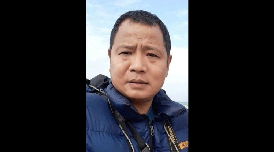
Mra, 37, the first from the frontier state to scale Mount Everest in 2009, hails from Upper Subansiri district. His companion Dao, 22, hails from East Kameng district.They went incommunicado on August 17 while on an official expedition to Mount Kyarisatam (locally known as Mt. Chiumo) located along the India-Tibet border at an altitude of 6890 mts.
Mra was leading a 13-member team on the expedition from July 28 to the snow-capped Mount Kyarisatam in the district. Deputy commissioner Abhishek also said with the water level dangerously increasing in Wapriyang Bung river, foot-based search operation was called-off with immediate effect on Monday evening. Four army choppers are on standby for the rescue operation.
“In the coming days, the situation is estimated to turn worse due to persistent rain over the past few days leading to swelling of all rivers — including Kameng, Kania and Wapriyang Bung. It is extremely dangerous to cross Wapriyang Bung at (Confluence Point of Kameng) and proceed further,” he said.
There is also heavy attrition rate of porters roped in from other areas due to inclement weather and risky terrain beyond Veo village.
“Even if the troops manage to cross Wapriyang Bung, it is extremely difficult to maintain supply chains or evacuate them in case of any emergency,” the deputy commissioner said.
Such has been the weather that there is no satellite imagery between August 17 and August 31 to find clues. There was satellite data for September 1 but that is also not clear, the official said.The administration had contacted the National Remote Sensing Centre (NRSC) and North East Space Applications Centre (NESAC) for any satellite imagery.