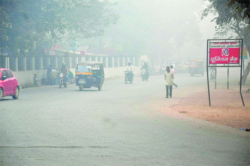

Pedestrians and vehicles make their way on a cold foggy morning near Gandhi Maidan on Sunday.
Picture by Ranjeet Kumar Dey
Severe cold conditions took residents by surprise on Sunday morning.
The Patna Meteorological Centre has predicted a long spell of fog over the next week and day-cold conditions over the next few days.
Apart from the chill factor, the fog cover played spoilsport for revellers this weekend. The Sun could be seen only around 2pm on Sunday, giving warm respite to residents for the next three hours.
'I was planning to take my family for a trip to Vaishali today but it was so foggy that I did not think of travelling. Hence, we cancelled the trip and watched PK,' said Mukesh Roy, a resident of Boring Road.
Flight and train operations, too, were hit. The first flight at Patna airport landed around 2pm on Sunday, leading to delay of several other flights during the rest of the day.
Experts attributed the cold to chilly winds blowing from the foothills of the Himalayas.
After a gap of more than a week, a thick layer of fog enveloped parts of the state. Weathermen attributed the conditions to the impact of a western disturbance over Uttarakhand. The disturbance has triggered day-cold conditions in most parts of north India, especially Uttar Pradesh, Punjab and Haryana. The temperature, especially the day temperature, has dropped by several notches across north India owing to the icy-cold north-westerly winds.
'We were expecting the western disturbance to hit Bihar on Monday but it reached the region today (Sunday) itself. As a result, thick fog was observed today, which lasted almost through the day in the lower layer of atmosphere. Such foggy conditions with cloudy days are expected throughout next week,' said Ashish Sen, director, Patna Meteorological Centre. Sen claimed that the minimum temperature in the city is expected to be around 9-10°C and corresponding maximum is likely to be around 20°C.
Met officials claimed that the cold westerly winds were blowing at an average speed of around 10-12kmph on Sunday. Ideally, the speed should not be more than 4-6kmph at this time of the year.
Weathermen ruled out cold-wave conditions as of now. Met chief Sen claimed that the prevailing temperature conditions do not satisfy the meteorological criteria for declaring cold-wave conditions. According to meteorological norms, cold wave conditions are declared at a place when the normal minimum temperature is 10°C or above but the actual temperature is recorded at 7°C or even lower. It is also declared when the normal minimum temperature is 10°C or less and the actual temperature is 5°C or less.
Though the state is not in the grip of cold-wave conditions, weathermen claimed that the conditions are likely for day-cold conditions over the next few days. The day-cold condition is said to be prevailing in the atmosphere, when the maximum temperature is around 8 to 10°C below the normal temperature, accompanied by thick fog cover.