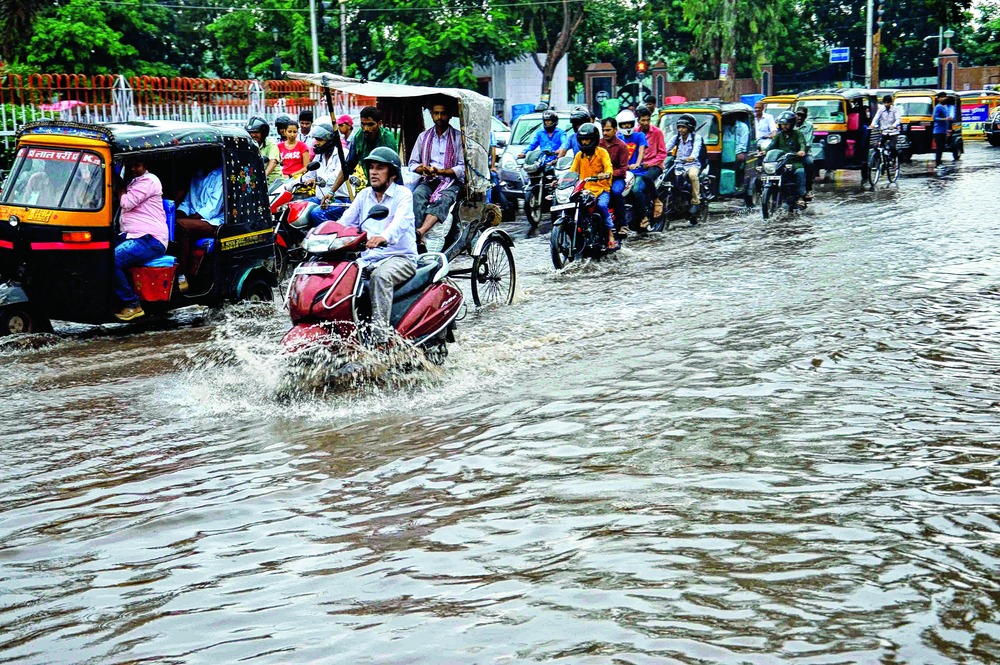

Two hours of rain was all it took to unsettle Patna on Monday, as rainwater swirled through all the major roads leaving them waterlogged.
Though the showers (around 17.1mm) brought in a welcome relief from the hot and humid conditions prevailing over the state capital and elsewhere, people just avoided commuting on the treacherous underwater terrain full of pits and bumps, choosing instead to wait wherever they could find shelter till the rain got over.
Major thoroughfares in Patliputra Colony, Kurji, Patel Nagar, Anand Puri, Gardanibagh, Punaichak, Station Road, Kankerbagh, Rajendra Nagar, Kadamkuan, Lohanipur, Dariyapur, Machhuatoli, Gandhi Maidan area and SP Verma Road got waterlogged just minutes after the rainfall started. Its intensity wavered from moderate to heavy.
"I was travelling on a motorbike on the Kankerbagh Main Road when the downpour started," said Rekha Vinay, a corporate professional and Kadamkuan resident. "I just stopped and took shelter in a shop, waiting for two hours there because water was gushing down from a flyover some distance ahead. It is always good to be safe than sorry."

Picture by Ranjeet Kumar Dey
With streets and roads waterlogged, vehicles slowed down and soon traffic snarls engulfed the city, leaving automobiles crawling for the next couple of hours.
Incomplete drainage work and a swollen Ganga have heightened the water-logging problem in low-lying areas, as rainwater could not be drained to the river quickly.
The current spell of rain is because of a combination of low-pressure area over northwest Bay of Bengal, adjoining areas of Gangetic Bengal and neighbouring areas and the eastern end of the axis of southwest monsoon passing through Gorakhpur in Uttar Pradesh and Gaya in Bihar.
Rainfall over the state was widespread, especially in eastern, southeastern and central parts. Weather scientists have forecast further spells over the next two days. Arpita Rastogi, the India Meteorological Department (IMD) station director at Patna, told The Telegraph: "We have issued heavy rainfall warning for the next 24 hours over parts of north-eastern and south-eastern Bihar. In addition, light to moderate rain would spread across other parts of the state over the next 48 hours."
In addition, IMD, in its countrywide weather bulletin, has forecast "very likely heavy to very heavy rains at a few places" in Bihar on September 7 and "heavy rain likely at isolated places" on September 8.
Arpita said the temperatures in Bihar were set to fall by a couple of degrees and humidity too would decline. The state has received 693mm rain against the required 841mm, but the present spell of rain has reduced the deficit, which was at 22 per cent last week, to 18 per cent. It is set to improve further.
The state disaster management department (DMD) is already on alert, following heavy rain in the catchment areas of Kosi and Gandak in Nepal. Floods in the state come mainly from rainfall in the neighbouring country, and water running off to swell the rivers here.