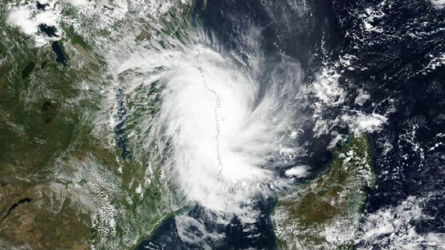
A deep depression over west-central Bay of Bengal intensified into Cyclone Jawad on Friday morning.
The storm is tipped to hit land near the Puri coast on Sunday afternoon and, after a tenure on land, is expected to take the sea route again towards the Bengal coast, Met officials said.
“It is expected to reach the Bengal coast around Monday afternoon. By that time, it is unlikely that the storm will remain a cyclone. The time spent on land and the resultant friction with trees and houses will weaken it considerably,” said Mrutyunjoy Mohapatra, chief of India Meteorological Department (IMD).
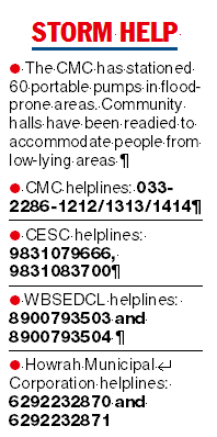
The Met bulletin has predicted rainfall across Gangetic Bengal from Saturday to Monday. Kolkata is likely to get heavy to very heavy rain on Sunday. The conditions are likely to be windy, with gusts up to 50kmph.
- On Saturday, heavy to very heavy rain is expected in Purba and Paschim Medinipur. North and South 24-Parganas, Jhargram, Howrah and Hooghly are likely to get heavy rain.
- On Sunday, heavy to very heavy rain is likely in North and South 24-Parganas, Purba and Paschim Medinipur, Jhargram, Howrah and Hooghly and heavy rain is likely in Purulia, Bankura, Nadia, Murshidabad, East and West Burdwan and Birbhum.
- On Monday, heavy rain is likely in North and South 24-Parganas, Nadia and Murshidabad.
- The coastal areas are likely to start getting windy from Saturday.
Around 5.30pm on Friday, Cyclone Jawad (name given by Saudi Arabia) was 300km from Visakhapatnam in Andhra Pradesh and 480km from Puri in Odisha, said a bulletin from the India Meteorological Department.


“It is likely to move northwestwards and reach west-central Bay of Bengal off north Andhra Pradesh-south Odisha coasts by the 4th December morning. It is likely to recurve north-northeastwards and move along the Odisha coast reaching near Puri around 5th December noon. Thereafter it is likely to continue to move north-northeastwards towards the Bengal coast,” the bulletin added.
By the first half of Saturday, Jawad is expected to turn into its strongest form, a “severe cyclonic storm”. On the sea, it would be generating wind speeds over 100kmph around Saturday evening, according to the Met forecast.
But it will lose momentum and by the time it reaches land, it is expected to be a cyclone again.
The storm is expected to enter land between Puri and Chandbali in Odisha, said a Met official. Chandbali is around 360km and Puri around 500km from Kolkata.
There was no word from the Met office on the possible area where Jawad would enter Bengal. By then, it will no longer be a cyclone.
In September, Gulab, the previous cyclone to hit the east coast, had crossed land 20km north of Kalingapatnam in north Andhra. Kalingapatnam is over 750km from Kolkata. The one before, Yaas, had hit land near Balasore in Odisha, over 250km from Kolkata, in May.