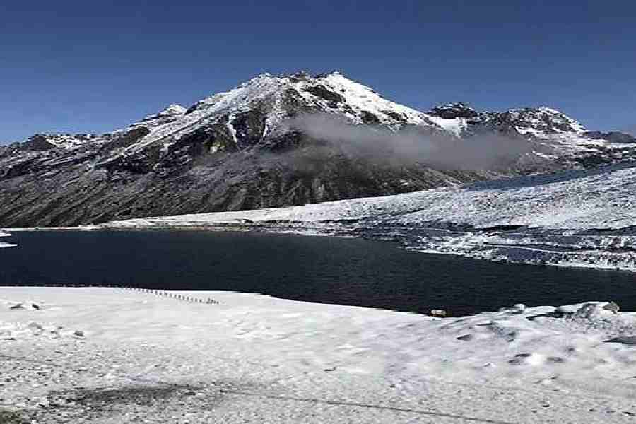
Scientists studying the Khangri glacier in Arunachal Pradesh’s Tawang district have observed rapid melting, formation of unstable terrain and the emergence of a potentially dangerous glacial lake that could pose a flood threat to downstream areas in the Mago Chu basin, an official said on Monday.
The findings were made during the fifth Khangri glacier expedition conducted by the Centre for Earth Sciences and Himalayan Studies (CESHS) here, in collaboration with the National Centre for Polar and Ocean Research and the North Eastern Regional Institute of Science and Technology, he said.
The scientific expedition began on May 4 in the transboundary Mago Chu basin, a key headwaters region of the Brahmaputra Basin system, with an aim of carrying out glacier health assessments, cryosphere monitoring, and climate hazard studies in the eastern Himalayas.
CESHS director Tage Tana said the expedition team observed "alarming geomorphological changes in the Khangri glacier" during ground studies, indicating the growing impact of climate variability in the high-altitude Himalayan region.
Among the major observations was the development of a large glacier sinking zone where the glacier snout is rapidly collapsing, creating unstable terrain conditions.
Scientists warned that such instability could increase landscape hazards and downstream vulnerability in the Mago Chu basin.
The team also identified a newly formed proglacial lake at an altitude of around 16,500 feet.
According to the scientists, the lake has the potential to trigger a glacial lake outburst flood (GLOF), which could impact downstream communities and river systems, including transboundary regions.
Despite comparatively good snowfall during the winter season this year, researchers found that glacier melting continues at a critical pace due to rising temperatures and persistent climate variability across the eastern Himalayas, Tana said.
To strengthen long-term glacier monitoring, the team installed five new scientific monitoring stakes at elevations of nearly 17,000 feet using an ice-core drilling system integrated with Differential Global Positioning System (DGPS) technology.
These installations will help monitor glacier mass balance and surface movement in the coming years.
The expedition team also retrieved important data from the existing automatic weather station (AWS) and automatic water level recorder. Maintenance and calibration of the systems were also carried out to ensure uninterrupted environmental monitoring in the high-altitude region, the official said.
In addition, moraine sediments and glacier meltwater samples were collected from the glacier snout for geochemical analysis.
Tana said the successful completion of the expedition has strengthened long-term cryosphere monitoring efforts in the eastern Himalayas and will provide important scientific inputs on glacier dynamics, water security, and climate-related hazards in the region.
Except for the headline, this story has not been edited by The Telegraph Online staff and has been published from a syndicated feed.