
Bhubaneswar, Feb. 10: Mushrooming of illegal constructions within the prohibited zones of ancient monuments across will shortly be passé with the development authority planning to draw up detailed maps of heritage sites to ensure better conservation and protection.
The Bhubaneswar Development Authority, along with the culture department, would prepare a heritage regulation guideline for the city with the use of these cadastral maps, which also show ownership of individual plots and their boundaries. Till date, the city has no detailed maps of monuments along with their immediate surroundings.
With reliable maps of the heritage sites and their surrounding areas, the authority will get to know precisely where not to give approval for building plans as well as which approvals to cancel.
"The Ancient Monuments and Archaeological Sites and Remains(Amendment and Validation)Act, 2010, prohibits construction within 100 metres of such monuments and permits only regulated development within 300 metres of them. With the detailed mapping of the monuments, we will get to know how many houses or buildings are actually located within the regulated or prohibited zone," said vice-chairman of the development body Krishan Kumar.
The culture department has been entrusted with the responsibility of preparing the maps. While there are 23 protected monuments under the Archaeological Survey of India (ASI), the state archaeology protects nine monuments in the city.

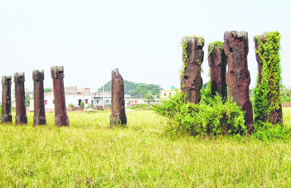
Deputy director (culture) B.P. Ray cited the example of Sisupalgarh, a 2,000-year-old site on the city outskirts, to underscore the importance of maps. "Within the boundary of this site, more than 1,000 illegal houses have come up without the permission of the development authority. Equipped with the maps, the enforcement wing of the development authority can demolish some of these structures to set an example," he said.
Sources said many big structures, including a private school and a mall, had come up near the famous Khandagiri-Udaygiri caves without the authority's approval. "There could be hundreds of such illegal structures across the city, and they will be easily identified once the maps are ready. The maps can also be superimposed on remote sensing and geo-information system (GIS) tools to make it more user friendly," said an official of the enforcement wing.
Former superintending archaeologist of the state archaeology B.K. Rath said: "The development authority and the Bhubaneswar Municipal Corporation have to take strong action to deter encroachers."
ASI superintending archaeologist (Bhubaneswar circle) Bhuvan Vikrama said: "The respective revenue circle of the state government has the detailed map of the monuments. But, if the government has a more comprehensive plan, it can help conservation."
However, he said taking action against the violators was ultimately the job of the city administration. "In Sisupalgarh, the entire 562.68 acresremains protected formally under the act, but only 0.77 acres is under the possession of the ASI," he said.