 |
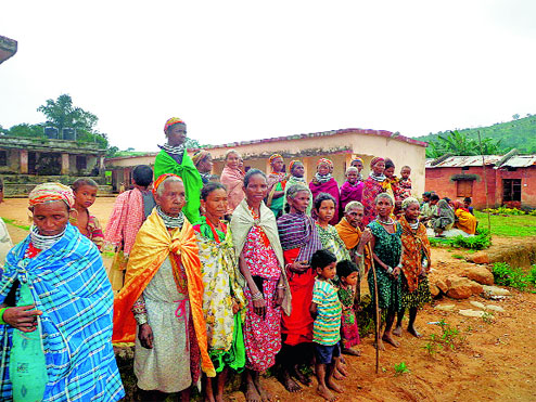
| Bonda tribals at a cyclone shelter at Mudulipada in Malkangiri. Picture by Ratnakar Dash |
Bhubaneswar, Oct. 12: Heavy rain accompanied by gusty winds lashed several Odisha districts today as a “very severe” cyclone Hudhud slammed the state after making a landfall in Visakhapatnam across the border.
Around 1.56 lakh people were shifted from vulnerable areas and lodged in 1,690 cyclone shelters in the nine worst affected districts, as the gale with wind speed reaching 80-90kmph blew away roofs of thatched houses, uprooted trees and smashed electric and telephone wires.
There were reports of house collapse from districts such as Ganjam, Gajapati, Rayagada, Koraput, Kandhamal, Malkangiri, Kahalandi and Nayagarh that experienced torrential rainfall.
One of the worst hit areas was Pottangi in Koraput district from where large-scale uprooting of trees and disruption of communication were reported. The state has already reported three cyclone-related casualties. While two persons were killed in Kendrapara district when a boat capsized during the evacuation operation, a fisherman was swept away by the tidal waves in Puri.
“Maximum impact of the cyclone will be felt when it crosses the state between Mathili and Khairiput between 9.30pm and 10pm today,” said special relief commissioner P.K. Mohapatra.
As many as 25 teams of National Disaster Response Force (NDRF) and Odisha Disaster Rapid Action Force were deployed in the eight most vulnerable districts, almost all of them located in south Odisha close to Andhra Pradesh that was worst hit by the gale.
The cyclone triggered heavy rainfall not only in Malkangiri, Koraput, Nowrangpur, Gajapati, Ganjam, Kandhamal and Kalahandi, which fall in its path, but also in most of the coastal districts, including Khurda, Cuttack and Kendrapara.
Mohapatra said the state was expecting a rainfall of around 255mm in the next 24 hours, which could trigger flash floods. “That is one of our major concerns as rivers such as Vamshdhara and Rushikulya may swell,” he said adding that a constant watch is being kept on the situation. Heavy rain is expected to continue in the state till October 15.
Under the impact of the cyclone, tidal surges were witnessed in parts of Kendrapara district, including Rajnagar where waves rose to a height of four metres.
Tourists in Puri, too, kept away from the sea, which had turned rough. “We have warned even fishermen against venturing into the sea,” said director, Bhubaneswar office of the Indian Meteorological Department (IMD), Sarat Chandra Sahu.
With rains pounding large parts of the state, including Bhubaneswar since this morning and wind picking up speed, East Coast railway authorities cancelled several trains while diverting many others. The cancelled trains included Bhubaneswar-Jagdalpur Hirakhand Express and Hyderabad-Visakhapatnam Janmbhoomi Express.
Odisha districts such as Ganjam, Gajapati, Malkangiri and Rayagada started experiencing gusty winds and heavy rains soon after the gale hit the Vishakhapatnam coast at 11.30am.
“Now the winds are blowing in our direction. We may experience the worst when Hudhud passes over the state bisecting the southern districts of Koraput and Malkangiri,” said a senior official.
While train services were disrupted mainly on account of uprooting of trees, bus services in almost all the southern districts were seriously affected because of the storm. In most of these districts buses did not ply as a precautionary measure.
Disruption of power supply was frequent even in cities such as Bhubaneswar and Cuttack though rural areas were the worst affected.
“Engineers have standing instructions to cut power supply if the wind speed increases. So far there is no report of any major damage to power infrastructure because of the gale,” said power secretary Suresh Mohapatra.
The water level in the Hirakud reservoir over Mahanadi was 624.89ft against the total reservoir capacity of 630ft.
“At this level we are safe even if it rains heavily in the upper catchment area of the river in neighbouring Chhattisgarh, which will also be affected by the cyclone,” said an official.
IMD director-general Laxman Singh Rathore said that due to hilly topography of south Odisha, the intensity of the cyclone was likely to get reduced in the next six hours.
Senior government officials here admitted that the state had suffered much less compared to the neighbouring Andhra Pradesh.
“We will extend our neighbour all possible help,” said the special relief commissioner pointing out that Odisha was in a position to spare at least two teams of the NDRF for deployment in Andhra Pradesh.