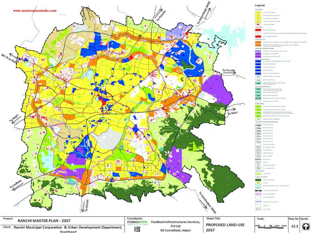
The Ranchi Municipal Corporation (RMC) has undertaken the Herculean task of preparing cadastral maps of the capital city to facilitate its Master Plan 2037.
A cadastre is a comprehensive register of real estate in a city, state or country. A cadastral map includes details of the land/property ownership, tenure, dimensions, precise location sometimes with GPS coordinates and value among others. The cadastre can be a fundamental source of data in civic planning as well as in disputes and lawsuits.
Municipal commissioner Prashant Kumar said the maps, expected to be ready by April, would not only help city fathers understand land-use patterns in municipality areas, but also guide them while deciding on taxation. Once ready, the maps will be uploaded in PDF format on the RMC website to allow people easy access.
"There is a reason behind undertaking this epic task. Sanctioning building plans has always been slo-mo because there is only one set of map with one particular officer of Ranchi Regional Development Authority (RRDA). The officer in RRDA and officials of RMC are overburdened with work owing to this one map of reference," Kumar said.
Realising that cadastral maps were the need of the hour, the RMC tried to refer to the map provided in the newly approved Master Plan 2037. "But, we saw the master plan has a Google map that cannot be used for our purposes. So, we decided to prepare cadastral maps on our own," the municipal commissioner maintained.
Currently, the municipal area comprises 70 mouzas or cluster of revenue villages, the maps for which cover 126 sheets. The master plan has added another 184 mouzas on 231 more map sheets.
"We have begun digitising the total 357 sheets, which will be further developed into separate cadastral maps so that both RMC officials and people in general can understand the land use pattern, ownership and other details," Kumar said.
On January 29, chief minister Raghubar Das had released Ranchi's digital guide map 2016. The map broadly covers roads, highways, educational hubs, hospitals, hotels, the airport, railway stations, cultural centres, stadiums and tourist spots in and around the city.
The new maps will break up the 70 mouzasin 55 wards on a 1:64 scale - a traditional scale in which one unit (such as an inch or a centimetre) on the map represents 64 units in reality.
"At present, it is very difficult to say exactly where one ward ends and another starts. The maps will help us demarcate periphery, nail jurisdiction and thereby, expedite plan sanction. For the common man's benefit, all the cadastral maps will be uploaded on our website in PDF version," the senior RMC official summed up.


