The southwest monsoon arrived in Jharkhand on Saturday, three days earlier than schedule.
IMD's Ranchi and Patna Met Centres issued special bulletins on. Saturday afternoon confirming the entry of southwest monsoon in Jharkhand from northeastern part of the state.
Weathermen at the Regional Meteorological Centre at Alipore in Calcutta said the monsoon currents had reached Bengal on Friday and that it advanced into Jharkhand on Saturday.
As per the new dates worked out by IMD since last year, the normal monsoon arrival date for Jharkhand has been revised from June 10 to June 15. Accordingly, the monsoon has arrived three days earlier in Jharkhand.
Last year (2020), the onset of monsoon in Jharkhand was declared on June 13, two days earlier than schedule.
"The southwest monsoon has set in over Jharkhand. It entered the state through the north east and covered several districts including Sahebganj, Pakur, Godda, Dumka, Deoghar, Jamtara, Dhanbad, Bokaro, Ramgarh, Ranchi, Khunti, East Singhbhum, West Singhbhum, Seraikela- Kharsawan and some parts of Gumla, Hazaribagh and Giridih. The complete onset over the state is expected in another 24 hours as conditions are favourable," said Abhishek Anand, head of Ranchi Meteorological Centre.
The Northern Limit of Monsoon (NLM) was on Saturday passing through Surat, Nandurbar , Raisen, Pendra Road, Bolangir, Bhubaneswar, Baripada, Purulia, Dhanbad and Dharbhanga.
A bulletin issued by IMD - New Delhi said conditions are favourable for further advance of southwest monsoon into some more parts of Madhya Pradesh, remaining parts of
Chhattisgarh, Odisha, West Bengal, Jharkhand and Bihar and some parts of east Uttar Pradesh during next 24 hours.
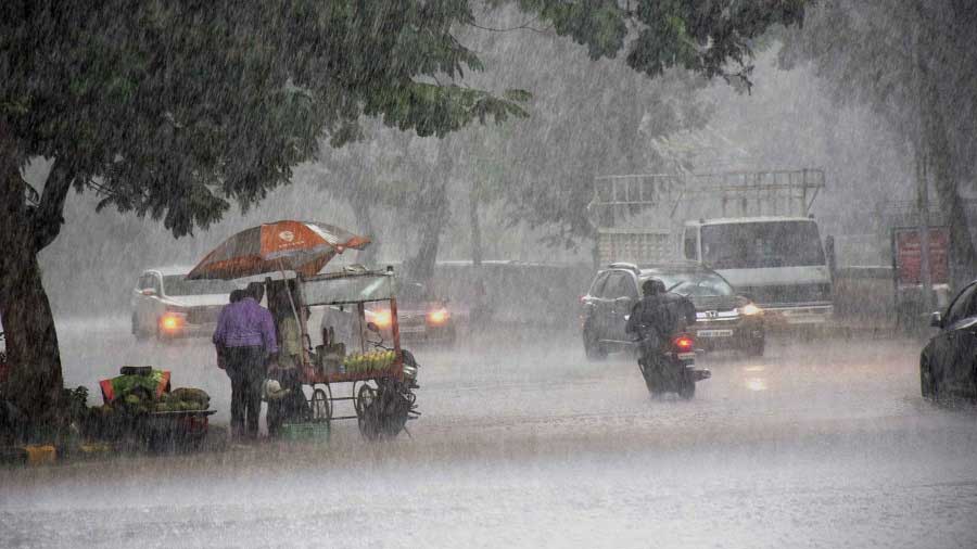
Weathermen said the low-pressure area over northwest Bay of Bengal and adjoining coastal areas of West Bengal and north Odisha would impact Jharkhand's weather and result in heavy rain in isolated areas in the next three to four days.
An associated cyclonic circulation was also extending upto mid-tropospheric level which would assist in rainfall activity.
The Ranchi Met Centre issued an alert for heavy rain in southern, central and north-eastern districts of Jharkhand in the next few days due to an active monsoon coupled with the low-pressure area.
The forecast suggested rain in most parts of the state in the next two days.Also, moderate thunderstorm with lightning associated with the onset of monsoon is very likely to happen over several districts of Jharkhand during next two to three days.
Weathermen advised people to keep a watch on the weather and protect themselves from lightning strikes.
Data suggests Hazaribagh recorded the highest rainfall of 65mm in the last 24 hours (8.30am on Friday to 8.30 am on Saturday) followed by capital Ranchi which notched 51 mm rain.
Several other districts, including Ramgarh, Koderma, Godda, Jamtara, Bokaro, Dhanbad and East Singhbhum, experienced moderate rain in past 24 hours.
Met statistics revealed that in 2019, the southwest monsoon reached Jharkhand on June 21, after a delay of 11 days.
In 2018, the southwest monsoon had reached the Kerala coast three days early on May 29 but it reached Jharkhand on June 25, after a delay of 15 days, as the monsoon currents were weak. In 2017 and in 2016, it was delayed by six days.
After its complete onset, the monsoon normally stretches till the first week of October and the average rainfall in Jharkhand during this period is around 1,100mm.