Aamir Khan’s blockbuster 3 Idiots ended in a mix of romance and slapstick on the banks of Ladakh’s glittering blue Pangong Tso (lake). Now the hunt’s on for a fourth idiot by the bend of the lake at the mountain feature known as Finger 4. That’s who allowed the Chinese to move in strength into the area.
As India comes to grips with the killings in the Galwan Valley, the army chief, General Manoj Mukund Naravane, left headquarters Tuesday to visit the Ladakh front. He’ll take personal stock of the situation and his trip follows a marathon round of negotiations that went on till late on Monday night between the ‘Fire and Fury Corps’ Commander Lt General Harinder Singh and his Chinese counterpart, Major General Lin Liu of the Xinjiang Military Command.
At that meeting, the Indian Army and the Chinese PLA – Peoples’ Liberation Army – decided to bring down confrontation levels on their frontier in Ladakh, according to sources. “Modalities for disengagement from all friction areas in Eastern Ladakh were discussed and will be taken forward by both the sides,” an Indian government official, who asked to remain unnamed, said.
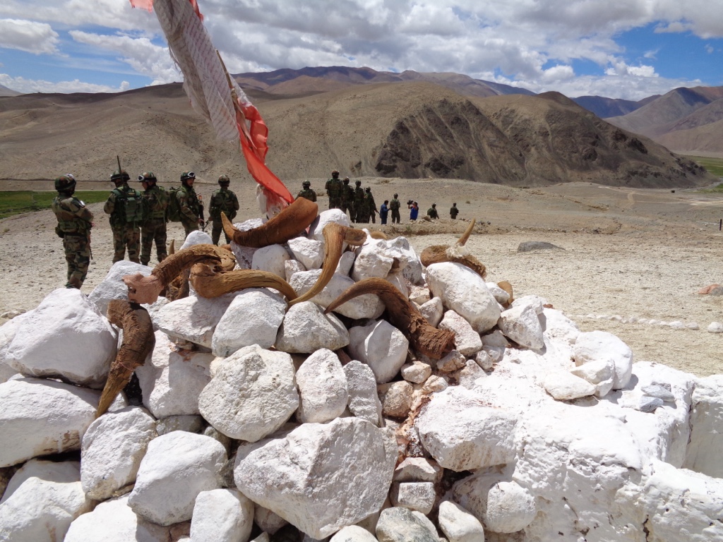
An Indian Army patrol leaves for its task in the Chushul Valley by a Chorten, a heap of stones with yak horn, for good luck.
This comment by the official suggests that the Chinese will have to pull back by at least 8km to the east on the North Bank of the Pangong Tso. They have built reinforced defences since occupying that area in Indian territory in April.
Monday’s meeting which continued for 10 hours marked the second round of talks between Singh and Lin.
The first round of talks were held on June 6. The Galwan Valley killings were on the night of June 15-16 during the fateful “disengagement” process that was agreed during the earlier talks.
The latest disengagement operation is likely to be spread out over several days. The calendar for the process sets out the venues, times and distances for troops of each side to position themselves.
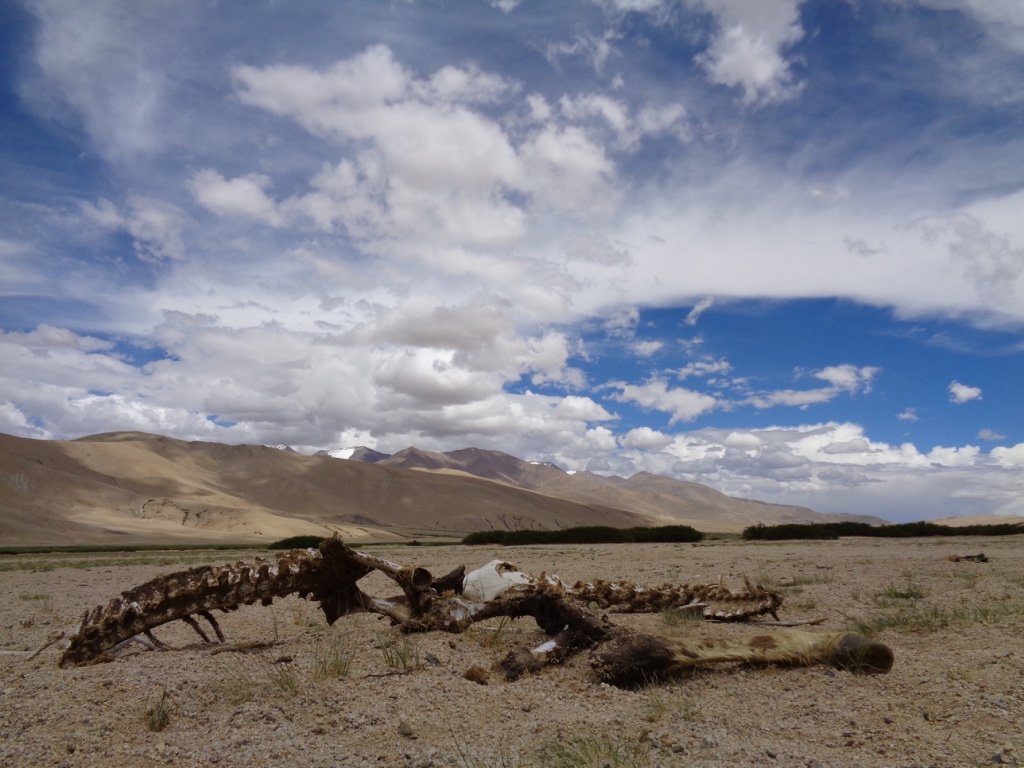
The Chushul Valley with the skeleton of an animal, possibly a Kiang (wild ass) in the foreground.
Harinder Singh served in the Directorate General of Military Intelligence (DGMI) in New Delhi before taking over his current responsibility. Lin is reported by the Chinese media to be “a man who runs 20km a day with 20-year-olds”.
In reviewing the events leading up the deadly border clash, it’s important to remember that the first reports of the Chinese moving into Indian territory reached New Delhi around mid-April. It appears that someone in the government overlooked them.
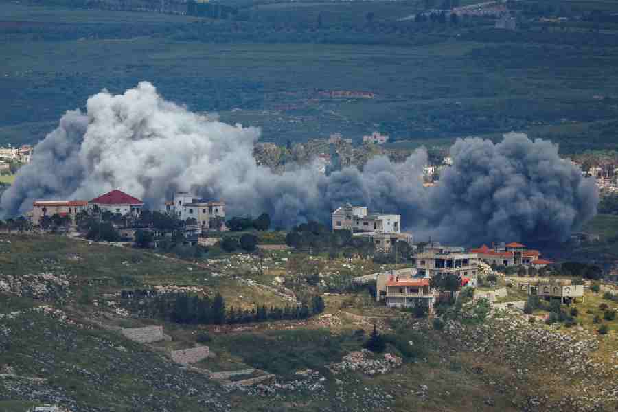
In the eight weeks since then, the Chinese PLA border guard moved in and reinforced their positions and were supplemented by fresh troops. They also dug and fortified bunkers on the shores of the lake. In addition, they climbed the mountain feature and built pillboxes with their gun-sights looking down on Indian positions a mere 350m away.
The Chinese are now so entrenched atop Finger 4 that Indian troops there can see and hear them. The smell of their food being cooked also wafts down from positions occupied by the PLA on the ridge of the barren hillside.
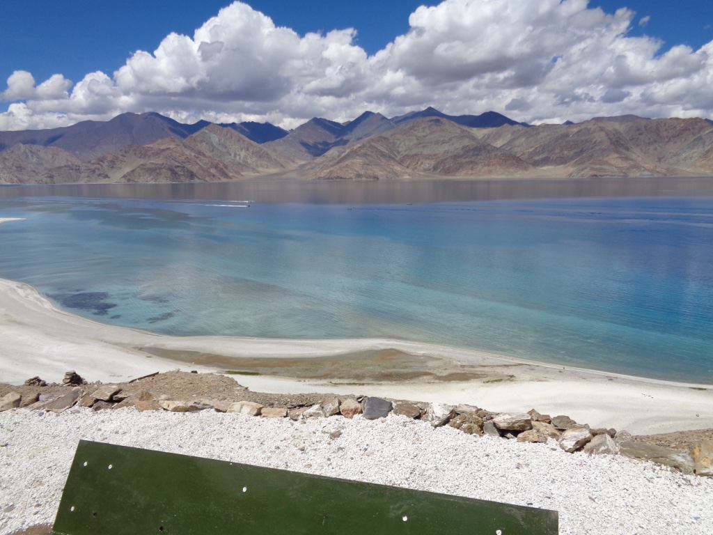
The north bank of the Pangong Tso 'fingers' seen from the south bank.
“If this was sudden, I could have understood,” a former commander of the Leh-headquartered 14 ‘Fire and Fury’ Corps, told this correspondent. “It is part of our regular duties in April, as we prepare for the summers to take stock of what is being done by the Chinese. They do too. We always declare an ‘op alert’,” he explained.
An “op alert” or operational alert is a routine exercise by the Indian army every year in high-altitude areas on the China frontier. It’s a time of greater mobility for the troops, heightened surveillance and increased patrols that invariably lead to more frequent but – till now – non-lethal face-offs with PLA patrols.
In the 8-km stretch between Finger 4 and Finger 8, through which the Line of Actual Control in the Pangong Tso area passes, the face-offs recorded are among the highest ever to take place along the frontier.
Why is that the case? The boomerang-shaped Pangong Tso (lake) takes a turn from the west to the east at Finger 4. From Thakung on the southern shores of the lake, this correspondent was given a demonstration in July 2016 about what happens. Thakung is opposite Finger 4.
The Indian army reconnoitred Finger 8 both on water and through foot patrols. The Chinese were always sensitive at the bend, because that’s the point at which Indian surveillance gets a good look at their positions in Sirijap in the Khurnak Fort – positions the Chinese had captured and/or operated from on the northern shores in the 1962 war.
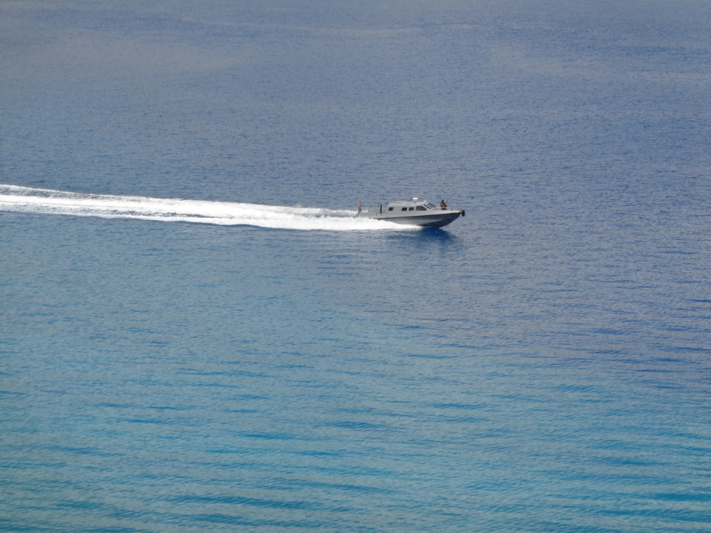
An Indian Army speedboat patrols the lake.
This illustrates how sensitive this area has been for the Indian Army and the security agencies for the last 58 years. Last year, the Indian agencies reported that the Chinese had added at least 13 more ‘LX Series’ speedboats to their fleet for water-borne patrols.
Yet, because of Covid, or, what is increasingly being described as “Covid Cover”, such routine patrolling was lacking this year.
In 1999, as Indian troops were fighting to evict Pakistani intruders on another front in Ladakh – at Kargil – the Chinese built a rough track to a point near Finger 4, heading westwards from Finger 8 inside Indian territory. Chinese multi-terrain vehicles were able to drive along the track. But it was also used by Indian Army and the Indo Tibetan Border Police (ITBP) foot patrols to their “limit of patrolling” (LOP) at Finger 8.
Since March 2020, this area was either not patrolled or the routine “patrolling reports” had missed the Chinese build-up and occupation – yes, the Chinese have occupied this area. The other possibility is that the reports, incredibly, were ‘invisibilised’.
Maintaining visual records of the area – the entire area is observable by the naked eye – was the responsibility of at least four other Indian agencies, apart from the army. These agencies are the ITBP, which reports to the Union Home Minister; the Research and Analysis Wing (R&AW) and the National Technical Research Organisation (NTRO which interprets satellite imagery). These last two agencies report to the Cabinet Secretariat. Besides this there’s also the ARC or Aviation Research Centre. All these organisations must bear some responsibility for not noticing the PLA making its moves in strength.
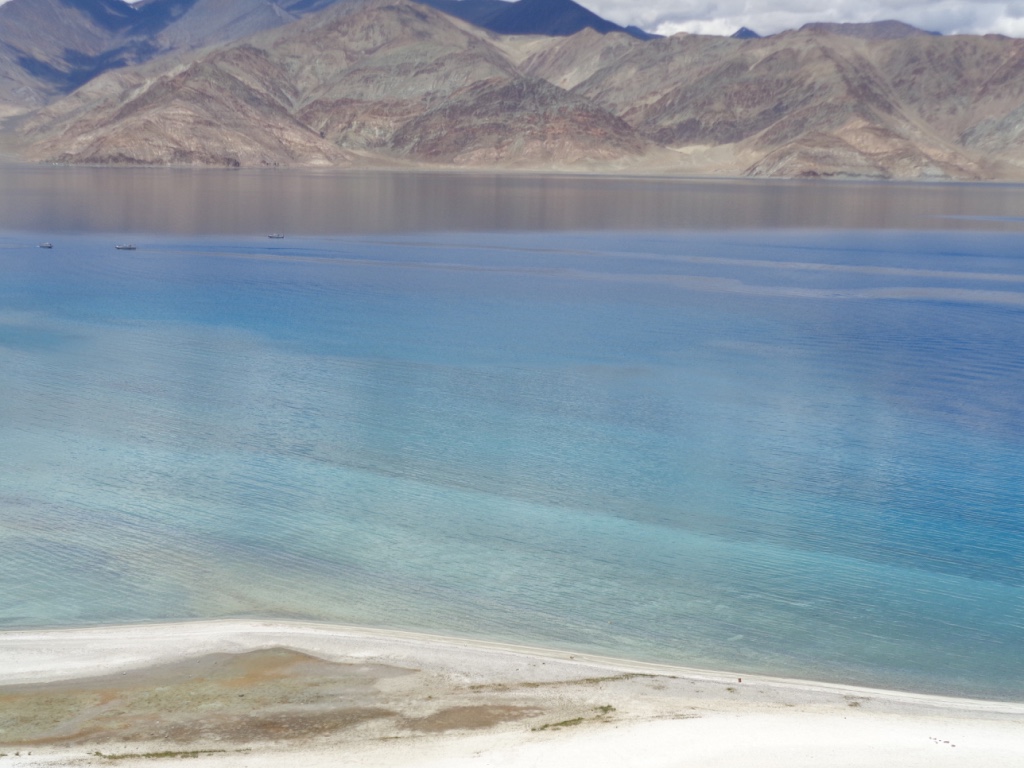
The 'Fingers' of the North Bank of the Pangong Tso.
There are many who argue that the multiplicity of agencies confuse the interpretation of intelligence. Equally, there is the view that multiple agencies make it possible to distill the clearest picture from multiple inputs.
The army in the past has spotted Chinese efforts to upgrade the road/track they built 20 years back. Such efforts were blocked because if they were to reach fruition they would change a “fact on the ground” and thereby legitimise Chinese claims.
One ex-Fire and Fury Corps commander even took up a Chinese request during his tenure and offered to black-top the road in a “joint venture”, thereby also legitimising India’s control. The Chinese did not respond after that. This was less than five years back.
Chinese sensitivity to Indian patrols crossing Finger 4, where the Tso bends, is heightened not only because of the view it offers to their defences. It is also because the G219 highway connecting Xinjiang and Tibet kisses the easternmost shore of the lake.
“I remember going to Phurtok La and seeing graziers with horses and sheep as a child,” a Ladakhi scholar, who hails from a village near the vicinity, told this reporter. “But it has now been years,” the scholar said. Phurtok La is on the southeast bank of the lake. When the lake froze in deep winter, it was possible to walk across with flocks of sheep.
In the weeks since the first alerts were sounded – and possibly ‘invisibilised’ – the PLA dug themselves in on the North Bank of the Pangong Tso. The Chinese have also swung elements of their mechanised and rocket forces of the 75th, 76th and 77th Group Armies to the front in Aksai Chin, backing them up on the shores of the lake.
All around the shores of the lake are historical markers to remind India of the follies of military failure. To the southeast are the Magar and Gurung Hills.
Then there’s Rezang La, a hill feature which Indian troops held when it was dominated by another, called Mukhpari. Multiple historical records say that had Indian troops held Mukhpari instead of Rezang La, the battle over there would have been more decisive than what it turned out to be.
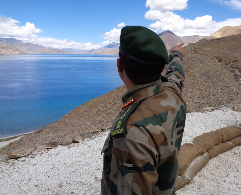
An army officer points to positions on the lake's shores.
The memorial in the Chushung Valley just behind Rezang La today is a monument to valour that was unable to prevent a military disaster.
All mountain warfare is determined by the ability to hold heights. Finger 4 is at a height while the lake where the spur ends is a brilliant turquoise.
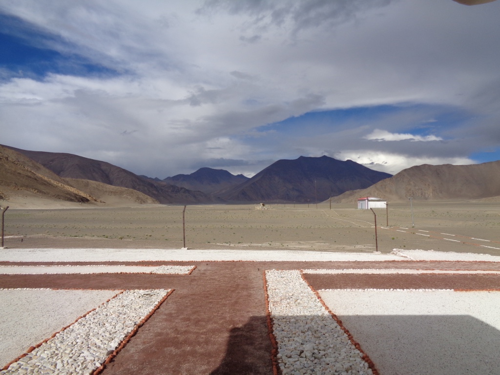
To the north of Rezang La is the Spanggur Gap, a clear opening in the hills on flat ground at 14,000ft. In Chushul, on the Indian side of the Gap, is the Indian Border Personnel Meeting (BPM) ‘Hut’, with walls adorned by Bollywood stars.
Ahead of it, the Chinese Hut is at Moldo by another little lake called the Spanggur Tso. That was where the generals were meeting till late last night.
The chain of command for the army goes up from the battalion responsible for the north bank of the Tso to the brigade stationed in Chushul; the division based in Karu; the corps headquartered in Leh; the command in Udhampur and finally to headquarters in New Delhi.
We mentioned the possibility of a fourth idiot in this sorry tale. That’s the person who didn’t take the reports coming from Ladakh seriously and allowed the Chinese to make their summer land-grab in Ladakh.
(All pictures taken by the author in July 2016)