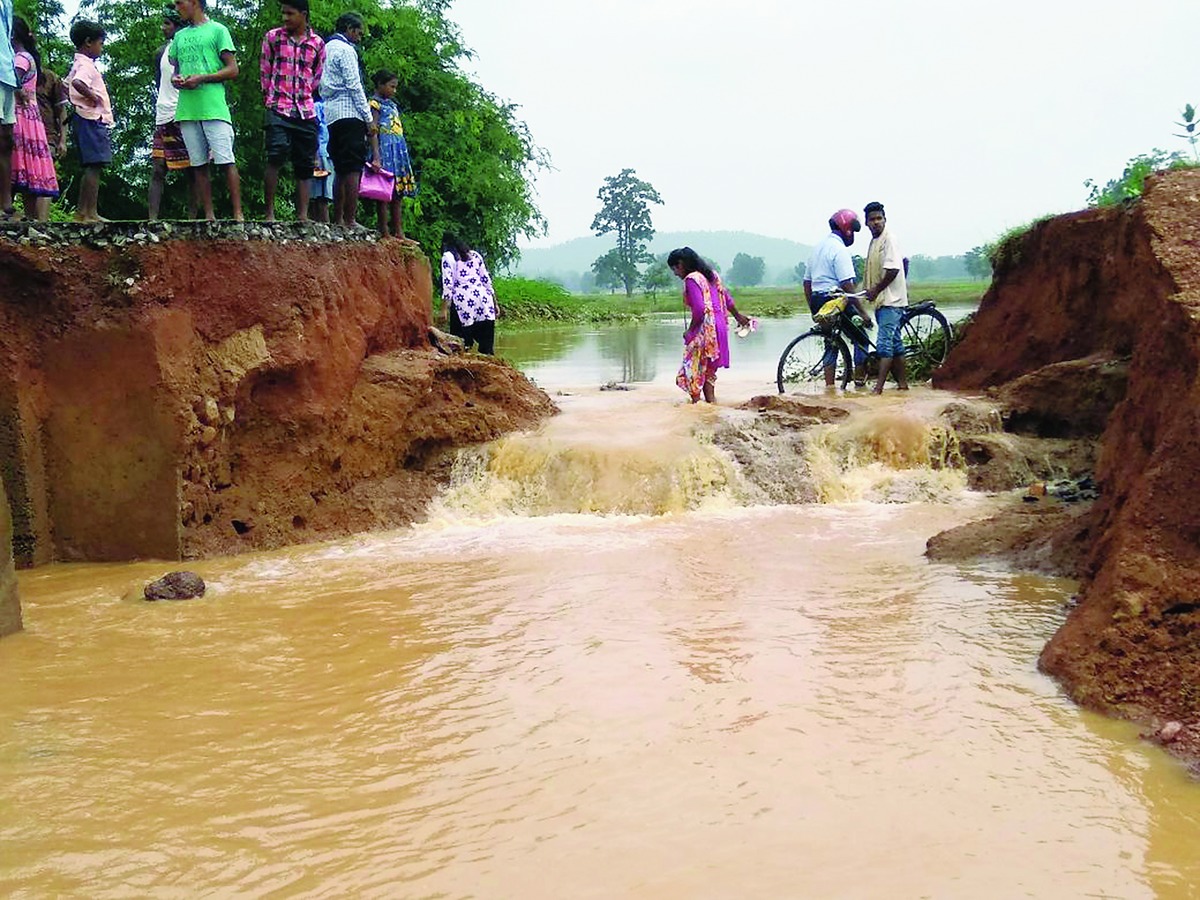

Bhubaneswar: Rain lashed various parts of the state following a low pressure system formed over northwest Bay of Bengal. The Regional Meteorological Centre on Monday predicted rain and thundershower at most places in the state over the next 48 hours.
According to a release by Regional Meteorological Centre, a cyclonic circulation formed over northwest Bay of Bengal near Bengal and neighbourhood has concentrated into a low pressure and several parts of the state will receive rainfall under its influence.
Chandbali received a rainfall of 22mm between 8.30 am and 5.30 pm on Friday, Cuttack received a rainfall of 19 mm followed by Daringibadi with 17 mm. Bhubaneswar, Hirakud, Paradip and Phulbani also received considerable rainfall during this period.
A Met official said heavy to very heavy rainfall is likely at one or two places over the districts of Jagatsinghpur, Kendrapara, Bhadrak, Balasore, Jajpur, Mayurbhanj, Cuttack, Sambalpur, Jharsuguda, Sundergarh and Keonjhar in next 24 hours. Heavy rainfall is also likely at a few places in Puri, Khurda, Ganjam, Nayagarh, Deogarh, Angul and Dhenkanal districts in next 24 hours.

"Strong and gusty surface wind of 25 to 35 kmph speed gusting to 45 kmph is likely to prevail along and off the Odisha coast. Fishermen are advised not to venture into the sea during next 24 hours," said a Met official.
"Since there is a strong monsoon current in Odisha, heavy rainfall will occur in Keonjhar, Dhenkanal, Mayurbhanj, Bargarh, Cuttack, Nayagarh, Khurda, Gajapati, Ganjam, Puri, Kandhamal, Kalahandi and Rayagada districts for next 48 hours," said a Met official.
Meanwhile, the office of the Special Relief Commissioner has asked the collectors of the districts where rainfall is likely to stay on alert to meet any eventuality.
The concerned districts have been asked to make arrangement for shelter in emergency situation.