“How much further up?” I asked as I stopped to catch my breath. “Little bit more. You are doing well, Saha, but go poley poley (slowly slowly, in Swahili language),” responded JL, my mountain guide. We were on the final leg of our ascent to the summit of the Kilimanjaro. It was dark all around except for the occasional flashes of the head torches of the several climbers trying to reach the top. It was also very quiet save for their grunts and heavy-breathing.
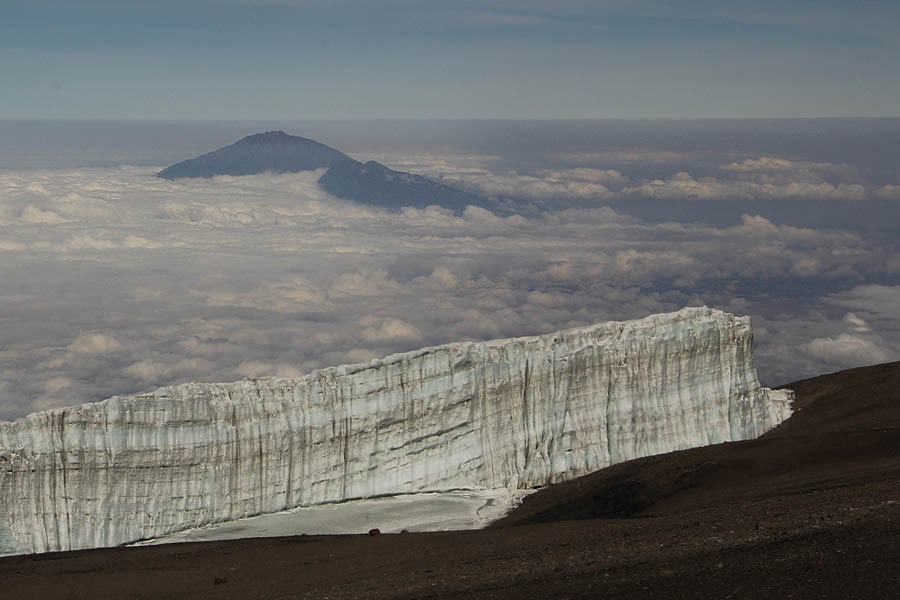
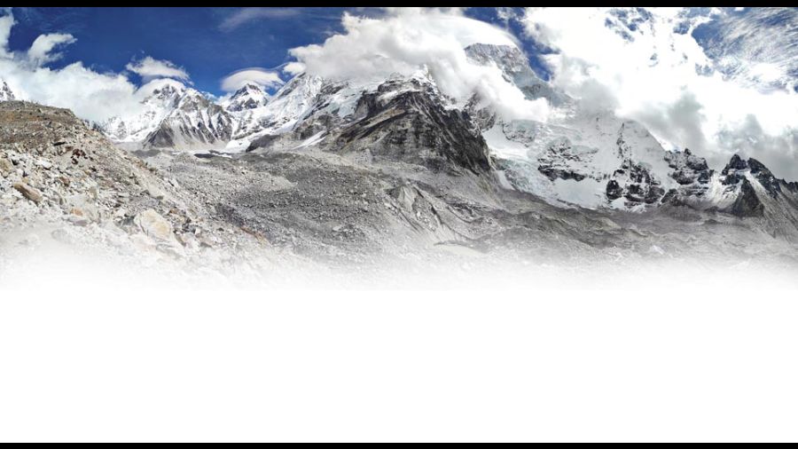
View from the summit - Rebmann glacier in front and Mount Meru at a distance
I was one of the several thousand climbers from across the world attempting to scale Kilimanjaro, the highest mountain in Africa and thus, one of the ‘Seven Summits’ (the seven peaks that are the highest mountains of each continent). Unlike, say, climbing Everest, scaling the Kilimanjaro does not require mountaineering equipment like rope, ice axe, piton, carabiner, jumar etc., as there is no technical climbing involved. But here, a climber needs to prepare thoroughly for long hikes, steep ups and downs, low oxygen and extreme cold conditions. Good fitness level with loads of stamina and endurance are essential.
JL had been my shadow and friend since I landed at Kilimanjaro International Airport in Tanzania. He has been a mountain guide for over a dozen years and is the African equivalent of the Himalayan sherpa. Extremely knowledgeable, he informed me that the first ascent of Kilimanjaro was in 1889 by a German-Austrian pair and since then thousands have climbed the mountain, though the success rate ranges between 45 and 65 per cent, the most common reason for failure being mountain sickness.
Scrambling over the Barranco Wall
Since the mountain is located just 300-odd kilometres south of the equator, ascending it involves moving rapidly between climatic zones, from tropical to subalpine to arctic near the top. All this happens within a few days and on each day, the climber has to acclimatise to a new zone. I was a little sceptical about my chances, being on the wrong side of 50 and with a dodgy knee and ankles, but decided to take the plunge anyway after months of preparation.
Onwards and upwards
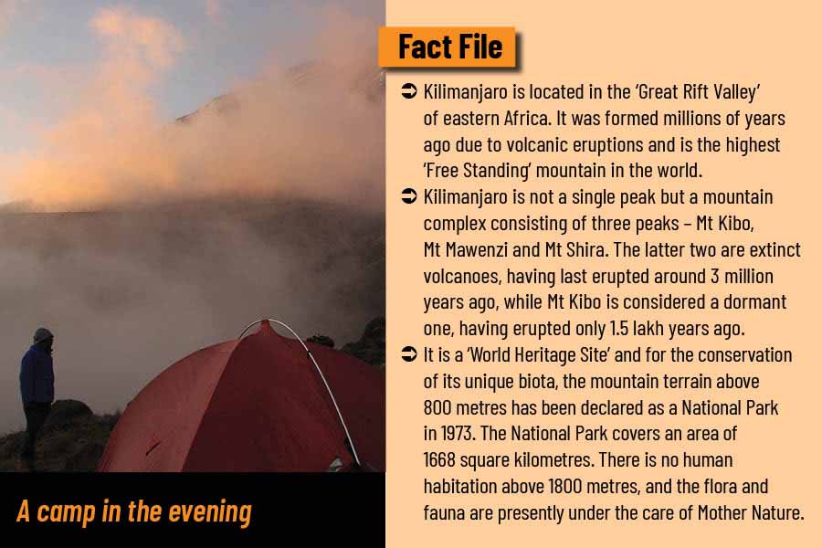
After a day of acclimatisation in Moshi town, I was in the office of Kilimanjaro National Park, located at the Machame gate (altitude 1800 metres), for permission to enter and climb the mountain with JL and his team of porters. There are seven different routes to the summit of Kilimanjaro and I had selected the southern Machame route because of its scenic topography. The plan was to climb up in five days and then descend to the base at the Mweka gate in another two days.
After completing the formalities, we started rather late and therefore had to march uphill rather fast to the Machame Camp (2800m) late in the evening. It was a seven-hour trek through an archetypal tropical montane rainforest — misty wet, evergreen and made up of tree fern, fig, yellow wood, African camphor wood, macaranga and chestnuts, to name a few. There were mountain gladiolus, violets and the peculiar elephant trunk flower on the ground level. The deep ravines with perennial streams created a botanical paradise. Not surprisingly, wildlife was mainly arboreal – blue monkey, black and white colobus monkey, bushbaby and plentiful birds.
On the second day, we purposely started early to reach the Shira Camp (3600m) by lunch. The ascent was steady, and the climate and vegetation changed to semi-alpine moorland. There were Erica bushes having Old Man’s Beard lichens hanging from branches and giant lobelias on the slope. Conditions were cold and windy, and one had to negotiate three succeeding ridges to reach the Shira plateau, where the camp was set. The camp offered a splendid view of Mt Shira (4005 m) in front and Mt Kibo (5895m) at the back.
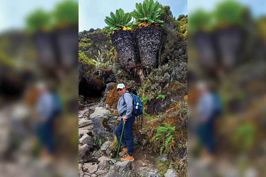
Giant senecio plant
Next day, we started even before the sun was peeping behind the ridge. It was supposed to be a long day with an initial ascent to the Lava Tower at 4600 metres. By now, the terrain was devoid of vegetation and dark lava rocks stood like sentinels on the loose soil where only tussock grasses grew. It was alpine semi-desert condition above the cloud level. Making steady progress to the tower where hot lunch awaited, we met scores of climbers converging from two other routes — Lemosho and Shira. Later in the afternoon, we descended to the Barranco Camp (3900m) passing through giant senecio trees growing on the dry boulder-strewn slope.
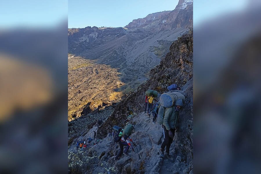
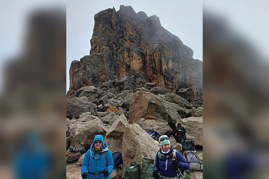
The Barranco Camp overlooked the formidable Barranco Wall (260m). This near vertical wall was a free-climb performed without safety ropes by porters and climbers alike. It is preferably done at dawn in semi darkness before the sun beats down on the slope. We scrambled over the holds to reach the welcoming flat top. Thereafter, it was up and down the barren mountain slope till the Karanga Camp (3950m).
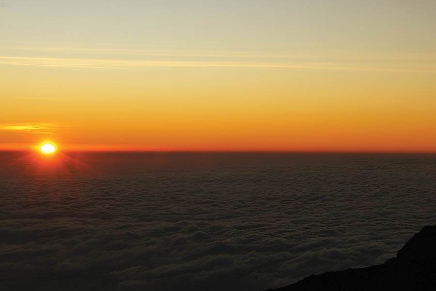
Sunrise near the Stella Point
The terrain by now was waterless and the open sun and cold wind dried out the exposed skin to pulp. Few small rivulets flowing down from the hanging glaciers were the lifeline for climbers. When, around noon on the fifth day, we reached the Barafu Camp (4675m), JL announced that there was practically no water or snow around to be melted. So water was rationed though we did manage to consume enough fluids to beat mountain sickness. The landscape was desolate and strong winds frequently whirled up dry, dark dust. As breathing became laboured, we retired to our tents to conserve energy for the final push to the summit.
Midnight toil
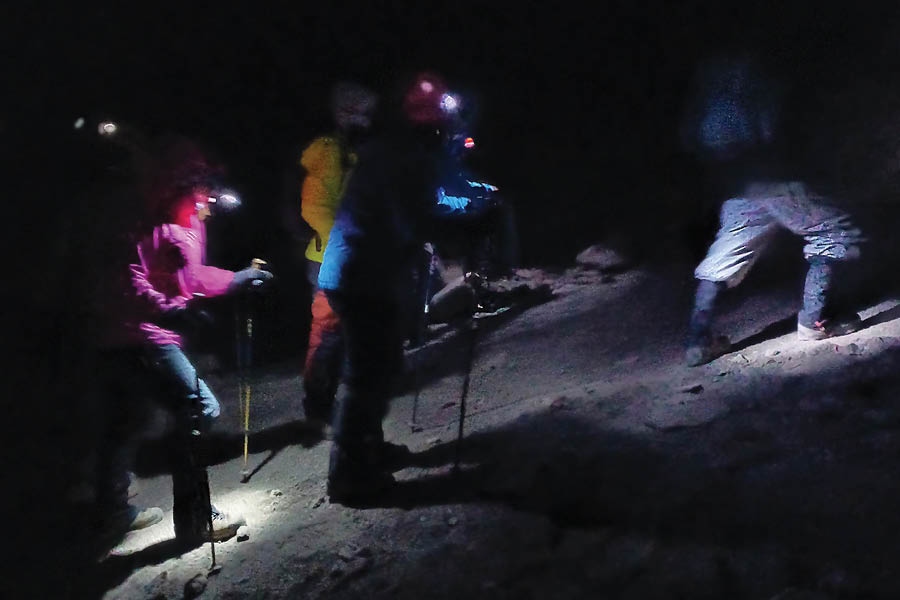
The midnight climb for the summit
After a light meal of energy drinks and fruits at 11 in the night and some friendly banter, we were ready for the most important day of this venture. I could feel the bite of the cold under my heavy balaclava, mittens and down jacket. Carrying extra batteries for the head torch and 3 litres of water (which soon became iced) we set off at midnight. I was one among the scores of climbers moving in a single file. Muffled voices filled the air as the climbers cheered one another. There was occasional laughter and an unending hum of porters’ songs in Swahili in the background.
It was amazing that they kept on singing till daybreak despite the cold and the rarefied air at high altitude. The torch light kept us focused on the path immediately in front. I stopped infrequently to catch my breath and drink the iced water but would be immediately nudged by the climbers behind me. Thus, we kept a steady pace although it was tiring, especially over the scree zone. I kept on looking at the watch, calculating the distance and time to be at the Stella Point (5756m) at the stroke of sunrise. And there, at 5.56 am, I was, watching the sun break through from behind Mt Mawenzi (5149m) and a sea of clouds. It was a sight to behold. Whistles and cheers from fellow climbers filled the air.
The glory of reaching the summit
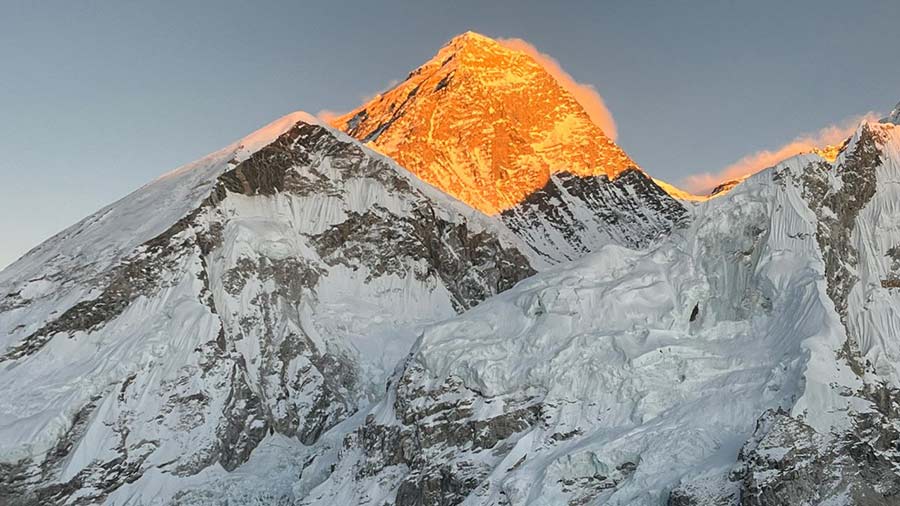
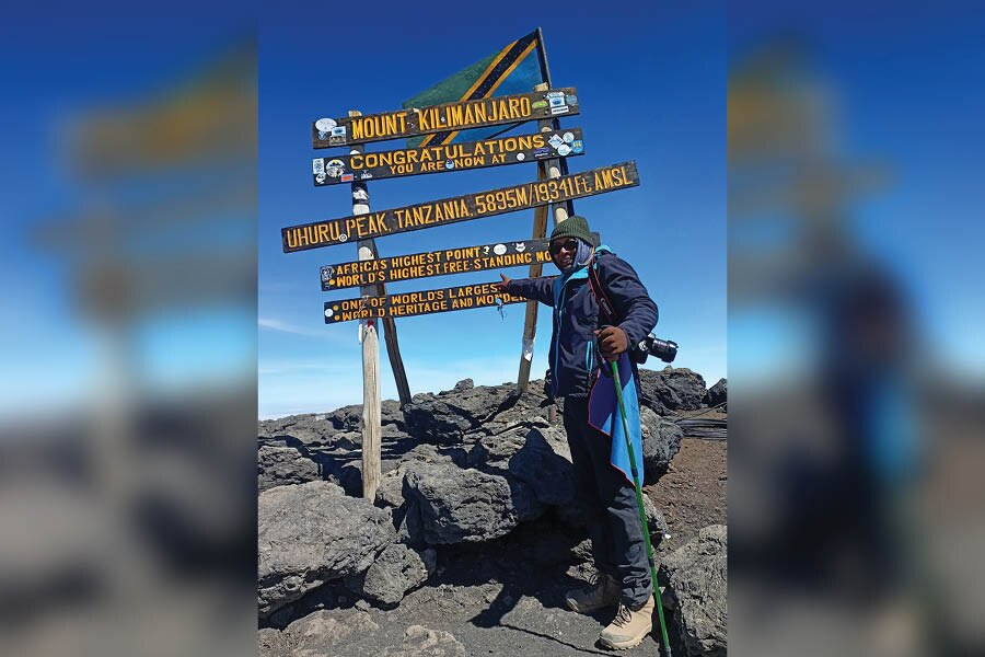
I sat down on a rock, not bothering about who overtook me and felt the mild warmth of the morning sun. I have travelled across the Himalaya both as a tourist and a mountaineer, and have seen several ‘sunrises’ but here at the Stella Point, it felt heavenly. This was the edge of the crater rim and some people decided to return from here. But there was a trail going along the edge of the crater to Uhuru peak (Freedom peak in Swahili) — the highest point in Africa at 5895 metres. It was now a rather easy trudge to the top. Keeping the impressive Rebmann glacier (a hanging glacier named after the 19th century German missionary, Johannes Rebmann) on the left and the caldera (volcanic depression) to the right, the hike over dark, loose soil and black rocks formed out of solidified magma took me another 40 minutes.
At the top, climbers greeted one another in Swahili: jumbo (hello) and karibu (welcome). I touched the wooden frame declaring the spot as the highest Africa, chuffed with my own effort. As I looked around photos, the sandy crater bottom felt like moonland. It was a cold, dry windswept, desolate landscape with no vegetation or sign of life. After about an hour, with a dream fulfilled, it was time to retrace my steps to the base of the mountain.
The Lava Tower