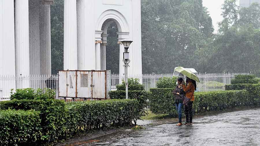
A cloudy sky and persistent rain marked Sunday in the city as a depression, remnant of Cyclone Jawad, kept moving along the east coast over the Bay of Bengal.
On Sunday evening, it was more than 100km from Puri in Odisha and around 200km from Sagar Islands in South 24-Parganas. The system was tipped to weaken into a well-marked low-pressure area by Monday morning, the time it would come closer to the Bengal coast, according to the Met forecast.
“It will further weaken into a low-pressure area, cyclonic circulation and dissipate on the sea itself by Tuesday,” said a Met official.
The rain in Kolkata is expected to abate by the second half of Monday. The sky is expected to be cloudy on Monday as well and should start clearing from Tuesday, according to the Met forecast.
North 24-Parganas, Nadia and Murshidabad are expected to get “heavy rain” on Monday, said officials.
“The depression lay centred over the northwest Bay of Bengal, close to the Odisha coast and south-southwest of Sagar Island, on Sunday evening. It is likely to move northeastwards, towards the Bengal coast, and weaken into a well-marked low pressure area over the next 12 hours,” said a Met official on Sunday evening.
Impact on Kolkata
The city woke up to a cloudy sky. The Met office recorded around 30mm of rain in Alipore over 24 hours till 8.30pm.
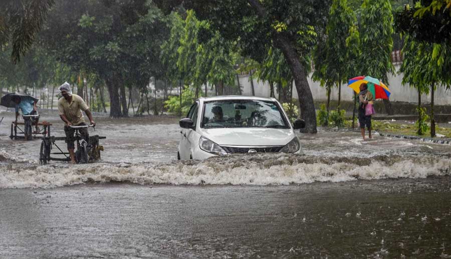
The rain throughout the day was persistent and widespread. The main effect the overcast conditions had was on the day temperature. The maximum temperature on Sunday was 21.6 degrees, a staggering six notches below normal and the lowest so far this season, according to the Met records. The minimum temperature was 20 degrees, four notches above normal.
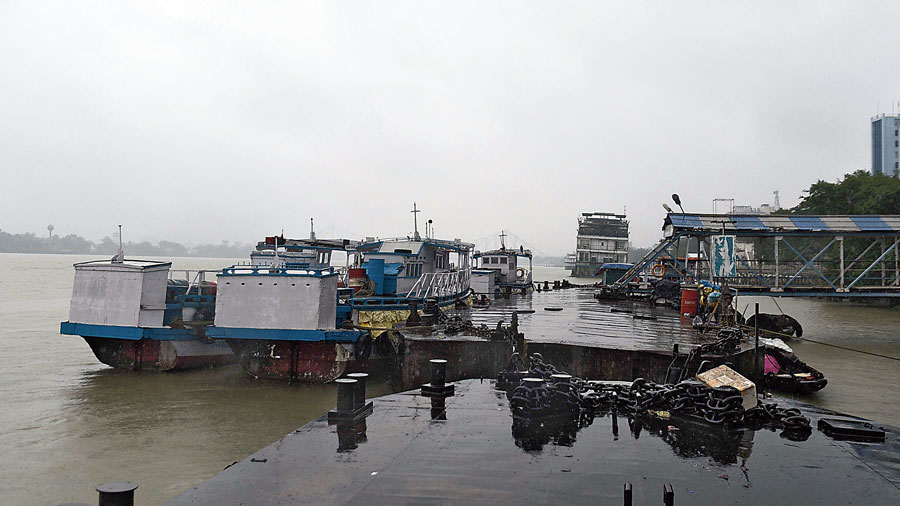
Ferry service shut at Chandpal Ghat because of the storm alert on Sunday afternoon. Gautam Bose
“Such a minimal difference between the maximum and minimum temperatures is unusual. The Celsius has not fallen according to December standards. But the low temperature lent a feeling of chill,” said G.K. Das, director, India Meteorological Department, Kolkata.
The rain throughout the day was not enough to cause waterlogging in the city, said officials of the civic body. “The lock gates opened around 4.15pm. Even if there is an intense spell of rain late in the night, it is likely to coincide with low tide in the Hooghly,” said an official of the drainage department.
Officials of the Kolkata port said a high tide in the Hooghly early on Sunday -- around 1.40am -- in Garden Reach did not have much impact on the city's drainage system since there wasn't accompanying rain.
Civic engineers said all pumping stations had been kept on high alert till late on Monday evening to ensure there were no snags while pumping out water in the event of heavy rainfall from Monday.
Celsius
The moisture content in the atmosphere is still on the higher side. Once the sky starts clearing up and the relative humidity dips, the conditions will be ideal for the free flow of northwesterly winds into the city.
“There is a snowfall alert in Kashmir. After a spell of snowfall, cold winds are expected to head south. In Kolkata, the Celsius will start going down but gradually,” said Das.
The Met office expects the night temperature in Kolkata to dip by “two to three degrees” by the middle of this week.