
Immediately after Durga Puja, a rainy spell is headed Kolkata’s way.
A low-pressure area over the Bay of Bengal, headed to the Andhra Pradesh-Odisha coast, is tipped to trigger rain in the coastal areas of Bengal, including Kolkata, from Friday to Monday, the Met office said on Friday afternoon.
The intensity and spread of the showers are likely to peak from Saturday.
“A low-pressure area lies over the west-central and northwest Bay of Bengal. On Friday, the system was positioned near the southern coast of Odisha and northern coast of Andhra Pradesh. Under the influence of the system, moisture-laden south-easterly winds are making inroads into coastal districts of south Bengal. The winds are likely to gain more steam over the next couple of days,” a Met official said on Friday afternoon.

Many parts of the city got sharp spells of rain and thunderstorms on Friday evening after an exceptionally sultry day. Around 6pm, the rain in Babughat had reduced visibility. The idols headed for immersion were getting drenched, some despite a plastic cover. Rain had spared Kolkata for most of this Puja. On Navami evening, some parts saw brief and scattered spells. Pradip Sanyal
“The city received light to moderate rain on Friday evening. The intensity and spread of the rain are likely to go up from Saturday and peak on Sunday and Monday. Kolkata, North and South 24-Parganas, East and West Midnapore, Howrah and Hooghly are likely to be most impacted by the system. Heavy rain is expected at one or two places in these districts on Sunday and Monday,” the official said.
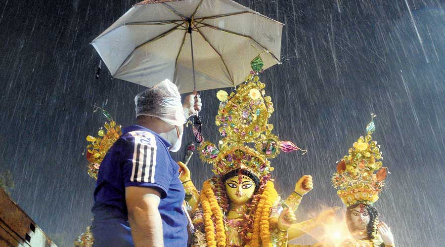
A man holds an umbrella over a Durga idol at Babughat on Friday. On Dashami, the showers were sharper, accompanied by lightning and rumblings of thunder. A low-pressure area on the Bay of Bengal, advancing towards the Odisha and Andhra coasts, injected a lot of moisture into the atmosphere. Coupled with the scorching heat accumulated over the day, the moisture formed thunderclouds which triggered the rain, said a Met official. The first half of Friday was hot and humid. The maximum temperature was 36.3 degrees, four notches above normal. The temperature was around 35 degrees in Kolkata at 1pm. The RealFeel, however, was a staggering 43 degrees, mainly on account of high humidity. Pradip Sanyal
On Sunday and Monday, Kolkata and the adjoining districts are also likely to see gusts of wind clocking 30 to 40kmph.
On Friday, the city was subjected to the twin assaults of heat and humidity for most of the first half, like it has been for the past few days. Around 1pm, the temperature was around 35 degrees.
Clouds started appearing in the afternoon and by 3pm, the sky was gloomy.
“The pent-up heat accumulated throughout the day and moisture from the Bay of Bengal are the ideal combination for the formation of thunderclouds,” said a weather scientist.
Some parts of Kolkata witnessed brief spells of rain and thunderstorms on Friday evening.
The low-pressure area had formed near the Andaman Sea a couple of days ago.
“During the monsoon, weather systems usually take shape over the northeast or northwest Bay of Bengal. The zones are much closer to the east coast, compared to north Andaman Sea, where the bulk of the systems form in October and which is around 1,000km from the coast,” said Das.
The climatological conditions in October, like a smaller wind shear and suitable sea surface temperature, are also favourable for intensification of any weather system, said Met officials.
The monsoon, on paper, is on its way out of the country. It has already withdrawn from most parts of Bengal, the Met office said.