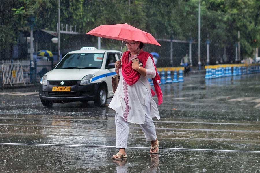
A weeklong dry spell ended with thundershowers in Kolkata on Monday. More rain is likely as the India Meteorological Department (IMD) has issued a thunderstorm warning over the districts of south and north Bengal between May 20 and 24.
Thunderstorms and lightning were reported from some parts of Howrah, Hooghly, Kolkata, South 24-Parganas and North 24-Parganas on Monday.
A depression is likely to form over central parts of Bay of Bengal, according to the IMD bulletin. A trough runs from northwest Uttar Pradesh to east Bangladesh across east Uttar Pradesh, south Bihar, Jharkhand and Gangetic West Bengal at 0.9km above mean sea level.
The cyclonic circulation over Gangetic West Bengal and its neighbourhood lies over northwest Bay of Bengal and adjoining north Odisha-West Bengal coasts at 3.1km above mean sea level. The weather office also notified that a low-pressure area is likely to form over southwest Bay of Bengal around May 22. It is likely to move initially northeast and concentrate into a depression over central parts of Bay of Bengal by morning of May 24. Under favourable synoptic conditions and strong moisture incursion from Bay of Bengal, there are high chances of thunderstorms with lightning along with gusty wind speed and thunder squall affecting the districts of West Bengal.
Thunderstorms with gusty wind blowing at 40-50kmph are likely to occur in one or two places in south Bengal on May 21 and 22.

Avoid taking shelter under tree/electric pole and avoid contact with water bodies
Heavy to very heavy rainfall (7-20cm) is likely to occur at one or two places in East Modnapore and South 24-Parganas heavy rainfall (7-11cm) is likely to occur at one or two places over Paschim Medinipur and North 24-Parganas on May 24. Thunderstorms with gusty wind speed reaching 30-40kmph are likely to occur at one or two places in North- and South 24-Parganas, East and West MIndapore, Kolkata, Hooghly, Howrah, Nadia, Jhargram and Bankura districts.
Heavy rainfall has also been predicted in some districts of north Bengal.
Squalls with gusty surface wind speed exceeding 45kmph are very likely along and off the West Bengal coast from May 24. Sea condition is likely to be rough to very rough over central Bay of Bengal from May 23 and over north Bay of Bengal May 24 onwards.
IMD has also posted some precautions for fishermen to take during this phase:
- Fishermen are advised not to venture into the central Bay of Bengal from May 23 and into North Bay of Bengal May 24 onwards
- Fishermen out at sea are advised to return to the coast before May 23
The possible impact of thunderstorm predicted are as follows:
- Damage to standing crops and horticulture, Reduction of visibility
- Damage to loose /unsecured structure
- Traffic disruption in urban areas
Action suggested at the time of thunderstorm and lightning:
- Take shelter in a safe place during thunderstorm activity
- Movement of traffic may be regulated judiciously during thunderstorm activity
- Avoid taking shelter under tree/electric pole and avoid contact with water bodies
- Use Mausam/Damini app for real time weather alert