The cyclone that is set to form over the Bay of Bengal in a few days is likely to recurve and proceed towards the Bangladesh-Myanmar coast in the last leg of its journey before landfall, a Met bulletin said on Monday.
The cyclone — to be called Mocha — is also likely to be the second “very severe cyclonic storm” on the Bay since Yaas in May 2021, said Met officials.
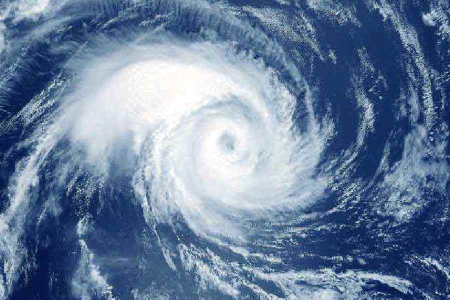
The life cycle of the storm began with the formation of a cyclonic circulation on the southeast Bay of Bengal a couple of days ago. On Monday, the system intensified into a low-pressure area.
“A low-pressure area has formed over Southeast Bay of Bengal and adjoining South Andaman Sea at 8.30 am today. It is likely to intensify into a depression on May 9 over the same region and further into a cyclonic storm over the southeast Bay of Bengal and adjoining areas of east-central Bay of Bengal and Andaman Sea on May 10. It is likely to move initially north-northwestwards till May 11. Thereafter, it is likely to recurve gradually and move north-northeastwards towards the Bangladesh-Myanmar coast,” said the Met bulletin.
While several forecast models had predicted that the storm would head towards Myanmar, the IMD had been tight-lipped about the possible target until Monday as it waited for the formation of the low-pressure area.
“Initially, the possibility of the storm heading towards Myanmar was stronger. But as of now, the Bangladesh-Myanmar coastline seems to be the possible destination. But no prediction is foolproof for a cyclone. The storm is expected to land around May 12…. Our forecast has an error margin of a few hundred kilometres. If the storm touches land along the Bangladesh-Myanmar coastline, then it is likely to have some bearing on the coastal districts of Bengal,” said G.K. Das, director, IMD, Kolkata.
The districts are on high alert, chief minister Mamata Banerjee said at a news conference on Monday afternoon.
“There is no reason to panic. The government is monitoring everything. Sunderbans, Digha and other coastal areas will be under close watch. The chief secretary held a meeting with different agencies on May 2. The integrated control rooms at Nabanna and the districts are functional round-the-clock. A ban on fishing is in place till May 14. We have sufficient relief material,” she said.
A change in direction, recurve in Met parlance, is a trait of cyclones on the Bay.
In May 2020, Cyclone Amphan had recurved and struck Bengal.
The system was initially moving in a north-northwest direction. But it started taking a recurve and travelled in a north-northeast direction towards Bengal and Bangladesh, making landfall near the Sagar Islands.
In October 2022, a similar recurve — from north-northwest to north-northeast — took Cyclone Sitrang further away from Kolkata than expected. The recurve, almost a 90-degree turn, was far sharper than projected.
Heatwave
The soaring Celsius has prompted the Met office in Kolkata to issue a heatwave alert for the south Bengal districts. Kolkata is also likely to get “heatwave conditions” on Wednesday, the forecast said.
The Met office recorded a maximum temperature of 38.5 degrees in Alipore on Monday. Salt Lake sizzled at 40.6 degrees. Bankura was the hottest place in Bengal, with a maximum temperature of 42.6 degrees Celsius.
The heatwave is likely to last till at least May 11.