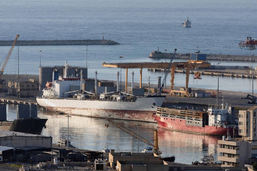
A night navigation system that will allow ships to move into the city even during the high tide at night was launched at the Calcutta port on Saturday.
The move promises to enhance the port’s capacity to handle ships.
The Calcutta port has installed more than 100 lights on the river and the shore between Diamond Harbour and the city, covering a distance of around 60km on the Hooghly.
The inaugural run, conducted early on Saturday, saw the successful transit of container vessel MV SinarPenida, with a Length Overall (LOA) of 117m and a draft of 6m, carrying 8,000 tonnes of cargo from Budge Budge to the sea amid complete darkness.
“The stretch of the Hooghly between Diamond Harbour and Calcutta has many sharp bends and the depth of the riverbed shifts frequently, from the right to the left bank. This poses a serious hazard for pilots who navigate the vessels from Sandheads to the port,” said a senior official of Syama Prasad Mookerjee Port. “The lights will help them navigate the vessels safely even during the night,” he said.
Airports that have night landing facilities, like in Calcutta, have runway lights for pilots at night or in poor visibility.
A port official explained the difficulties of navigating a vessel through the Hooghly between Diamond Harbour and Calcutta.
“The river channel from Haldia to Sandheads is straight, and we know the depth. However, in the stretch between Calcutta and Diamond Harbour, the river’s course and depth change constantly,” said the official. “The navigable bank is shifting from the left to right bank constantly.”
One of the sharpest bends is at Panchpara. Diamond Harbour is over 50km south of Panchpara in Howrah, but the course of the river changes to the opposite side within this distance, said the port official.
“The navigational aid can be used but at night, a vessel cannot only depend on that. Lights play a crucial role in guiding vessels at night. Besides, due to network issues, the navigational aids don’t work all along the stretch,” said the official.
There are different lights with different functions. Transit marks indicate deep waters. Buoyed channels demarcate the sand and shallow water. Riverbank illumination is also going on, said an official.
“The successful introduction of night navigation in the upper stretches of the Hooghly is a testament to the scientific and technological approach adopted by the port. It will significantly improve operational efficiency and turnaround time, paving the way for enhanced trade throughput,” chairman of Syama Prasad Mookerjee Port, Rathendra Raman, said.
Sanjoy Kumar Mukherjee, senior public relations officer of the port, said in 2024-25, 3,157 ships were handled by the Calcutta port.
Historically, the long and meandering 232-km river channel from the sea to the Calcutta dock system, marked by restrictions in navigable depth and strong cross-tidal currents, posed a significant challenge for continuous vessel movement.
“The National Technology Centre for Ports, Waterways and Coasts, IIT Madras, prepared a comprehensive study and roadmap for night navigation in collaboration with the Port of Antwerp,” said an official.
“With the introduction of night navigation, the port is expected to witness a notable increase in the number of vessels that can be handled daily,” said an official.