The Bengal government has initiated steps to resolve the long-pending land dispute in South Berubari mouza, Jalpaiguri, along the India-Bangladesh border as Bangladesh has reportedly failed to provide mouza maps of the area to the district administration.
The state’s land survey department has begun preparing land maps for the disputed stretches of Berubari within the Indian mouza since Saturday. The area is located some 35km from Jalpaiguri town.
"The land dispute in the villages of South Berubari will be resolved very soon,” said Shama Parveen, the district magistrate of Jalpaiguri.
The DM said the mouza map of the Boda police station area of Bangladesh, which includes parts of South Berubari, had been formally sought from Bangladesh, but no response had been obtained so far. "In the absence of a response, the state government’s land survey department has taken the initiative to prepare the mouza map,” Parveen said.
In 2015, 51 erstwhile Bangladeshi enclaves in India and 111 erstwhile Indian enclaves in Bangladesh were physically transferred to each other.
Villages such as Kajaldighi, Barashashin, Chilahati, Naotari Debottar and Paranigram in South Berubari, which were transferred to India, however, continued to face problems due to lack of clarity in land documents.
As a result, residents — many of whom live on land inherited from their ancestors — still have Bangladesh’s Boda police station in their land records instead of the Indian Berubari mouza.
Consequently, they have not received land deeds in their names, leaving them unable to avail government welfare schemes or legally buy and sell land.
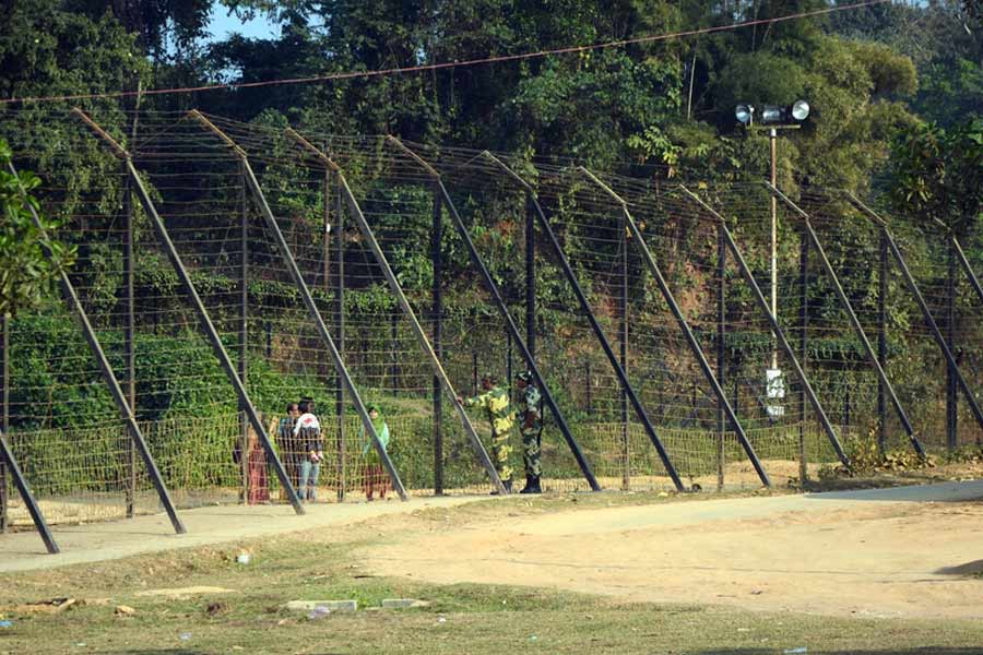
The unresolved land dispute has also stalled infrastructure development along the border, with no barbed-wire fencing or border road along a 17km stretch.
"We had repeatedly appealed to the district land office to register the land in the names of the residents and issue land deeds. This will not only enable construction of the border road but also allow residents to benefit from government schemes,” said Sharadaprasad Das, joint secretary of the South Berubari Defence Committee.
Sources said that many residents of villages like Childanga, Foudar Para, Bangram and Daker Kamat, located along the 6km of unfenced border, do not have land ownership documents. “Hence, they have resisted BSF efforts to seek consent for land acquisition, fearing they wouldn't be compensated even if their land is taken,” said a source.
Annakanta Das, deputy chief of the South Berubari gram panchayat, said: "We are grateful to the district administration and the state government for taking a positive role in addressing the land issue in South Berubari. We hope that the problem will be resolved soon."