
Expect nerves to be taut from Sunday afternoon to Monday afternoon. South Bengal will bear the brunt of the season’s first cyclone for roughly 24 hours, the Met office has said.
Flights will remain suspended at Calcutta airport between Sunday noon and Monday 9am, airport officials said. Many trains have been cancelled.
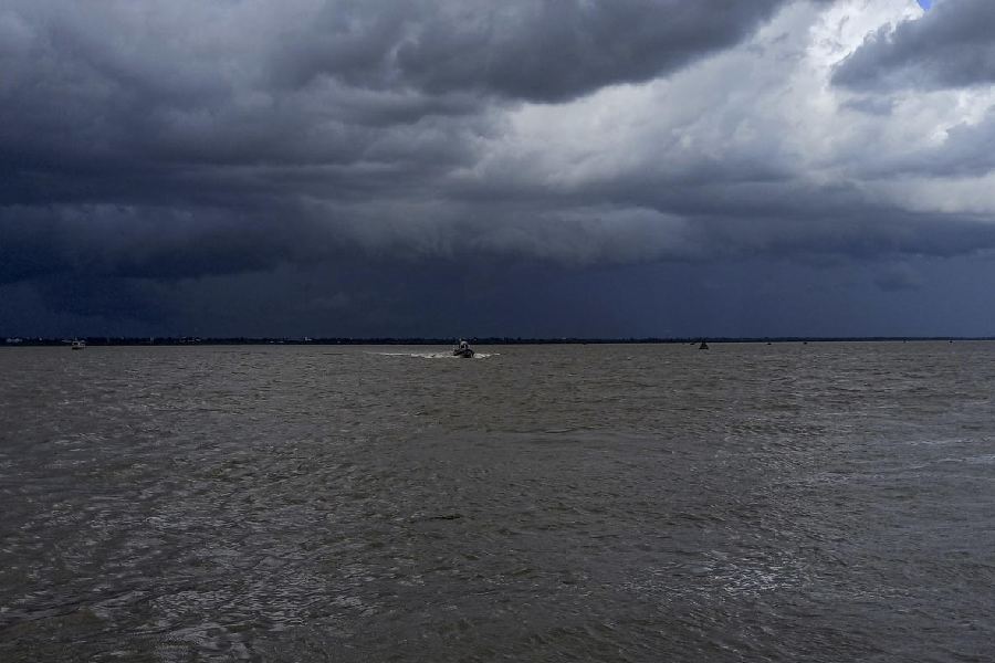
The deep depression over east-central Bay of Bengal intensified into Cyclone Remal early on Saturday evening, a Met bulletin said. Around 5.30pm, it was about 360km from Sagar Island in South 24-Parganas, moving at 12km an hour.
Clouds from the outer band of the system had reached south Bengal by Saturday afternoon, triggering isolated thunderstorms. South 24-Parganas, North 24-Parganas, Calcutta and Nadia reported local showers accompanied by gusts of wind.
“The real effect will be felt between Sunday afternoon and Monday afternoon,” said Somenath Dutta, deputy director-general of the India Meteorological Department, Calcutta.
Position
Around 5.30pm on Saturday, Remal was over “the north and adjoining east-central Bay of Bengal, about 360km south-southeast of Khepupara (Bangladesh), 350km south-southeast of Sagar Island and 390km south-southeast of Canning”, the Met bulletin said.
On Friday morning, it had been a depression over central Bay of Bengal, around 660km from Sagar Island. It was then travelling at 16kmph.
“The speed of a system on sea depends on multiple factors like the wind direction in the upper atmosphere, sea surface temperature and gradient,” said H.R. Biswas, head of the weather section at the Regional Meteorological Centre, Calcutta.
Power
Remal is likely to become a severe cyclonic storm over the sea around Sunday afternoon. It is likely to sustain that intensity till landfall around Sunday midnight.
Sustaining the intensity would mean unleashing winds blowing consistently at 110kmph to 120kmph, with gusts clocking up to 135kmph.
“It would.... cross Bangladesh and adjoining West Bengal coasts between Sagar Island and Khepupara by May 26 midnight as a severe cyclonic storm with wind speed of 110-120 gusting to 135kmph,” the Met bulletin said.
A cyclone’s intensity is determined based on the wind speeds it generates, said Biswas. “By that comparison, Remal is more comparable with Aila,” he said.
Aila, also a severe cyclonic storm, made landfall in the Sunderbans on May 25, 2009, unleashing winds that clocked 120kmph.
Impact
The coastal areas of South 24-Parganas, North 24-Parganas and East Midnapore will receive extremely heavy rain (over 200mm) on Sunday, Saturday’s forecast said.
In addition to torrential rain, the two 24-Parganas will witness ferocious winds. Areas along the coastline in these two districts can expect winds blowing consistently at 110kmph to 120kmph with gusts clocking 135kmph.
The winds will flatten anything in their path — weak homes, poles and trees — in the pockets along the coastline, the Met office warned.

The fury of the winds will be marginally lesser in East Midnapore, Calcutta, Howrah and Hooghly. But even these areas will see winds blowing consistently at 70-80kmph, with gusts clocking 90kmph.
Calcutta, Howrah and Hooghly are likely to get very heavy rain (120mm and above) on Sunday.
The landfall of a cyclone is a lengthy process. Remal is expected to take three to four hours, a Met official said.
“The area where the storm actually hits land is likely to see the maximum impact. But places like Calcutta, not in the direct track of Remal as of now, are likely to see the intensity of the rain and winds go up from an hour before landfall to an hour after the landfall,” said a Met official.
Even after landfall, a depleted version of the storm is likely to move north and trigger heavy rain in districts like Nadia and Murshidabad on Monday. The districts are likely to see winds blowing at 60-70kmph, with gusts clocking 80kmph.
Trains
The railways have cancelled many trains that link Calcutta with South 24-Parganas and North 24-Parganas. Suburban trains on the Sealdah South section and the Barasat-Hasnabad link on the Sealdah North section have been suspended from 11 pm on Sunday to 6 am on Monday.
In the Howrah division, more than a dozen trains on the Howrah-Bandel section have been cancelled on Sunday.