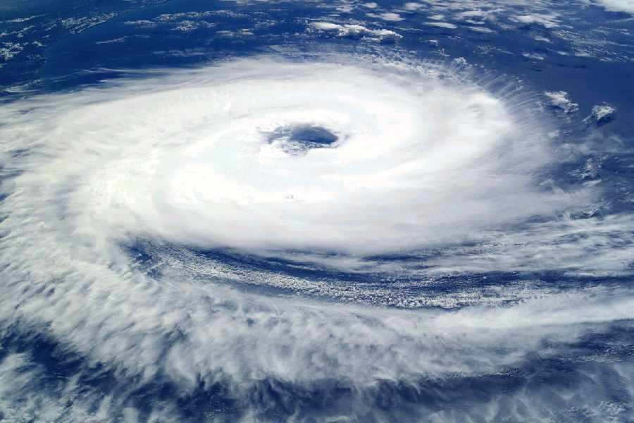
Cyclone Mocha hit land in Myanmar on Sunday afternoon, more than 500km from Kolkata, unleashing monstrous winds and torrential rain.
At the time of landfall near Sittwe, the capital of the Rakhine state in Myanmar, Mocha was an “extremely severe cyclonic storm”. Around 550km from Sittwe, all that Kolkata got were breeze and a partly cloudy sky, which brought the Celsius down. The winds came from the outer edge of the storm, via northeastern India.
Cyclone gone, the conditions are likely to be gradually conducive to thunderstorms in Kolkata, according to the Met forecast.
The storm unleashed winds that clocked 209kpmh during landfall, according to Myanmar’s Meteorological Department. It damaged houses, transformers and cell phone towers and tore roofs off buildings in Sittwe and adjacent areas.
Cyclone Amphan, which caused extensive damage to coastal Bengal in May 2020, had a maximum windspeed of 185kmph during landfall (near the Sagar islands in South 24-Parganas). Mocha’s landfall started around 11.30am and continued till 2.30pm.
“At the time of landfall, Mocha was a stronger storm than Amphan, the deadliest storm in Kolkata’s recent memory,” a Met official said.
In Kolkata and south Bengal, the mercury is set to rise from Monday again, said Met officials.
But now that the cyclone on the Bay is gone, the conditions are likely to become gradually favourable for a wet spell in Kolkata, said an official.
Usually, in summer, moisture-laden winds enter the land from the Bay. The atmospheric pressure on the sea is higher than that on the land, especially if there is a cyclonic circulation or a low-pressure area on land. But Cyclone Mocha had turned the sea into a low-pressure zone and the direction of the winds had reversed from land to sea. “Now that there is no system on the Bay, moisture-laden winds will again enter the land from the sea. In the coming days, a system is likely to take shape over Jharkhand and adjoining areas. When that happens, the moisture and heat are likely to form thunderclouds. A weather system is likely to provide the lifting mechanism for the clouds,” said G.K. Das, director, India Meteorological Department, Kolkata.
“Since Monday and Tuesday are likely to see the Celsius jump, the necessary heating will already be present on the earth’s surface. Between May 17 and 22, a rainy spell is likely in south Bengal. More than one spell of thunderstorm is expected in Kolkata,” he said.