Several districts across Jharkhand experienced light to moderate rain, thunderstorm, lightning and strong winds since Friday evening resulting in a drop in temperatures.
The India Meteorological Department's Ranchi centre said lower temperatures were likely to persist for the next 24 hours after which the mercury will witness a gradual rise.
Deputy director of Ranchi Met centre Abhishek Anand said the rain and thunder was due to the impact of Nor'wester activity triggered by an induced cyclonic circulation. " A cyclonic circulation has formed over Odisha and southern Chhattisgarh due to the impact of a western disturbance passing through north-west India. This has helped in triggerring Nor'wester activity in isolated pockets of Jharkhand since Thursday, " he said.
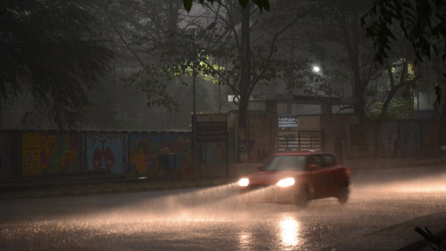
Jamshedpur and its adjoining areas witnessed gusty winds accompanied by showers since Friday evening. The intensity of rain increased on Saturday morning.
Dark convective clouds formed over southern and central Jharkhand. Visibility was reduced to as low as 200 metre at 8am in the steel city and its adjoining areas on Saturday. Street lights had to be switched on. Vehicles also used headlights in the morning.
Weathermen confirmed that visibility also became poor in several other parts of Jharkhand, including Ranchi and Bokaro.
Chatra topped the rain chart with 45mm while Jamshedpur recorded around 45 mm. The IMD weather station at Jamshedpur recorded around 30 mm of rain.
Simdega and Kharsawan witnessed over 25 mm of rain. Nimdih in adjoining Seraikela-Kharswan and and Khunti experienced around 20 mm of rain. The IMD observatory in Ranchi recorded around 12 mm of rain. As many as 10 IMD observatories including ones in Chandil, Latehar, Hazaribagh, Gumla and Bokaro recorded around 10mm of rain.
Met scientists at IMD's Patna office said the rain was the result of the western disturbance passing over the north-west region.
"The weather condition would improve in most parts of Jharkhand from Sunday. Satellite pictures suggested formation of a fresh western disturbance which is likely to affect the western Himalayan region and adjoining plains of north west India from March 16," said a climate analyst at the IMD's Patna office.