A system that was over Bangladesh at the start of the week is now refusing to leave south Bengal, triggering incessant rain in and around Calcutta throughout the week since Monday.
More than one spell of rain and a “generally cloudy” sky is expected on Friday as well, said a Met official. The intensity of the showers will dip from Saturday, he said.
A cyclonic circulation had formed over Bangladesh and adjoining coastal areas. On Monday morning, it was over north Bangladesh and the neighbourhood. By Tuesday, it had moved down and was over Gangetic Bengal and the neighbouring areas. On Wednesday, it was over the northwest Bay of Bengal and adjoining Gangetic Bengal. On Thursday, it shifted over the northern parts of Gangetic Bengal.
H. R. Biswas, head of the weather section at the Regional Meteorological Centre in Alipore, told Metro: “The system has overstayed its expected tenure over south Bengal by more than 24 hours. It has not been static. The movement has been over south Bengal. Now, it is entirely over land. Districts like Murshidabad, Nadia and Burdwan are under the system.”
The monsoon trough has also been passing through south Bengal. On Thursday, it was over Diamond Harbour before moving into the Bay.
Between Monday and Thursday, the Met office recorded close to 150mm of rain at the observatory in Alipore, which serves as the official recordkeeper for Calcutta.
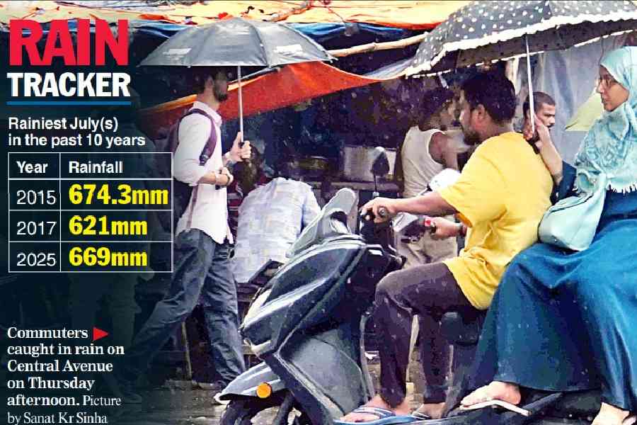
The late flourish ensured that Calcutta ended July with a whopping 73 per cent rain surplus. The city got 669mm of rain in July, compared to the usual quota of 387.4mm. In the past decade, only July 2015 saw more rain, 674.3mm, in Calcutta (see chart).
Met officials had earlier said the intensity of the rains would dip in and around Calcutta from the second half of Wednesday. The system was expected to have lost its steam or changed its position further away from south Bengal by then.
Wednesday was cloudy, but the first half had intermittent showers. A fresh spell, however, began around 10pm and lasted for a while. By 10.30pm, it was blinding in many parts.
The Met office recorded around 30mm of rain in Alipore between 5.30pm on Wednesday and 5.30am on Thursday. Most of it happened between 10pm and 12am.
Salt Lake received 72mm of rain between 8.30am on Wednesday and 8.30am on Thursday, the most between 10pm and 1am. The readings by the pumping stations of the Kolkata Municipal Corporation showed that Maniktala got 62mm between 10pm on Wednesday and 3pm on Thursday. Belgachhia got 82mm and Ultadanga 56mm during the same period. Ballygunge got 26mm and Jodhpur Park 29mm.
The sun hardly made an appearance on Thursday. The day saw intermittent rain. The consistently overcast conditions dragged the temperature down. At 28.3 degrees, the maximum temperature was four notches below normal.
The circulation will either weaken or move away from south Bengal in 24 hours, according to the forecast.
“The sun is likely to make brief appearances on Friday, though the sky is likely to be generally cloudy. The appearances will be slightly longer from Saturday. As the sun comes out more frequently, the days are going to be hotter. By Sunday, the maximum temperature is likely to touch 32 degrees,” said a Met official.
North Bengal is likely to see a rise in the intensity of rains from Saturday, he said.


