Large parts of West Bengal are set to receive heavy rainfall over the next few days due to strong moisture incursion from the Bay of Bengal and an anticipated eastward shift of the monsoon trough, the India Meteorological Department (IMD) said on Wednesday.
According to the forecast, southern districts including North and South 24 Parganas, Purba and Paschim Medinipur, Bankura, Jhargram and Paschim Bardhaman are likely to see heavy rainfall till August 24.
In North Bengal, Alipurduar, Jalpaiguri and Kalimpong are expected to experience intense downpours till August 22, with Malda and South Dinajpur likely to be affected later in the week.
The IMD bulletin noted that a depression over Odisha has weakened into a low-pressure area, but the associated cyclonic circulation over Madhya Pradesh and a shear zone over central India are continuing to feed moisture into the region.
This will trigger widespread light to moderate showers with heavy spells at isolated places across the state, accompanied by thunderstorms, lightning and gusty winds reaching 30–40 kmph.
Forecast Highlights:
- South Bengal (Aug 20–24): Heavy rain is expected in Kolkata, Howrah, Hooghly, Murshidabad, Nadia, and the coastal districts, with maximum intensity over South 24 Parganas, East and West Midnapore, Jhargram, Bankura and Bardhaman.
- North Bengal (Aug 20–26): Jalpaiguri, Alipurduar and Kalimpong will face heavy rainfall till August 22, while Malda and South Dinajpur may see intense showers on August 23–24.
Possible impact
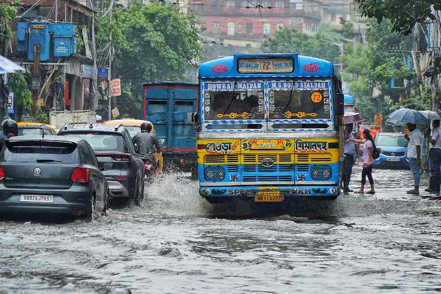
- Waterlogging in low-lying and urban areas.
- Traffic disruption and reduced visibility during intense showers.
- Rise in water levels of rivers.
- Risk of lightning strikes, especially in open fields.
Advisory
The IMD has urged people to avoid waterlogged areas, refrain from taking shelter under trees or electric poles during thunderstorms, and regulate traffic movement in flood-prone zones.
Fishermen have been advised not to venture into the sea along and off the West Bengal coast and over the North Bay of Bengal on August 20 and again between August 23–24, when squally weather with wind speeds of 35–45 kmph gusting to 55 kmph is expected to make sea conditions rough to very rough.