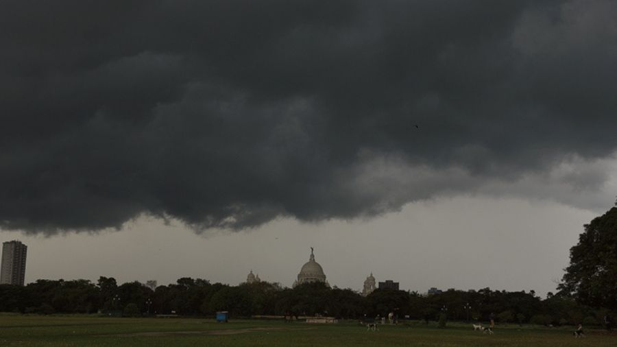
Shortly after West Bengal breathed easy having learnt that a developing cyclonic storm over Bay of Bengal is expected to give the region a miss, the IMD on Saturday predicted the formation of a new low-pressure system near the coast of Myanmar, which, in all probability, will dump heavy rain in the state's southern districts next week.
Kolkata and its adjoining areas, which are still reeling under the impact of torrential rain that occurred earlier this week, should brace for heavy showers next Tuesday and Wednesday owing to this new weather system, the IMD said in its forecast.
A cyclonic circulation is likely to emerge over northeast and adjoining east central Bay of Bengal near the Myanmar coast around September 27, and under its influence, a low-pressure area may develop in the subsequent 24 hours, the Met office said.
"The system is expected to move northwestwards and reach West Bengal coast around September 29," it said in a special bulletin.
By-election to Bhabanipur assembly seat, where Chief Minister Mamata Banerjee is a contestant, is scheduled to be held on September 30.
The weatherman further said that the existing deep depression over north and central Bay of Bengal may intensify into a cyclonic storm by Saturday evening and cross north Andhra Pradesh-south Odisha coasts between Visakhapatnam and Gopalpur by the evening of Sunday.
Under the influence of these two weather systems, rain and thundershower with lightning are very likely to occur at "many places" in south Bengal on Sunday and Monday and "most places" on Tuesday and Wednesday.
The deep depression may also bring heavy rain to East Midnapore on Sunday and West Midnapore and South 24 Parganas on Monday.
The newly developing low-pressure system, on the other hand, could trigger heavy rain at one or two places in Kolkata, East and West Midnapore, North and South 24 Parganas, Howrah and Hooghly districts on Tuesday.
Additionally, Bankura, Jhargram, East and West Bardhaman and Purulia districts may receive rainfall on Wednesday, the Met office said.
The weatherman warned that as an effect, water levels will rise in rivers, low-lying areas may get flooded in the city and the towns, and crops could be damaged in parts of the state.
Squally wind with speed reaching 45 to 55 km per hour and gusting up to 65 kmph is very likely over North and South 24 Parganas and East Midnapore districts.
In Kolkata, West Midnapore, Jhargram, Howrah and Hooghly districts, the wind speed may hover between 30 to 40 kmph, gusting up to 50 kmph.
Over the next few days, sea conditions will be rough to very rough, and fishermen have been told to keep away till further notice.
Several areas in Kolkata and neighbouring districts of South and North 24 Parganas that have been battered by last Monday's torrential rain still lay inundated, causing immense difficulties to locals.
The metropolis on Monday recorded the highest one-day September rainfall in 13 years at 142 mm, according to Met data.