 |
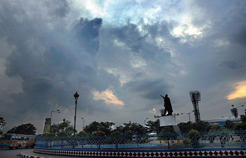
| Clouds envelop the sky over Red Road against the backdrop of Netaji’s statue and the Eden Gardens on Tuesday evening. Picture by Sanat Kr Sinha |
An overcast sky and localised short spells of rain on Tuesday provided a respite from the swelter of the past two days while a cyclone brewing in the Bay promised more clouding and rain over the rest of the week.
Cyclone Hudhud, which was a depression in the Andamans on Tuesday, had moved westward by evening and was tipped to travel northwest overnight.
While rain in Calcutta is a possibility, the Met office clarified that the cyclone would possibly make landfall “too far away from the city to trigger a downpour”.
“Meteorological calculations show that the depression, which on Tuesday lay southeast of the Andaman and Nicobar Islands, would move in a west-north-westerly direction and intensify into a deep depression within 24 hours and further intensify into a cyclonic storm,” said a senior official of the India Meteorological Department, Delhi.
The system is likely to cross the Andamans in continuation of its northwest movement and graduate into a severe cyclonic storm that would hit land late on Thursday along the north Andhra Pradesh-Odisha border.
“The cyclone is likely to make landfall more than 600km away from Calcutta. There will be clouding in Calcutta but heavy rainfall is unlikely. After landfall, the system will lose its intensity and is likely to travel towards Chhattisgarh and Jharkhand. So, moderate rainfall is expected in Calcutta and its surroundings over the weekend,” a Met official said.
According to weather scientists, Hudhud’s projected path was similar to Cyclone Phailin’s between October 8 and 14 last year. The wind speed when it hits coast will be around 150 to 160kmph, slower than Phailin.
“The trajectory of the weather system will become clearer by Wednesday,” the Met official said. “Fishermen along the Bengal coast have been advised not to venture into sea in the run-up to the cyclone because the winds will be strong and the waters rough.”
The cloud cover over the city on Tuesday had nothing to do with the depression, though. Thunderclouds formed in and around Calcutta mainly because of the the confluence of two types of winds. The south-westerly monsoon has receded till Bihar, which is why cool winds from the north and northwest are blowing into eastern India.
“Cool winds from the north are reaching Calcutta and so are monsoon winds blowing in from the Bay of Bengal. The confluence of two types of winds led to the formation of thunderclouds over the city,” said Gokul Chandra Debnath, director of IMD Calcutta.
Monsoon winds withdraw from Calcutta around October 10.
The maximum temperature dipped from 35.6 degrees Celsius on Monday to 34.9 degrees on Tuesday, thanks to the cloud cover. It is tipped to drop a notch each day to reach 31 degrees by Sunday.