
A low-pressure area has formed over the northwest Bay of Bengal, off the Odisha coast, as of May 27.
According to the latest meteorological update, the associated cyclonic circulation extends up to 7.6 km above mean sea level and is tilting southwards with height.
The system is expected to move slowly in a northward direction and become more marked in the next 48 hours.
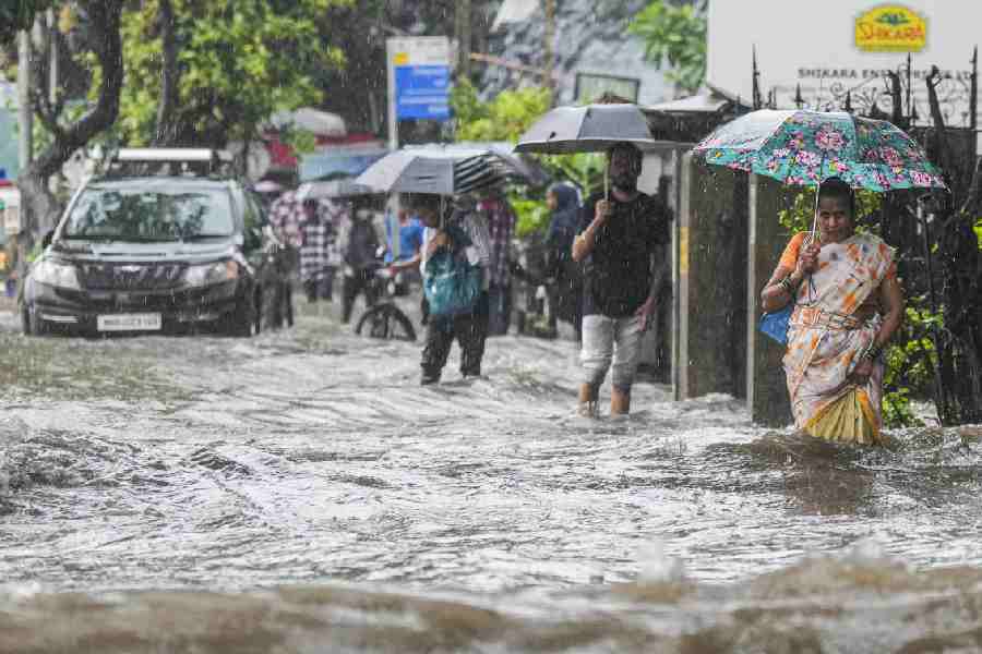
Both north and south Bengal are likely to experience heavy to very heavy rainfall, thunderstorms, gusty winds and lightning activity in the coming days.
May 27
South Bengal is forecast to receive light to moderate rain or thundershowers at many places.
Thunderstorms accompanied by gusty wind with speed reaching 30-40 kmph, lightning and light to moderate rainfall are expected at one or two locations across all districts.
Heavy rainfall in the range of 7 to 11 cm is likely at one or two places in South 24 Parganas and East Medinipur districts.
In north Bengal, light to moderate rain or thundershower is expected at a few locations.
May 28
Light to moderate rain or thundershowers are very likely at many places in south Bengal.
Thunderstorms with gusty winds (30-40 kmph), lightning and light to moderate rainfall are likely to occur at isolated places across all South Bengal districts.
Heavy rainfall (7-11 cm) is expected at one or two places over North and South 24 Parganas, East and West Medinipur and Howrah.
In north Bengal, light to moderate rain or thundershowers are likely at a few locations.
May 29
South Bengal is expected to receive light to moderate rain or thundershowers at most places.
Heavy to very heavy rainfall (7-20 cm) is likely at one or two places in East and West Burdwan, East and West Medinipur, Bankura, South 24 Parganas and Hooghly.
Heavy rainfall (7-11 cm) is likely in the remaining districts of South Bengal.
Thunderstorms with gusty winds reaching 40-50 kmph and lightning are likely in North and South 24 Parganas and East and West Medinipur, while gusty winds at 30-40 kmph with lightning may occur over Jhargram, Kolkata, Howrah and Hooghly.
For North Bengal, light to moderate rain or thundershowers are expected at most places, with heavy to very heavy rainfall (7-20 cm) likely in Jalpaiguri, Alipurduar and Coochbehar districts.
Heavy rainfall (7-11 cm) is expected in the remaining districts. Thunderstorm with lightning are also likely across all districts.
May 30
South Bengal will likely experience light to moderate rain or thundershower at many places.
Heavy to very heavy rainfall (7-20 cm) is forecast at one or two places in East and West Burdwan, East and West Medinipur, Jhargram, Bankura, Birbhum, Murshidabad, South 24 Parganas and Hooghly.
The rest of the South Bengal districts may receive heavy rainfall (7-11 cm).
Thunderstorm activity with gusty winds of 40-50 kmph and lightning is expected over North and South 24 Parganas, East and West Medinipur, while gusts of 30-40 kmph with lightning may occur over Jhargram, Kolkata, Howrah and Hooghly.
North Bengal will witness light to moderate rain or thundershowers at most places.
Heavy to very heavy rainfall (7-20 cm) is forecast for several areas, with extremely heavy rainfall exceeding 20 cm likely over Darjeeling, Alipurduar and Jalpaiguri districts.
Kalimpong, Coochbehar and North Dinajpur are also likely to experience heavy to very heavy rainfall, while the remaining districts may receive heavy rain (7-11 cm).
May 31
South Bengal is forecast to have light to moderate rain or thundershower at many locations, with heavy rainfall (7-11 cm) likely in Birbhum and Murshidabad.
In North Bengal, light to moderate rain or thundershower is expected at most places.
Heavy to very heavy rainfall (7-20 cm) is likely at one or two places in Darjeeling, Jalpaiguri, Kalimpong, Coochbehar and Alipurduar, while other districts are expected to receive heavy rainfall (7-11 cm).
June 1
North Bengal is forecast to receive light to moderate rain or thundershowers at most places.
Heavy rainfall (7-11 cm) is expected at one or two places in Darjeeling, Kalimpong and Alipurduar districts.
The possible impact of this extended spell of heavy rainfall and thunderstorm activity includes damage to standing crops, vegetables and horticulture, especially in open fields.
There is also a risk of lightning strikes, temporary waterlogging in low-lying areas and possible wall collapse in vulnerable kutcha houses.
Urban areas may face traffic disruptions, while the hilly regions of North Bengal could experience reduced visibility (less than 1 km) due to low clouds and valley fog, alongside the possibility of landslides in Darjeeling and Kalimpong districts.
The authorities have suggested precautionary measures, including taking shelter in safe places during thunderstorms, avoiding shelter under trees and electric poles, and staying away from water bodies.