The unfortunate disaster that struck Rishiganga-Dhauliganga Valley in early February is a sad reminder of the consequences of undermining the natural vulnerability of the Himalayas. We should not delude ourselves into believing that this is the last disastrous Himalayan event that caused losses to life and property, including two hydropower plants. In an article in Nature in 2013, yours truly had cautioned that rising temperatures in the Himalayas raise the threat of glacial lake outburst floods. Of the 8,800 glacial lakes in the Himalayas, more than 200 have been classified as dangerous. Himalayan nations were urged to build an international network to monitor risks such as those from glacial lakes and give early warning of hazards — similar to the tsunami warning systems installed around the Indian Ocean. Did anyone listen and act on any of the prescriptions? No.
That the Himalayan river catchments are vulnerable to landslides that temporarily dam rivers is well-known. The landslides are triggered by a plethora of natural and man-made factors such as heavy rainfall, earthquake, active geological features, deforestation, large-scale land-use changes and so on. In a relatively young mountain range such as the Himalayas, there are multiple reasons that lead — independently or synergistically — to hazard events such as the one we witnessed. Before jumping to conclusions, we must understand the non-linearity related to such events. Peddling half-baked ideas borrowed from grey literature and hearsay can be embarrassing.
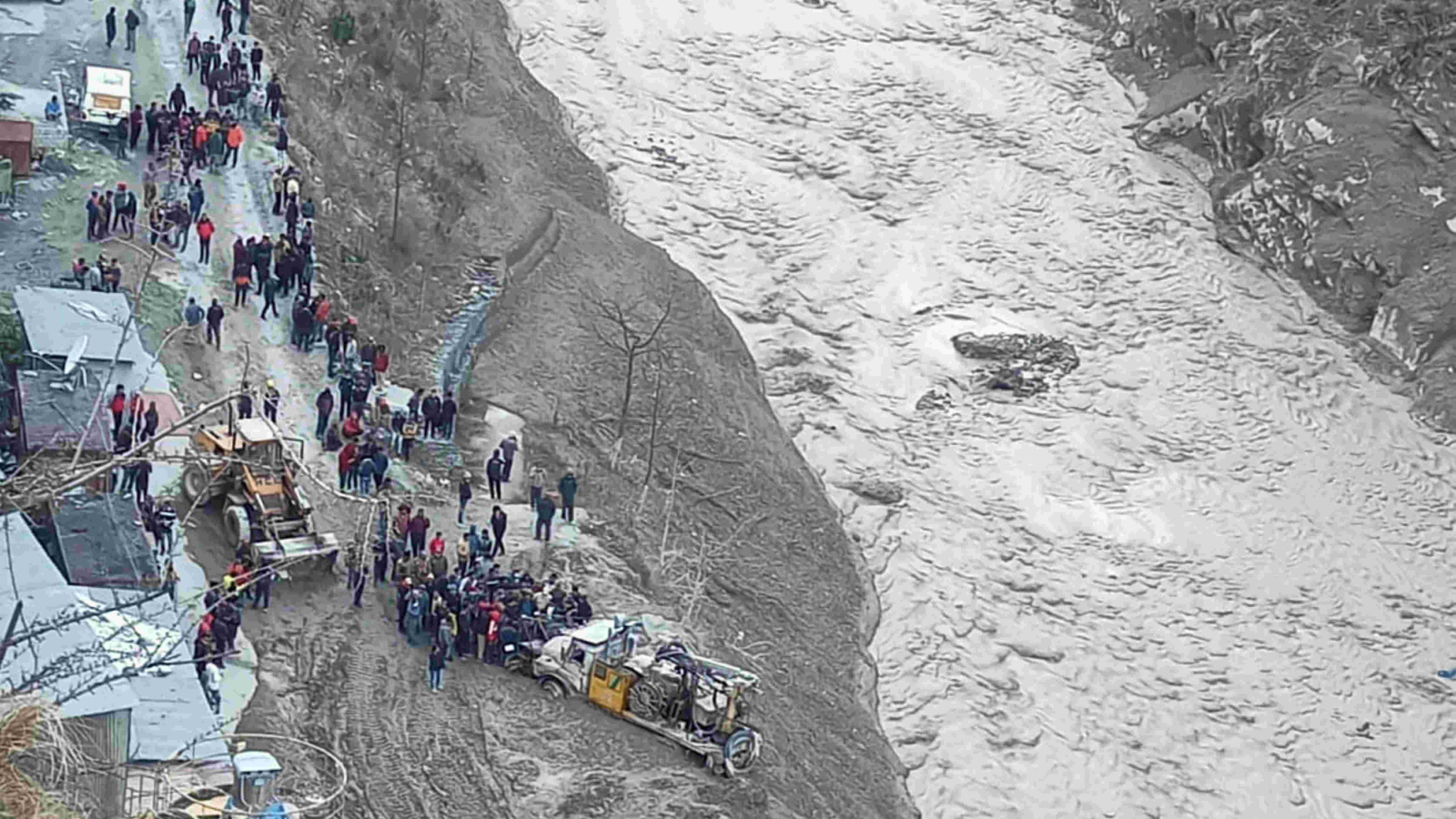
Watching the live pictures as they came in, it appeared to be a mudflow — a mix of debris, rocks, clay with some amount of water that is either contributed by heavy precipitation (rain or snow), a lake breach or the base flow of a river. Was it a glacial lake outburst flood? Not really. There aren’t any GLOF events known from the Indian Himalayas so far. Of the 34 GLOF events in the Himalayan region known thus far, four are from Bhutan, 16 from Tibet and 14 from Nepal. GLOFs occur mostly in monsoon, typically following a cloudburst and dense rain. That wasn’t the case here.
The possibility of an avalanche and/or landslide driven flood event appears to be high. With more information trickling in from the site, this seems to have been the case. The sliding slope and the avalanche carried down massive quantities of debris comprising ice, snow, firn, rocks, clay and mud. Not many know that the Dhauliganga Valley, from Vishnuprayag to the Reni-Tapovan stretch — the site of destruction — has numerous geothermal (hot) springs, which indicate the underlying reasons for the area being geologically active and unstable. Recent evidence suggests that the Himalayas are warming more rapidly than other world mountains. The presence of geological features such as geothermal springs, can potentially trigger massive material movement of glaciers, snow, water and sediment. The Dhauliganga Valley between Reni village and Vishnuprayag is narrow; this prevented the voluminous debris flow from spreading, thereby downscaling its volume and speed.
It may be useful to remind ourselves that the origins of the destructive 1970 floods that caused devastation in the Ganga Valley also lay in the Rishiganga watershed. Those floods became a precursor to the world famous Chipko Movement. Today, the memorial of Gaura Devi, the leader of ‘Chipko’, on the outskirts of Reni village, overlooking the massive destruction below, stands as a mute spectator to the drama that has unfolded.
Why do we continue to suffer death and destruction despite the available scientific information? The difficulty seems to be the post-mortem approach in policymaking. We only respond through instruments such as disaster relief and other rescue mechanisms. Sadly, our investment in pro-active scientific approaches — natural hazard surveillance or flood forecasting — to prevent disasters is missing. In absence of robust science-policy-based instruments, we are left with the sad option of recovering dead bodies and counting our losses. The other concern is that our policymaking doesn’t appear to take good science seriously. This space has been left open to the media. Much of what goes into social media and grey literature is bad science and frivolous information. Consider the claims of the so-called experts on television channels: some said that dams are responsible for this tragedy, while others pontificated that the Himalayan glaciers will disappear in the next decade. This is patently unscientific information and the media, if they want to remain credible, must avoid falling prey to poorly-informed sources.
To deal with the long-term sustainability of the Himalayas and their inhabitants, the following measures may be useful. Administrative controls, law enforcement and sanctions in case of violations are necessary to prevent environmental destruction. The introduction of environmental easements to the local citizenry in the Himalayas would protect the fragility of the mountains and address the concerns about providing economic incentives to the local people without harming the environment. Compensatory afforestation programmes funded by hydropower corporations need to be effectively monitored. These activities must mandatorily involve local communities, civil society and women’s self-help groups for meaningful results. The relocation of vulnerable villages/buildings to safer areas and the imposition of penalties for erecting structures on riverbanks are also necessary. Primary and secondary school curricula in the Himalayan states must include basic knowledge of geology and ecology of the mountains to ensure long-term environmental and human security. Finally, policymakers need to actively engage with scientists and experts with proven credentials to build a network of information based on land-use changes, hazard surveillance, weather monitoring and forecasting systems along the lines of the tsunami warning system.