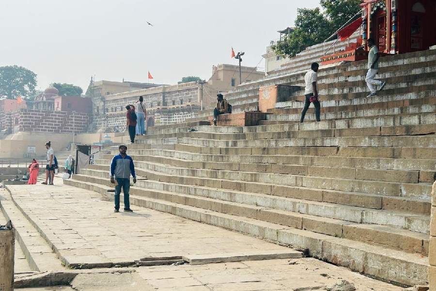
The land along Varanasi’s iconic riverfront is sinking under the impact of relentless groundwater depletion and the unique geology that drives the Ganga’s flow along the city.
Scientists at the Banaras Hindu University and Chapman University in the US, who combined data from satellites with groundwater and rainfall measurements, have calculated land subsidence rates ranging from 2mm per year to 8mm per year along the riverfront.
Their study found cumulative subsidence levels ranging from 2cm to 2.5cm at the Manikarnika ghat (near the Kashi Vishwanath temple), Harishchandra ghat and the Ravidas ghat between February 2017 and August 2023. The subsidence levels ranged from 3cm to 5cm at the Chousatti, Prahlag and Samne ghats.
“Our findings highlight the need for systematic measurements of subsidence along the ghats,” Ashwani Raju, an assistant professor of geology at the BHU who led the study, told The Telegraph. Raju and his collaborators have published their findings in the peer-reviewed journal, Science of the Total Environment.
The scientists have called for subsidence rates to be taken into account in future water management and groundwater use strategies for Varanasi, which has experienced steady groundwater depletion alongside population growth, rapid urbanisation and intensive cultivation on nearby farmland.
Raju and principal collaborator Ramesh Singh at Chapman University assessed groundwater changes using data from a US satellite from 2003 to 2023 and from the central and state groundwater boards. And they used data from a European satellite to monitor ground displacements from 2017 to 2023.
Varanasi is among the world’s oldest continuously inhabited cities. Archaeological excavations have revealed its earliest settlements dating back to 1200 BC.
And the city’s riverfront has grown as a pilgrimage site since the 6th century AD.
Multiple studies have over the past decade documented widespread groundwater depletion across vast swathes of land, stretching from the foothills of the Himalayas to the entire expanse of the Indo-Gangetic plains.
The Indo-Gangetic plains are made up of alternating layers of sand, silt and clay sitting atop one another up to an average depth of 4.9km above ancient bedrock.
The groundwater is trapped within layers of sand and its depletion causes irreversible deformation of the clay layers, hampering groundwater replenishment, Raju said. The outcome of these processes is land subsidence.
Groundwater depletion has been linked to land subsidence at many sites in the world, including cities such as Chandigarh, Delhi and Lucknow in the Indo-Gangetic plains. Mexico City and Tehran have the highest subsidence rates of up to 30cm per year.
But the shape of the geological fault through which the Ganga water flows along Varanasi exacerbates the effect of the groundwater depletion along the riverfront and the ghats.
“High water velocity along the meandering ghats leads to the erosion of the ghats’ sections along the riverfront,” Raju said. “We see groundwater depletion across the city of Varanasi. But the effects of the river amplifies subsidence along the ghats. We can see these effects in the form of the deformations or undulations on the stairways at some of the ghats.”
The other collaborators were Mitali Sinha, Saurabh Singh, Abhinav Patel and Praveen Kanojia at the BHU.