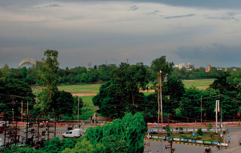
THE CLOUD

THE DRIZZLE

THE CONSOLATION

Bihar's miss proved to be Jharkhand, Bengal and Chhattisgarh's bounty.
The low-pressure that originated in north Bay of Bengal and lay over Jharkhand on Thursday, moved to Chhattisgarh on Friday, denying Bihar its share of what the weathermen had predicted.
The next phase of active monsoon would not hit the state for another four days.
"The low pressure turned into a depression and moved southward towards Chhattisgarh, causing rain. Bihar received only high-speed winds. Bihar is unlikely to receive any significant rainfall in the next four days, as the southwest monsoon is weak in the region," said Ashish Sen, the director at Patna meteorological centre.
The Met centre had issued an alert for heavy rainfall across the state on Thursday evening with the experts predicting that the low pressure would move towards Bihar from Jharkhand.
However, most parts of the state had to remain content with overcast skies and intermittent drizzle. Winds blew at an average speed of around 20-25kmph in south Bihar and 15-20kmph in Patna.
Though the city did not receive much rain, the cloud cover and windy conditions led to a plunge in the mercury column.
NIGHT-MARE

The maximum temperature in the city slid from 34.4ºC on Thursday to 29ºC, down five degrees.
Residents welcomed the cool weather but were left disappointed by the absence of heavy rain.
"I was delighted to read about the heavy rainfall forecast in the newspapers this morning. The overall pleasant weather, which was marked by windy conditions and drizzle till the afternoon hours, made me optimistic about more rain. However, things did not change much by dusk, when I got to know that the clouds carrying the heavy rain promise have moved farther away from the state. I had drawn up an elaborate plan to relish a game of football with my friends in the mud and slush on the ground on Saturday, but I guess I would have to change my plan now," said Nishant Singh, a resident of Boring Road.
Weathermen claimed that the clouds over the city sky are likely to clear by Saturday evening followed by sultry weather conditions.
"The weather is likely to turn sultry for a couple of days starting Sunday. The maximum temperature is likely to hover around 35 degrees Celsius coupled with a high level of humidity," said Sen.
Meteorologists claimed the next phase of active monsoon rainfall was expected in the state only after four days.
"The low pressure area sucked heavy amount of moisture from Bihar. Thus, a dry phase would be observed over the next three days. However, the formation of a fresh system over the Bay of Bengal is expected in a day or two. That would lead to incursion of moisture in the region. Hence, we expect monsoon to become active in the four-five days," said Sen.
Monsoon 2015 forayed into Bihar on June 22 - marking a delay of 10 days - through the northeastern parts before it covered the rest of the state, including Patna, on June 25.
Even after reaching the state, the monsoon had remained mostly inactive, which had led to heavy deficiency in rainfall in the initial few days.
As a result, the deficiency figure for the state stood at 28 per cent on June 30 and the same for Patna stood at 41 per cent. However, good rainfall earlier this week brought down the deficiency for the state to 13 per cent (as on Friday), and for Patna to 9 per cent.
Private weather agency Skymet has predicted that the rainfall across the country would vary between normal and 104 per cent of normal in July.
The private weather agency had earlier stated that four spells of active monsoon rainfall was expected across the country during July 6-8, July 14-17, July 23-26 and July 30 to August 2.