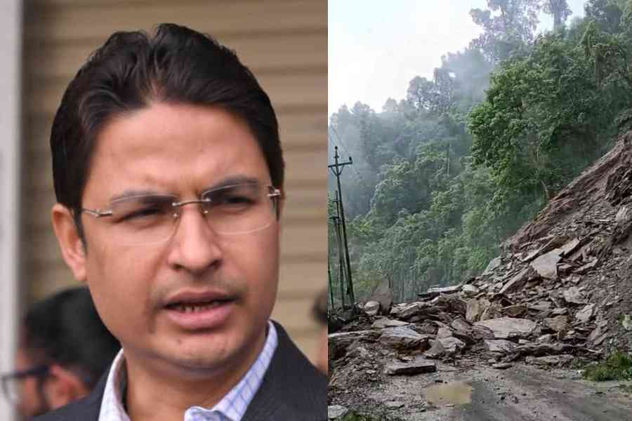
Darjeeling MP Raju Bista is pushing for an inter-ministerial panel to look into the issues affecting National Highway 10, the lifeline of Sikkim, Darjeeling and Kalimpong.
“I am going to Delhi today (Sunday) and will meet Nitin Gadkari, Union minister of road transport and highways (MoRTH) and seek for an inter-ministerial panel to look into the issues of the NH10,” Bista told The Telegraph.
The NH10 opened to traffic on Sunday afternoon after six days of closure for repair work of damage caused by landslides and cave-ins. Stretches of the arterial highway of the region have been frequently closed throughout monsoon because of landslides
and cave-ins.
Earlier, Sikkim chief minister Prem Singh Tamang (Golay) said that the Himalayan state loses ₹100 crore for every day the NH10 is closed.
Bista, a BJP MP, had played a pivotal role in in transferring the maintenance of the road from Bengal PWD (highway division) to the National Highways & Infrastructure Development Corporation Limited (NHIDCL).
The Darjeeling MP’s proposal comes as three central government agencies are involved in the hills through which the NH10 passes.
“There is the NHPC (which has built dams along the highway route), the NHIDCL and the IRCON (which is constructing the rail link to Sikkim),” said Bista.
The 45km-long railway route that would connect Rangpo, the bordering town in Sikkim, with Sevoke in Bengal will have 14 tunnels.
The railway line runs a few hundred metres above the NH10 in many stretches.
Experts have warned that the NH10 would continue to be vulnerable because of the mega projects in the region.
A soil expert, who has worked in the Sikkim-Darjeeling region, recently said: “From a technical soil-physics perspective, the fate of the NH10 is sealed. It would never be the same as it was before the dams were built.”
The 78.58km highway connecting Rangpo on the Bengal-Sikkim border to mainland India runs along the Teesta river for around 52km.
It is also along this stretch that the 132MW Teesta Low Dam-III and the 160MW Teesta Low Dam-IV have come up between 2013 and 2016 at a cumulative estimated cost of around ₹3,200 crore. This is the highway’s most vulnerable stretch.
Experts said long reservoirs created by these dams resulted in deep waters of up to 25 metres in the valley’s bottom where previously white-water rapids flowed.
“Tremendous pressure of the water column helps in pushing the water into the foot slopes of the hills forming the valley. This changes the character of the soil,” said Chatterjee, adding that the soil layers at the base of the hillslopes and the bottom of the valley have become saturated with water.