|
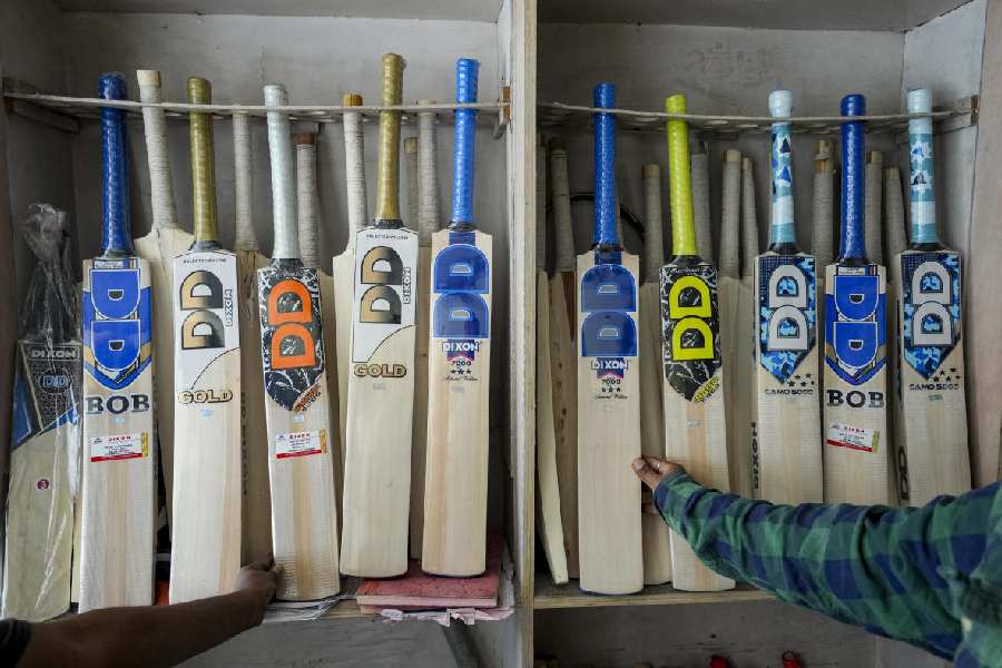
| After the heavy rainfall recently, the Teesta eats into its banks in Jalpaiguri. Picture by Biplab Basak |
Siliguri, July 16: Around 300 years ago, the Teesta was a tributary of the Ganga, claim experts of the geography department of North Bengal University.
Armed with this information, they have planned to undertake an extensive research on the changing course of the river since the 18th century.
Old records and maps written and drawn by Major James Reynold, the then surveyor-general of India, indicate that the Teesta used to take a different route and flow into the Ganga, instead of merging with the Padma in Bangladesh, as it does now.
The records show that after originating in the Sikkim hills, the Teesta merged with the Ganga somewhere in Pabna district of Bangladesh, located on the other side of Malda.
?The map of the Teesta, drawn by Reynold is definitely important to geologists,? said Subir Sarkar, the head of the geography department of North Bengal University. ?The course of the river had gradually shifted eastwards, owing to neo-tectonic activities in the whale back-shaped plate of the region.?
According to him, the difficulty in tracing the course lies in the fact that the places, along which the river used to flow, were mostly uninhabited in those days. As a result, there is no account of local residents to substantiate the claim. ?We have zeroed in on a few localities mentioned on the map, which we are studying now,? Sarkar said.
A few reports filed by travellers and surveyors like Buchanan Hamilton, who came to the region in 1830-33 and penned his account, and Miligan, who undertook the first land survey in the country in 1811, indicate that the Teesta was changing its course. ?Their narration and reports mention devastating floods and earthquakes that had taken place in the area, which had eventually changed the course of the river,? Sarkar said. ?In addition, neo-tectonic activities led to shifting of rivers in the east and westward directions. While rivers like the Teesta shifted to the east, others like the Kosi moved west.? The Geological Survey of India recorded these findings in the early 1980s, further substantiating the researchers? claim.
?Such researches have a social implication, as residents of a region must learn about the geographical changes as well as the history of the place,? Sarkar added.