WATERLOGGING WOES ACROSS CITY

Alipore: The spells of rainfall that poured water over your weekend plans aren't stopping anytime soon because Calcutta is currently in the eye of the monsoon trough, a position made more daunting by a low-pressure area in the making.
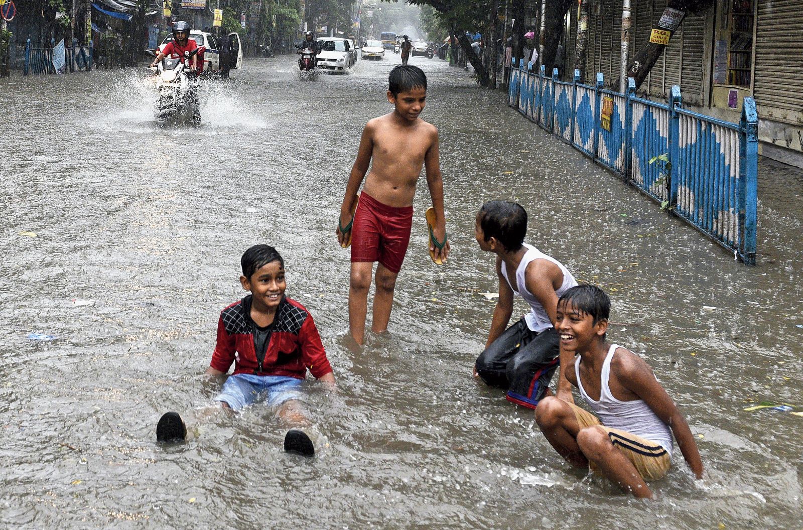
Streets were flooded and traffic was reduced to a crawl on Sunday as the skies opened up intermittently since the previous night. The weather office has forecast more of the same in the next two days.
The most intense spells of rain were restricted to central Calcutta and New Market, which recorded 80mm of rain from midnight till 5.30pm on Sunday. More than 50mm came down in just one hour from 12.15pm.
Ballygunge wasn't too far behind with 59.4mm of rain from midnight till 5.30pm. But most other places received less rainfall. Ultadanga in the north had 30.5mm during the same period while Patuli deep in the south recorded only 9.4mm.
Howrah also reported a downpour, with Shibpur receiving 77.5mm.
"We had a cyclonic circulation spread over Bangladesh and neighbouring Gangetic Bengal to go with the monsoon trough passing right over the city. This led to the formation of tall thunderclouds. We expect more rain in Calcutta and the rest of Bengal over the next two days because the cyclonic circulation is intensifying into a low-pressure area," said Sanjib Bandyopadhyay, the deputy director-general of the India Meteorological Department (IMD), Calcutta.
The downpour from around 12.30pm left central and parts of south Calcutta swimming in misery. Strand Road and MG Road were in knee-deep water. Waterlogging was also reported in the area around North Port police station, on CIT Road near Rabindra Sarani, CR Avenue and Eden Hospital Road, Amherst Street, College Street, Hatibagan, Thanthania Kalibari, RN Mukherjee Road, JN Road, Amir Ali Avenue, Rashbehari Avenue near Bijan Setu, Darga Road, the Bypass near Science City and parts of the Park Circus connector.
A motorist who had stepped out of his Tallah Park home at 1.55pm reached Chandni Chowk after an hour and five minutes, a distance he usually covers in 20 minutes on a Sunday. "There was knee-deep water on Central Avenue near MG Road. The curvature of the road spared the middle portion a little and so all vehicles were moving single file through this corridor," he said.

The rain forced many people to cancel planned outings. "We had planned to have lunch outside but the heavy rain made us cancel our plan," said Ballygunge resident Sanjib Mukherjee, whose elder brother and sister-in-law are visiting him.
According to the weather office, the city's proximity to the monsoon trough makes heavy rain a possibility in bursts throughout the next 48 hours.
The monsoon trough is an imaginary line that joins low-pressure points across the breadth of the country. On Sunday, it was passing through Jammu, Chandigarh, Hardoi, Patna, Dumka, Calcutta and northeast Bay of Bengal.
Troughs and cyclonic circulations have atmospheric pressure lower than their surroundings, which is why they draw air towards themselves. Their current position is making the two active systems inject moisture-laden air from the Bay of Bengal into land, leading to cloud formation and rainfall.
Bandyopadhyay said the cyclonic circulation would shift its position while intensifying. It is tipped to move to the northwest Bay of Bengal, which is near the Odisha coast, from over Bangladesh and adjoining Bengal.
"We will be able to predict rainfall more precisely after the low-pressure area forms and we get to know its position," the IMD deputy director-general said.
The weather office has forecast moderate rainfall - 20 to 59mm in 24 hours - on Monday and Tuesday. Heavier spells in one or two pockets of the city are not ruled out.
The skies have been cloudy since July 21, the longest sunshine phase being the five-hour one on Saturday. The skies are likely to remain "mainly cloudy" over the next two days, a weather scientist said.