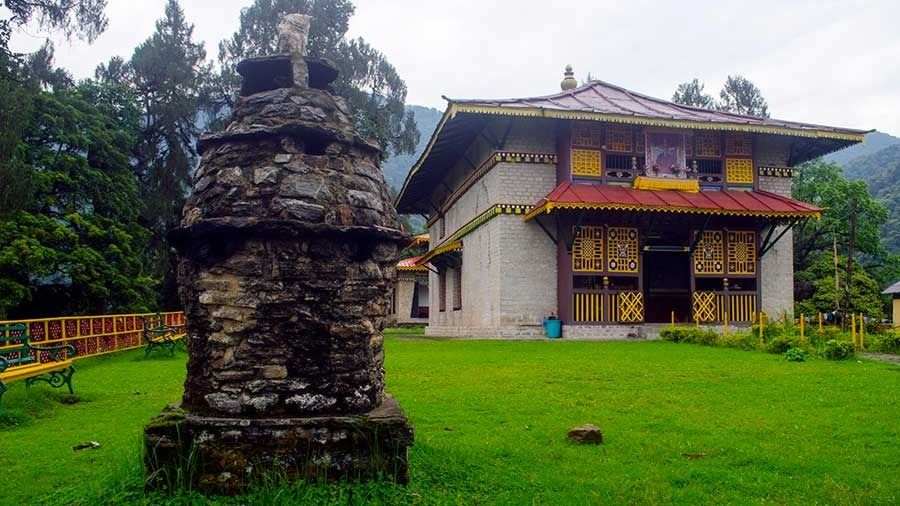
The historic trading route, the Silk Route, connected China to the Mediterranean between the second and 15th century AD. It passed through China, India, Persia, Arabia, Greece and Italy. Many smaller routes weaving through the eastern Himalayan regions connected the rest of India with the main route up north.
One such route passed through north Bengal and east Sikkim, entering Tibet via Nathu La and Jelep La. In the last decade, the spots near the ancient route in east Sikkim have become a popular tourist circuit. The route is dotted with spectacular high-altitude lakes and offers amazing views of the Kanchenjunga, along with stories from history.
Arriving at Zuluk
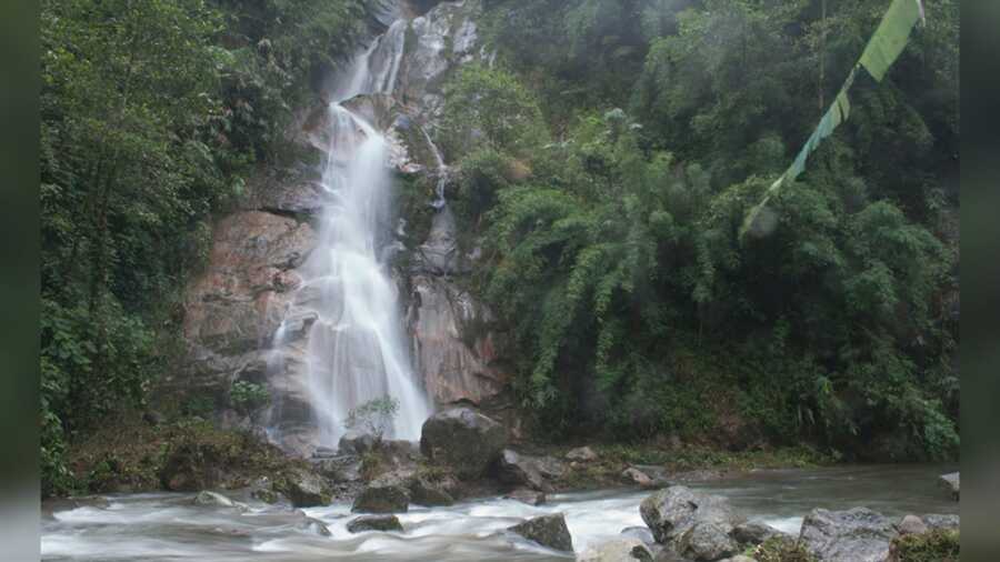
The misty Que Khola waterfall en route to Zuluk is worth a stop Rangan Datta
Our Sikkim Silk Route adventure started early on a September morning from Rongli. The permits, which are needed to travel to the region, were in place and we set off for Zuluk after a quick breakfast. Our first stop was the Que Khola Fall in Nimachen. The post-monsoon waterfall thundered down the mountainside and made for a picturesque backdrop during a tea break. We made our way to Padamchen, the entry point to the Silk Route, where our permits were stamped before we arrived at Zuluk just before lunch.
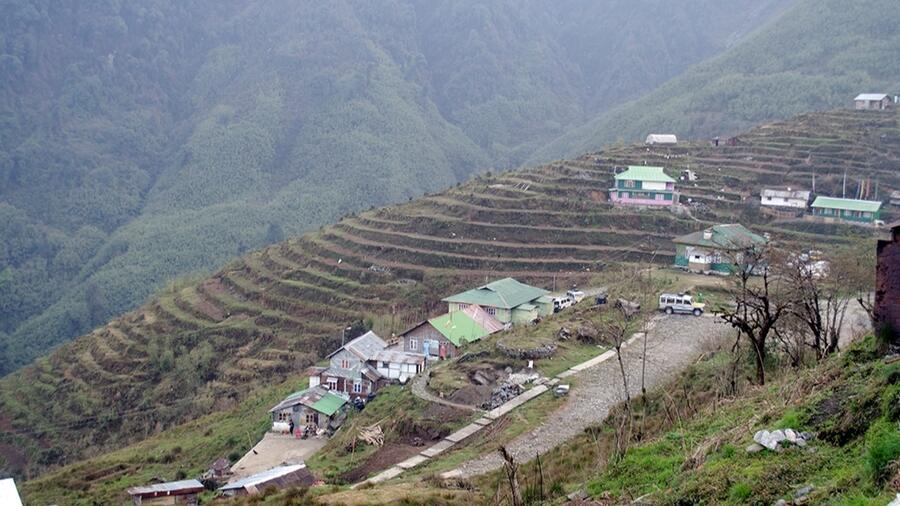
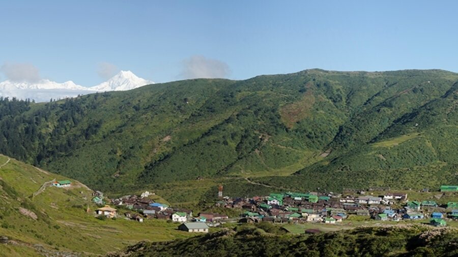
Zuluk, at 9,400 feet, is the gateway to travelling on the Sikkim Silk Route Rangan Datta
At an elevation of about 9,400 feet, Zuluk (or Dzuluk) marks the start of the high-altitude terrain of the Sikkim Silk Route and the village was to be our home for the next two nights. A post-lunch exploration of the village was cut short by a spell of rain and the heavy showers continued throughout the evening. The disappointment of having to stay indoors was partially soothed by the view of a post-shower sky studded with stars and a view of the twinkling villages further down the valley.
Sparkling sun and snow
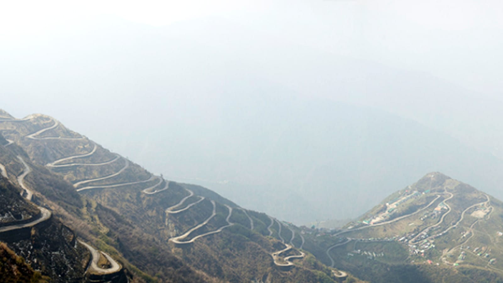
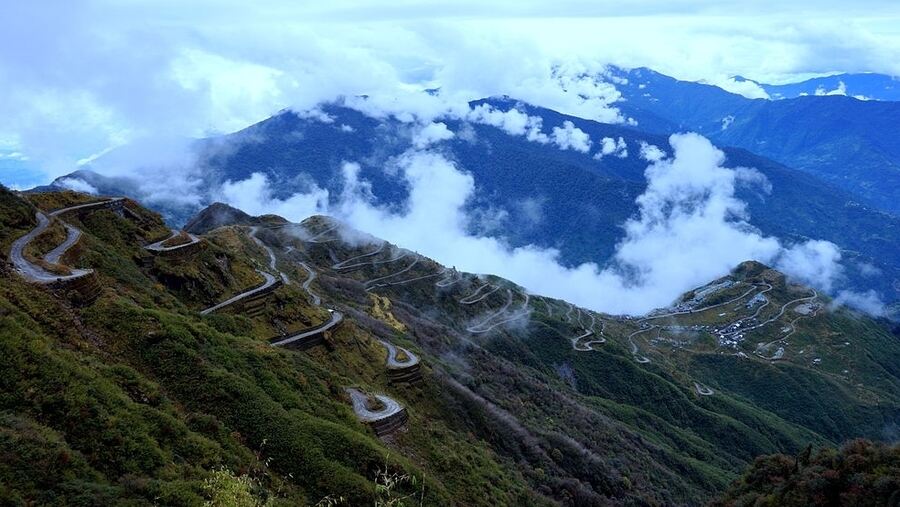
The zig-zag roads that connect the villages along the Sikkim Silk Route are an oft-photographed feature of the region Rangan Datta
About 13km and 17km away from Zuluk are the viewpoints of Thambi (11,200 ft) and Lungthung (13,000 ft), which afford spectacular sunrise views of the Kanchenjunga. Our second day in Zuluk started very early, while it was still dark — around 5am — so we could reach Lungthung to see the massif at sunrise. Our jeep meandered through the famous zig-zag roads of the Sikkim Silk Route, past Thambi, to Lungthung.
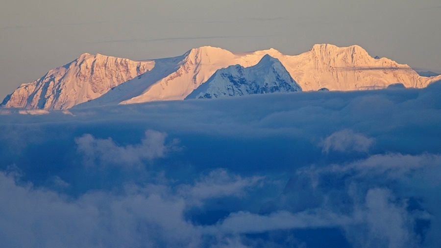
Lungthung view point is known for sunrise views of Kanchenjunga and its sister peaks Rangan Datta
We arrived right on time, and within minutes, the first rays of the sun hit the snowy mountains, and the white snow of the Himalayas was awash with a golden glow. Sadly, the main peak of the Kanchenjunga remained behind the clouds, but its sister peaks were soon alight with a crimson hue. We spent an hour admiring the grand spectacle before heading north to visit the old Baba Mandir.
The old Baba Mandir
The Nathang valley is documented to have been captured by Tibetans and then reclaimed by the British in the late 1800s Rangan Datta
North from the Lungthung viewpoint, the road bifurcates — the left heads to Nathang village and the right, which climbs higher, goes to the old Baba Mandir before converging at Nathang.
We took the right heading to Baba Mandir. By now, Kanchenjunga had emerged from the cloud cover and along with views of the valley and village below, we were awarded frame-worthy sights of the majestic mountain.
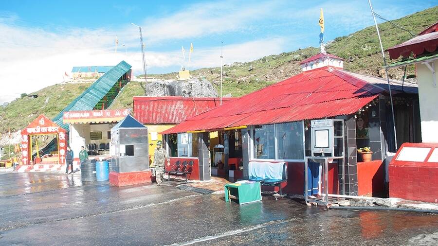
The Old Baba Mandir at Nathang was built to honour Indian soldier Harbhajan Singh Rangan Datta
The Baba Mandir, also referred to as Harbhajan Babaji ka Bunker, is dedicated to the late Indian soldier Harbhajan Singh. There is also a recently built New Baba Temple, for those who wish to honour the soldier, but can’t climb the many steps that lead to the original site. It can be visited en route to Tsongmo (Changu Lake) and Nathu La from Gangtok.
Views of snowy peaks are a constant companion on the roads along Nathang valley Rangan Datta
Lake views
The small eateries near Baba Mandir are great for the typical mountain-holiday breakfast of soupy noodles, after which we set off in the direction of Nathang and further to Kupup village. Just beyond the village, at a height of over 13,100 feet is a beautiful lake, locally called Bitan Cho. Shaped like an elephant, complete with a tail and trunk, it is popularly referred to as the Elephant Lake. The beautiful waterbody is one of the most sacred spots in Sikkim and the nearby Kupup village is known for the Yak Golf Course, reputed to be the highest golf course in the world.
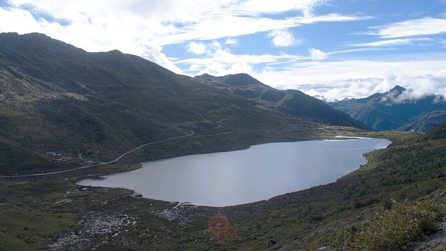
The sacred Bitan Cho, also known as Elephant Lake, gets its name from its shape, which resembles a pachyderm Rangan Datta
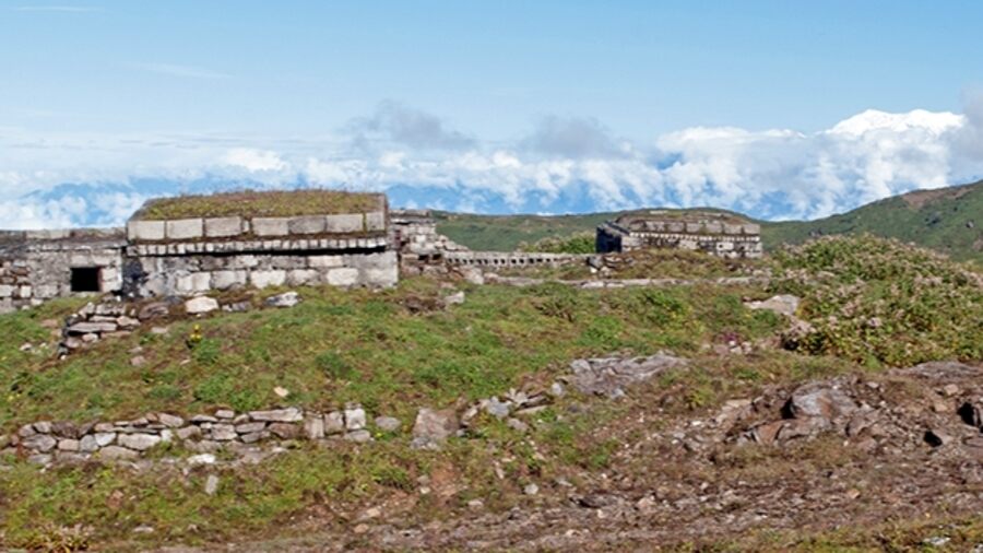
Bitan Cho was our last stop, and after spending some time on the banks of the sacred lake, it was time to head back to Zuluk. The return journey included a stop for lunch at Nathang and a visit to a British-era war memorial. Historical records indicate that the Nathang area was captured by Tibetans in 1886 and then recaptured by the British in 1888. A few graves and the war memorial, dating back to 1888, stand in memory of the soldiers killed during the fight to reclaim Nathang.

A war memorial dating back to 1888 honours the British soldiers killed during the recapture of Nathang Rangan Datta
Travel details:
- Most tourists travel to Sikkim from NJP railway station or Bagdogra airport. Spicejet operates two flights from Delhi and Kolkata to the recently opened Pakyong airport near Gangtok
- Private vehicles and taxis are available to take tourists into Sikkim or close to Zuluk to Rongli or Rongli Bazar
- Travellers can reach Rongli via Kalimpong as well as via Rangpo from Gangtok
- Only a Sikkim-registered vehicle is allowed to visit Zuluk and beyond. There is no public transport in the region, so be sure to hire a vehicle for your journey
- A Protected Area Permit is required to enter Zuluk and travel the Sikkim Silk Route since it is near the Indo-China border. Hotels in Sikkim usually make the necessary arrangements
- There are homestays and hotels for stay options along the entire route
Rangan Datta is a mathematics and management teacher by profession and a travel writer and photographer by passion. He has been addicted to discovering off-beat places since his undergraduate days at St. Xavier's College. Blogging and contributing to Wikipedia are his other passions.