 |
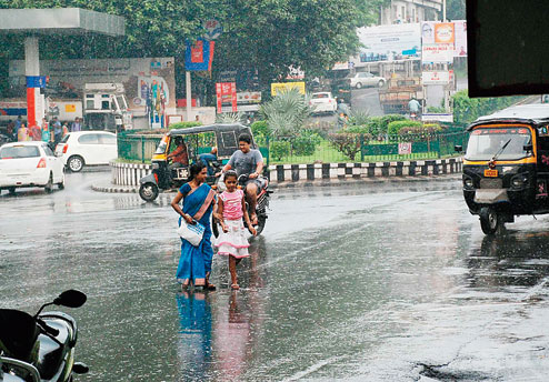
| Residents caught unawares during a drizzle in Bistupur on Friday evening. Picture by Bhola Prasad |
Jharkhand, keep your fingers crossed. Hudhud might actually spare you.
The severe cyclonic storm over the West Central Bay, which is likely to make landfall near Visakhapatnam in Andhra Pradesh on Sunday, is unlikely to have much impact on the state’s weather if it stays on its current path, weathermen have said.
According to Met observations based on latest satellite pictures on Friday, the deep depression is currently moving at a speed of 70-80kmph towards west-north-westwards and lies centred 530km from Visakhapatnam and 570km from Gopalpur in Odisha at 8.30am. The system, which is likely to intensify into a very severe cyclonic storm in the next 24 hours, is projected to cross north Andhra’s coastline close to Visakhapatnam, where it is expected to hit land by Sunday forenoon.
“If the storm moves on its projected path, it won’t have much impact on Jharkhand’s weather. It will be too far — about 1,000km away from Ranchi — from the state then. There will be cloud formation and light to moderate rain at a few places. But if it deviates and moves towards north-eastwards after landfall and hits Gopalpur in Odisha, like Phailin did last year, the impact will be widespread in Jharkhand. Many places across the state will then witness downpours,” said B.K. Mandal, director of Ranchi Meteorological Centre.
However, no weather alert has been issued in Jharkhand though and the picture will be clearer on Saturday, he added.
Officiating director of Patna Meteorological Centre R.K. Giri seconded Mandal, saying that both Jharkhand and Bihar were unlikely to be affected by Hudhud, the first cyclone this year.
“Hudhud is not as strong as last year’s Phailin. It is moving at a speed of 70 to 80kmph and by the time it hits the coast, the storm is expected to gain its top speed of 150-160kmph. Phailin was stronger as it picked up a speed of over 200kmph during landfall in Gopalpur last October,” Giri explained.
Hudhud was expected to keep heading northwest. “If it so happens, Jharkhand will experience light rain for two-three days from October 13 (Monday),” Giri said.
The Regional Meteorological Centre at Alipore, Calcutta, has predicted heavy rain at a few isolated places in southern Jharkhand for 48 hours from Monday.
“Satellite images and other Met readings suggest that the storm is expected to hit Andhra Pradesh’s north coast near Visakhapatnam. It is unlikely that the cyclone will change its course,” said a duty officer, adding that Hudhud’s effect would be felt in Jharkhand and Bengal from Sunday evening.
“The intensity of the rain will increase if the storm curves north after landfall, just as Phailin had done,” he added.
On the other hand, the withdrawal line of southwest monsoon continues to pass through Forbesganj, Gaya, Rewa, Hoshangabad and Malegaon. Weathermen reiterated that Hudhud would hold back the monsoon’s departure from Jharkhand by a few days.
Is the state adequately prepared to tackle Hudhud? Tell ttkhand@abpmail.com


