A rise in the tiger population is pushing the big cats to newer terrain in the Sunderbans, foresters said.
Dhanchi, a small forest island on the eastern side of G-Plot beach on the edge of the Bay of Bengal, and Thakuran Char, a piece of land formed by periodical accretion of soil on the banks of the Thakuran river, are two such pockets, one of them said.
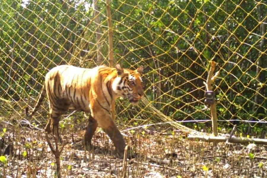
“Trap cameras in Dhanchi have already found the presence of a tiger, an adult male. In Thakuran Char, we have found pugmarks. These two pockets had no recorded presence of tigers. As part of the ongoing annual (state-level) tiger census, trap cameras will be installed in both pockets for formal documentation,” said Milan Mandal, the divisional forest officer of the South-24 Parganas division.
The tiger count in the Sunderbans has been going up steadily. As a result, tigers are moving to newer territories. “Because of its challenging terrain, the tiger density in the Sunderbans is different from any other tiger habitat. Here, roughly 25sqkm can hold a tiger. Dhanchi is spread over around 35sqkm and the island on the bank of Thakuran covers roughly 100sqkm,” Mandal said.
Dhanchi and the Thakuran char fall in Ramganga and Raidighi — two of the three tiger ranges in South-24 Parganas division, Matla being the third range — respectively.
The last quadrennial national tiger census had its report — Status of Tigers: Co-Predators and Prey in India, 2022 — published in 2023. Prepared by the National Tiger Conservation Authority (NTCA) and the Wildlife Institute of India (WII), the report estimated 101 tigers in the Sunderbans.
The report estimated that the tiger density in the Indian part of the Sunderbans had reached 4.27 per 100 square kilometres. The mangrove forest's estimated carrying capacity is 4.68 tigers per 100 square kilometres, the report said.
Trap cameras were first used in the tiger census in the Sunderbans in 2010, when 70 tigers were counted. The number increased to 76 in 2014 and 88 in 2018.
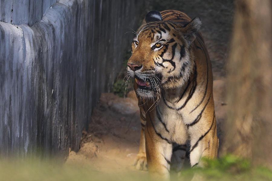
The tiger traced in Dhanchi forest crossed the river and reached the borders of a couple of villages on the other side around Christmas Eve. On December 27, it was driven back to the forest.
It was first clicked inside Dhanchi forest in the second week of November. The big cat is believed to have moved from the larger Dhulibhasani forest — a known tiger habitat in the Ramganga range.
The pictures clicked at Dhanchi forest have been sent to the NTCA and the WII for further analysis.
Every tiger has unique stripes. The pictures of the Dhanchi tiger should match with the existing database of Sunderbans tigers, said officials. Once the tiger is identified, foresters will have a concrete idea of where it came from.
More such new tiger pockets could emerge across the mangrove delta, said a veteran forester.
“A tiger is a very territorial animal. It has its own territory that it protects very diligently. When the population increases, they start finding new areas. They look for areas that are undisturbed, with enough to eat,” said Ravikant Sinha, former chief wildlife warden of Bengal.
But he also gave a disclaimer that the Sunderbans’ tiger-carrying capacity was not cast in stone.
“It is a theoretical number, based on assumptions. Let us assume that there can be about four tigers per 100sqkm. It can change. We take the prey density, human interference and other factors into account to reach the estimation. These factors are dynamic,” he said.
The tidal waves in the Sunderbans, the world’s only mangrove tiger habitat, ensure that new islands keep coming up and disappearing.
Sinha said a British record dating back to 1908 found 52 forested islands in the Sunderbans. “Our own satellite mapping post 2010 showed around 65 forested islands,” he said.
Both Dhanchi and Thakuran char have been built by such periodic accretion of soil, said foresters. The second, in particular, is a full-fledged forest because of a plantation drive that began many years ago, said a forest official.
Both forests have a steady population of spotted deer and wild boars, they said.
The annual state-level exercise is an estimate of the tigers based on the findings of the trap cameras. In comparison, the national count is a more detailed exercise, taking into account prey base and human interference.
The annual camera trap exercise for an estimation of the number of tigers in the Sunderbans started on November 27. The first phase covered the entire Sunderbans Tiger Reserve and Matla range of the South-24 Parganas forest division. The second phase, starting January 13, will cover the remaining parts of the South-24 Parganas division.
The Sunderbans is spread across 10,000sqkm, a little over 4,000sqkm of which is in India. The rest is in Bangladesh. The Indian Sunderbans is split between the STR and the South 24-Parganas forest division.
The STR covers 2,585sqkm. It is made of the Sunderbans National Park (East and West), which is the core area, and the Sajnekhali Wildlife Sanctuary and the Basirhat Range, which form the buffer zones.