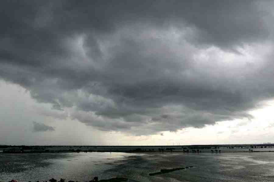
A cyclonic circulation persisting over the northwest Bay of Bengal and its adjoining regions, extending from 1.5 to 5.8 km above mean sea level and tilting southwestwards with height, is expected to influence widespread rainfall activity across West Bengal.
According to the latest meteorological analysis, conditions are now favourable for the further advance of the southwest monsoon over parts of Gangetic West Bengal, remaining areas of northwest Bay of Bengal, and Sub-Himalayan West Bengal in the next two to three days.
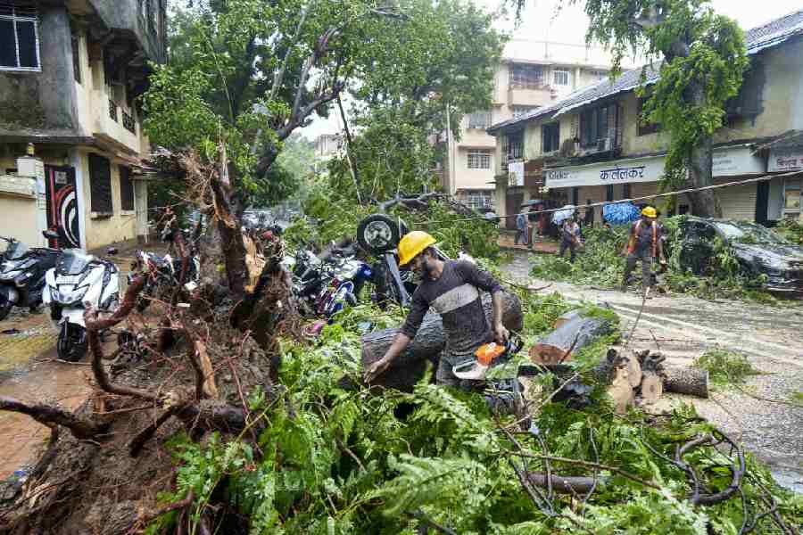
With strong moisture incursion from the Bay of Bengal, both North and South Bengal are likely to witness enhanced rainfall activity accompanied by thunderstorms, gusty winds and isolated incidents of heavy to very heavy rainfall over the coming days.
Forecast for June 16
In North Bengal, heavy rainfall ranging between 7 to 11 cm is very likely to occur at one or two places over Jalpaiguri, North Dinajpur and South Dinajpur districts.
Thunderstorms accompanied by gusty wind (30–40 kmph), lightning and light to moderate rainfall are expected at one or two places over Malda, North Dinajpur and South Dinajpur.
South Bengal is also likely to experience thunderstorms with gusty winds (30–40 kmph), lightning and light to moderate rainfall in one or two places across all districts.
Heavy rainfall (7–11 cm) is very likely at one or two places over North 24 Parganas, South 24 Parganas, East Midnapore and West Midnapore districts.
Forecast for June 17
In North Bengal, heavy rainfall (7–11 cm) is forecast for one or two places over Jalpaiguri and Alipurduar districts.
Thunderstorms with lightning and light to moderate rainfall are expected over Malda, North Dinajpur, South Dinajpur and Jalpaiguri.
South Bengal districts will continue to experience thunderstorms with gusty winds (30–40 kmph) and lightning.
Heavy to very heavy rainfall (7–20 cm) is very likely at one or two places over East Burdwan, Bankura, South 24 Parganas and West Midnapore.
Heavy rainfall (7–11 cm) is also expected at one or two locations across the remaining districts.
Forecast for June 18
Alipurduar district in North Bengal is likely to witness heavy rainfall (7–11 cm).
Thunderstorms with lightning and light to moderate showers are forecast at one or two places over Malda, North Dinajpur, South Dinajpur, Coochbehar and Jalpaiguri.
South Bengal districts will also see thunderstorms with gusty wind (30–40 kmph), lightning and light to moderate rainfall.
Heavy to very heavy rainfall (7–20 cm) is very likely at one or two places over West Burdwan, Purulia, Bankura, Birbhum, and West Medinipur.
Heavy rainfall (7–11 cm) is likely in the remaining districts.
Forecast for June 19
North Bengal will face a heightened weather threat with heavy to very heavy rainfall (7–20 cm) expected at one or two places in Jalpaiguri and Alipurduar districts.
Heavy rainfall (7–11 cm) is also likely over Darjeeling, Kalimpong, Coochbehar and North Dinajpur.
In South Bengal, heavy rainfall (7–11 cm) is likely at one or two places over Birbhum, Purulia and West Burdwan.
Forecast for June 20
Jalpaiguri and Alipurduar in North Bengal are once again likely to see heavy rainfall (7–11 cm).
In South Bengal, no warnings have been issued for this date.
Forecast for June 22
In South Bengal, heavy rainfall (7–11 cm) is very likely at one or two places over South 24 Parganas and East Midnapore.
The heavy rain activity is expected to result in landslides in hilly areas of Darjeeling and Kalimpong.
Temporary waterlogging in low-lying areas and reduced visibility during intense rainfall could disrupt urban traffic.
Residents are advised to avoid movement in landslide-prone and waterlogged zones.
Traffic movement should be regulated as needed.