Cyclone Montha made landfall in Andhra Pradesh on Tuesday evening, unleashing winds that consistently clocked over 90kmph and triggering over 100mm of rain in coastal areas.
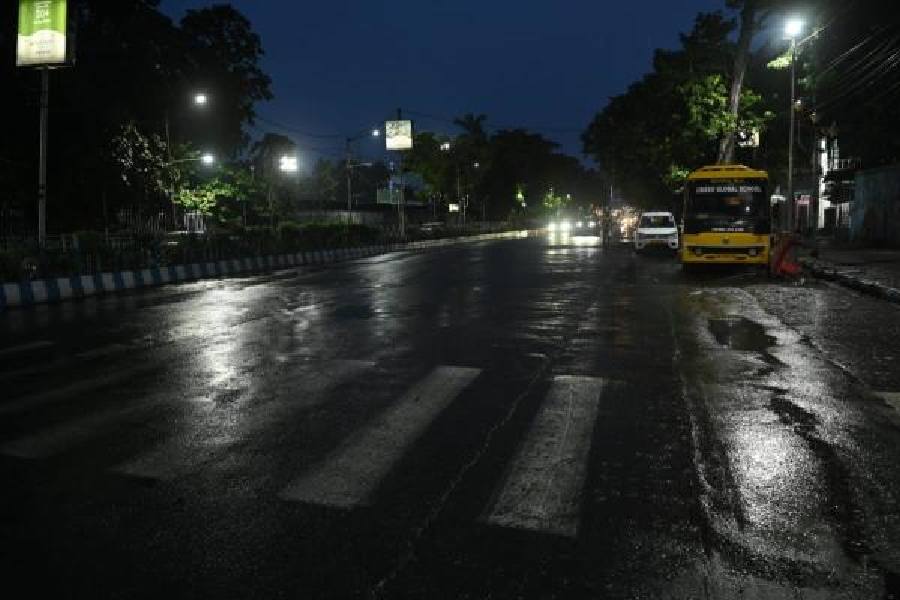
Over 750km away from the landfall zone, Calcutta barely got a drizzle on Tuesday. A Met bulletin predicted light to moderate showers with mild gusts of wind and streaks of lightning in south Bengal — as the depleted system moves north after landfall — till Friday, with heavy rain in some districts. Calcutta is not one of them, but its neighbour, South 24-Parganas, is where heavy rain is likely.
Around 11.30am on Tuesday, Montha was a severe cyclonic storm moving north-northwest, around 200km from Kakinada in Andhra Pradesh.
A Met bulletin, based on observations recorded at 5.30pm and issued at 7pm, said “latest observations indicate that the landfall process has commenced”. Montha had sustained its intensity as a severe cyclonic storm at the time of landfall, generating winds blowing at 90-100kmph gusting up to 110kmph.
Some parts of the city got a brief spell of rain in the afternoon and some in the evening. The conditions were breezy.
A Met official said it was not a direct impact of the cyclone. “The cyclone’s direct impact extends up to about 200 to 250km from the centre. Coastal Andhra and Calcutta are nearly 800km apart. But the cyclone is a large system bringing about changes in the wind pattern. Moisture-laden southerly winds are dominant in south Bengal now,” the official said.
The coordinates in the Met bulletin suggested the landfall zone was in Konaseema district of Andhra Pradesh. Around 5.30pm, the centre of the storm was 110km south of Kakinada and 120km south-southeast of Machilipatnam.
The landfall process was expected to continue for three to four hours, the Met office said.
The core or the eye of a cyclonic storm is a relatively quiet zone, surrounded by spiralling bands of winds. As a storm passes, an area experiences the peripheral winds in the front. As the relatively calm core passes through land, there is a brief lull. That is followed by the passage of the rear winds, which are just as strong as the ones at the head of the spiral.
“It will continue to move north-northwestwards and cross Andhra Pradesh coast between Machilipatnam and Kalingapatnam around Kakinada during the next 3-4 hours as a severe cyclonic storm with a maximum sustained wind speed of 90-100kmph gusting up to 110kmph,” said the bulletin based on the observations at 6.30pm.
The Met office has said the storm is likely to have more impact in Bengal
after landfall, as it moves through Andhra, Odisha and Chhattisgarh.
“By the morning of Thursday, it will weaken into a well-marked low-pressure area. But Uttar Pradesh, Bihar, Jharkhand and Bengal will still be affected. The intensity of the rain is likely to be more in north Bengal than in south Bengal,” said a Met official.
Between Wednesday and Friday, light to moderate rain with occasional thunderstorms is expected across south Bengal. South 24-Parganas, East and West Midnapore, Jhargram, Birbhum, West Burdwan, Purulia, Birbhum and Murshidabad are likely to get heavy rain. The showers in Bengal will be accompanied by mild gusts of wind clocking between 30 and 40kmph, according to the forecast.
In north Bengal, a wet spell is expected to last from Wednesday to Saturday. Heavy to very heavy rain (7-20 cm) is likely in Darjeeling, Kalimpong, Jalpaiguri, Cooch Behar and Alipurduar districts, most likely on Friday. Heavy rain is expected in Malda and North and South Dinajpur.
East and West Burdwan, Bankura, North 24-Parganas, Howrah and Hooghly were among the districts that got thundershowers on Tuesday. In Calcutta, the day started hot and sunny, but the sky turned cloudy late afternoon.