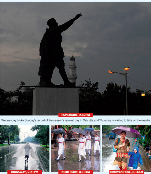

Heavy rainfall has been forecast throughout Thursday with a wind formation spread over the region intensifying over the past 24 hours to boost the monsoon. In meteorological terms, heavy rainfall means between 64.5mm and 124.4mm in a day, which is way more than what the city has received this season. The rain is likely to come in spells on Thursday, each lasting longer than 30 minutes.
The increased flow of monsoon winds brought rainfall even on Wednesday. The 35.4mm of rain recorded by the Alipore meteorological centre was the highest of the season, beating Sunday’s 26.7mm.
“A cyclonic circulation positioned over the Bay of Bengal near the Bangladesh coast till Tuesday gained strength overnight to become a low-pressure area. Its span has increased as well, encompassing a large part of south Bengal,” said a senior official of the India Meteorological Department, Calcutta.
Most of south Bengal, including Calcutta, North and South 24-Parganas, Murshidabad, Nadia, Burdwan and Bankura, will get heavy rain, the official said.
A depression or a low-pressure area has atmospheric pressure lower than its surroundings, which is why it tends to pull air towards itself. In this case, the low-pressure area is pulling the monsoon winds inland, increasing the inflow of moisture.
This has led to the formation of tall columns of cloud over south Bengal and Calcutta, increasing the prospect of longer and heavier periods of rain than what the city has received this season.
Pictures by Pradip Sanyal and Bibhas Lodh