Border disputes in the northeastern states are so commonplace that they seldom grab headlines unless the violence takes a toll on lives. And now, with the Taliban taking news centre stage, this little corner has receded further from our minds.
The boundary between Assam and Mizoram turned into a festering hotbed of violence since July 26, when six policemen from Assam were killed at a disputed site. Over the next fortnight, the incident steamrolled into retaliatory moves, with trucks headed for Mizoram along National Highway 306 being attacked in Assam and the landlocked Mizos staring at an acute shortage of essential commodities, including medicines.
It was only earlier this month that the two states managed to sign a truce. As per a Union home ministry directive, neutral forces will remain in charge of disputed zones straddling the three Barak Valley districts of Cachar, Karimganj and Hailakandi in Assam, and Mamit and Kolasib in Mizoram.
On August 12, the advocate-general of Assam and his Mizoram counterpart informed the Gauhati High Court that there was no longer any blockade on the Assam-Mizoram border. The court said that although it could not go into the inter-state dispute in view of Article 131 of the Constitution, it could look into the law and order concern.
Article 131 of 1949 states: “...Supreme Court shall, to the exclusion of any other court, have original jurisdiction in any dispute between the a) Government of India and one or more states; or b) between the Government of India and any state or states on one side and one or more other states on the other; or c) between two or more states.”
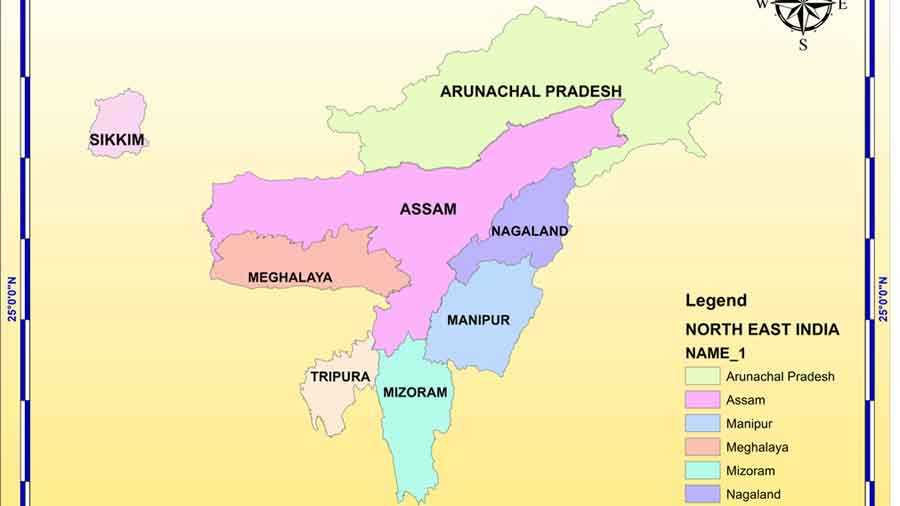
Since the states of Arunachal Pradesh, Meghalaya, Nagaland and Mizoram were carved out of Assam, the boundaries have been a bone of contention. Mizoram was a part of Assam until 1972, when it became a Union territory and later, the 23rd state of India on February 20, 1987 after the Mizoram Accord was signed in June 1986.
Much earlier, the British had taken over the land the Mizos used for jhum (shifting) cultivation to plant tea bushes and resented the hunting ritual of the Mizos that was impeding the tea plantation drive by the British in Assam’s Barak Valley district. So in 1875, the British made a demarcation between the plains of Assam and the hills where the Mizos lived.
In 1933, another boundary demarcation was made, separating Assam’s Cachar district from Manipur and Mizoram. While the Mizos follow the 1875 demarcation line, Assam goes by the 1933 decision. When Mizoram became a state, a no-man’s land stretch was marked out on either side of the boundary, but it has remained a festering zone.
Assam’s border with Meghalaya, too, is contentious in 12 areas. The problem owes its genesis to Meghalaya challenging the North-Eastern Areas (Reorganisation) Act, 1971, which gave Blocks I and II in Karbi Anglong district to Assam. Meghalaya claims these blocks formed part of the erstwhile Khasi and Jaintia Hills district when it was notified in 1835. Meghalaya cites survey maps of 1872 and 1929 as well as notifications of 1878 and 1951 while Assam proffers the recommendations of the Churachand Committee. This month, the chief ministers of the two states decided to look into these disputes and have formed three committees to obtain the views of local residents.
Similarly, Arunachal Pradesh contends that its forest tracts were given to Assam. After it achieved statehood in 1987, a tripartite committee recommended that certain territories be transferred from Assam to Arunachal but Assam contested this. The case is still in the Supreme Court.
The longest-running border dispute, however, is between Assam and Nagaland, which began soon after Nagaland became a state in 1963. The State of Nagaland Act, 1962, had defined the borders according to a 1925 notification when Naga Hills and Tuensang Area were made a new administrative unit. Nagaland does not accept the present boundary delineation.
Now it all borders on a thrust-and-parry mechanism.