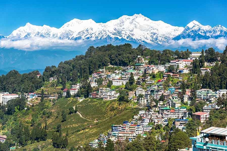
One of the least satisfactorily answered questions in the India-China boundary dispute is how did Arunachal Pradesh become a contested region. China’s claim that the state is South Tibet is probably maximalist posturing. Except for the Tawang-Bomdilla corridor in Arunachal’s western districts, the “Tibetan Buddhist Church”, as Alastair Lamb called it in The McMahon Line: A Study in the Relations Between, India, China and Tibet, 1904 to 1914, had virtually no influence in the rest of the state unlike, say, in Sikkim, Ladakh and Bhutan.
Tawang, the birthplace of the sixth Dalai Lama, was indeed under Tibetan control. It was only during the Simla Conference of 1913-14 that Henry McMahon and Charles Bell bargained for its inclusion in India. The reason was that Tawang was too close to the Assam plains. Tibet, in turn, was promised British support in case of Chinese aggression.
As anticipated widely, China invaded Tibet in October 1950. The Tibetans took the matter to the UN, but none of its allies, including Britain, the United States of America or India, were willing to sponsor its motion. Ultimately, it was El Salvador, which did the favour. When this desertion became apparent, Tibet actually asked for the return of Tawang.
It should also be noted that even though Tawang was politically made to fall on the Indian side of the McMahon Line, it was still allowed to be under the cultural and religious control of Lhasa. However, after China communicated to India its decision to take over Tibet, India in early 1950 decided to end Lhasa’s suzerain influence on Tawang.
There is also the legacy of the British frontier administration, which complicated the matter. The most significant is the Bengal Eastern Frontier Regulation 1873, which created an Inner Line along the base of the hills surrounding the plains of Assam. This line divided British revenue from non-revenue land. While the former were to be administered, the latter were to be claimed, but not administered.
Lord Curzon’s Romanes Lecture 1907, titled “Frontiers”, gives more insights into how notions like ‘suzerainty’, ‘protectorate states’, ‘excluded’, ‘partially-excluded’ areas came out from this approach to frontier management. These were territories where the British involved themselves in indirect administration in a calibrated way. The Tibet case stood out. They did not want to take control of it but they did not want other powers extending their ‘sphere of influence’ there. This legacy of boundary ambiguity is now being capitalized by China.
But there is a more primal politics shaped by subliminal anxieties. As in Kashmir, the anxiety here is water, once again. Just as all major tributaries of the Indus, including the five that irrigate the fertile plains of Punjab, either originate or flow through Kashmir, all the major tributaries of the Brahmaputra also flow out of Arunachal. Controlling Arunachal can be an important handle in controlling Northeast as well as Bangladesh. The same civilizational threat the Indus valley would feel at losing control of the waters that feed it would also be true of the fertile plains the Brahmaputra irrigates. This is true even of friendly countries: the protest by Bangladesh at India’s proposed Tipaimukh Dam over the Barak is the litmus test to demonstrate this archetypal anxiety in the relationship between any river valley and the hills that surround it. This dynamic can also be seen in the objections from Manipur, Assam and Arunachal Pradesh to the demand for a Greater Nagaland.
This geography of security needs better understanding in formulating any conflict resolution strategies. Halford Mackinder’s influential Geographical Pivot of History (1904), taken forward by Robert Kaplan in Revenge of Geography, spells this out. Rimland and heartland nations have very different perceptions of security. Island nations are bound by natural boundaries; heartland nations are invariably bound by artificial ones. It is important for heartland nations to have a sense of control over territories immediately beyond their national boundaries. Russia’s extreme response to Nato befriending Ukraine was explained thus. The vast plains that separate Russia from western European powers have always been a source of Russia’s security through history. The futile invasions of Napoleon and Hitler demonstrated this.
The British Empire had a curious mix of both psychologies. The friction between Lord Morley in London at the India secretariat and Lord Curzon as viceroy in Calcutta says this loudly. The heartland outlook to security was evident in Curzon’s Tibet anxiety, which led him to invade the monastery State in 1904 when he became convinced it was leaning towards Russia. In London, Morley and his likes dismissed this concern and eventually ended up undoing whatever Curzon achieved. Morley’s letter to Curzon’s successor Lord Minto in October 1906 is revealing: These “frontier men”, forget “the complex intrigues, rival interests and, if you like, diabolical machinations which make up international politics for a vast sprawling Empire like ours...” Ironically, Minto while in London in Morley’s office spoke the same language, but once in India, he, too, began seeing as Curzon did, and expressed his dissatisfaction at the way the Lhasa Convention 1904 was allowed to be usurped by the Peking Convention 1906. It is arguable that if Curzon had his way, the British would have left Tibet, like Bhutan or Sikkim, before 1975.