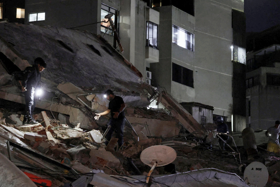
At least 23 buildings in Joshimath have been earmarked for demolition and 470-odd others labelled unusable, because of sinking ground, by government structural engineers.
Their survey was triggered by the ground fissures that shook the Uttarakhand town two years ago.
Engineers from the Central Building Research Institute (CBRI), Roorkee, surveyed 2,364 buildings across Joshimath. They labelled 37 per cent as “usable”, 20 per cent as “unusable” and one per cent as “to be demolished”. They have recommended “further assessment” of the remaining 42 per cent.
Abrupt release of water from subterranean rock fractures had sped up ground subsidence in parts of Joshimath on the night of January 2-3 in 2023, causing ground fissures and cracks in homes, hotels and other buildings.
Located near the Alaknanda river in the Garhwal Himalayas, the town is a key transit hub for pilgrims and tourists headed for Badrinath, Hemkund Sahib, Auli and the Valley of Flowers in Chamoli.
The CBRI team’s damage assessment underscores the need to review town planning principles in hilly regions, with the stress on good construction practices, increased regulatory oversight on the construction methods, and greater awareness of local geotechnical conditions.
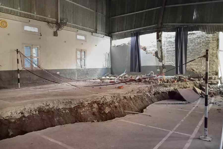
The team has identified multiple flaws in the buildings surveyed: poor-quality unburnt or sun-dried clay bricks, poor connections between thick masonry walls and heavy timber floors, unusually tall storey heights in buildings with unreinforced masonry, poor-quality construction and workmanship, the small size of reinforced concrete elements, and walls without adequate support underneath in reinforced concrete buildings.
Inadequate drainage around buildings can cause the ground under them to sink, which can make the buildings less stable, said Ajay Chaurasia, chief scientist at the CBRI who led the damage assessment.
The survey found 99 per cent of the buildings “non-engineered” — meaning they did not comply with the provisions of the National Building Code of India, 2016, a set of rules to ensure that buildings are designed and built to be safe and strong.
The findings by Chaurasia and his colleagues are tobe published in CurrentScience, a research journal from the Indian Academy of Sciences.
The CBRI team has also generated a building vulnerability map intended for administrators and policymakers to draw up future guidelines for the safety of buildings and rehabilitation strategies.
The vulnerability map needs to be combined with geological and hydrogeological maps for “a holistic risk map” of the region, the CBRI team said in its report.
Concerns about ground subsidence in Joshimath go back by decades. In 1976, a scientific panel found that Joshimath was situated in an old landslide zone and was sinking. It recommended a ban on heavy construction in the area.
Geologist Piyoosh Rautela, from the Uttarakhand Disaster Management Authority, expressed concern in 2010 saying Joshimath was showing signs of continuous ground subsidence. He cautioned that sudden, large-scale dewatering of subterranean rock layers could accelerate the ground subsidence.
The January 2023 fissures prompted the Prime Minister’s Office to call meetings of experts and urge an investigation to develop a risk-sensitive plan for Joshimath.