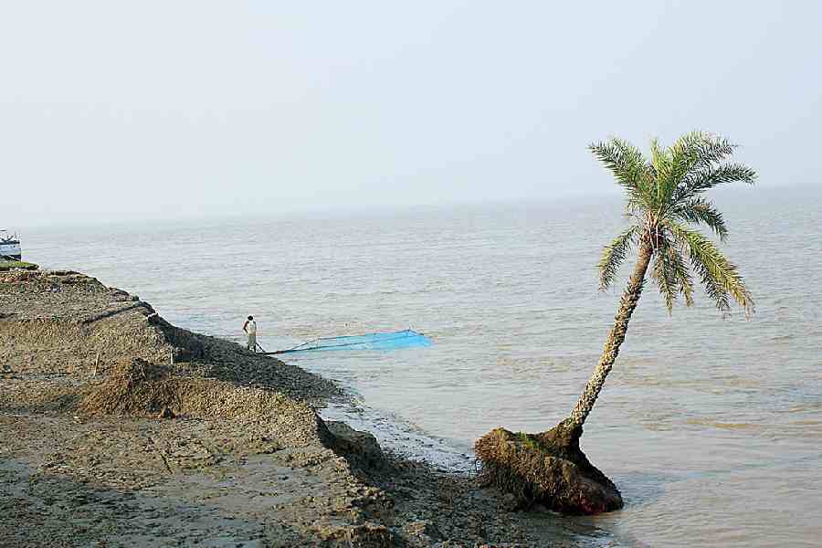
The sea could erase 40 per cent of Ghoramara Island by 2042 and push back shorelines by over a kilometre on other Sunderbans islands, threatening homes, food supplies and mangroves, a new erosion-mapping study has warned.
The study — the first to track island-by-island shoreline changes over 50 years — has identified the inhabited Ghoramara and the uninhabited Bhangaduni and Dalhousie as the most vulnerable islands along a 210km stretch of Bengal’s Sunderbans coast.
Ghoramara’s length had shrunk from 12km in 1972 to 7km in 2022. The island’s area, 3.3sqkm in 2022, is projected to shrink by 1.3sqkm — nearly 40 per cent — by 2042. Shorelines by then will likely move inward by 450 metres on Ghoramara and more than a kilometre each on Bhangaduni and Dalhousie.
“On populated islands, erosion means lost homes and farmland; on uninhabited islands, it means lost mangroves,” Mousumi Dey, a research scholar at the Doctor Hari Singh Gour University (DHSGU), Sagar, and the study’s lead author, told The Telegraph.
“Mangroves buffer the region from storms and rising seas — their loss makes the entire ecosystem more vulnerable.”
Dey and her colleagues used satellite imagery to examine how the shorelines of islands in East Midnapore and South 24-Parganas had shifted between 1972 and 2022. They also applied mathematical tools to forecast how those shorelines might change in the years ahead.
Their analysis, published last week in the journal Remote Sensing Applications: Society and Environment, suggests that Bhangaduni and Dalhousie could each lose over 6sqkm of land by 2042.
Bhangaduni’s shoreline has already receded by about 2.8km on its southern section since the 1970s, and is expected to retreat another kilometre.
Erosion on Ghoramara, which can displace households and disrupt farming, has implications for food security and forced migration. On Bhangaduni and Dalhousie, the retreat of land threatens mangrove forests that help stabilise the coastline and support biodiversity.
All three islands are expected to continue losing ground over the next 15 years. Ghoramara and Bhangaduni, in particular, have suffered erosion along their entire perimeters. Other islands, including Namkhana and Bulcherry, have lost over 80 per cent of their shoreline edges to the sea.
Nayachar, though not immune to erosion, stands apart. It has gained nearly 30sqkm of land since 1980, buoyed by the sediments carried by rivers flowing into the Bay of Bengal. Researchers say the expanding island could one day serve as a refuge for residents displaced from Ghoramara.
Multiple earlier studies had documented the Sunderbans’ vulnerability to sea level rise.
One, published in 2015 by researchers from the National Institute of Oceanography in Goa and the Indian Space Research Organisation, had estimated that the Sunderbans had lost 80sqkm of land, with four islands losing 30 per cent of their area since the 1970s.
That study too had noted Nayachar’s unusual growth in a landscape where the sea is consuming land.