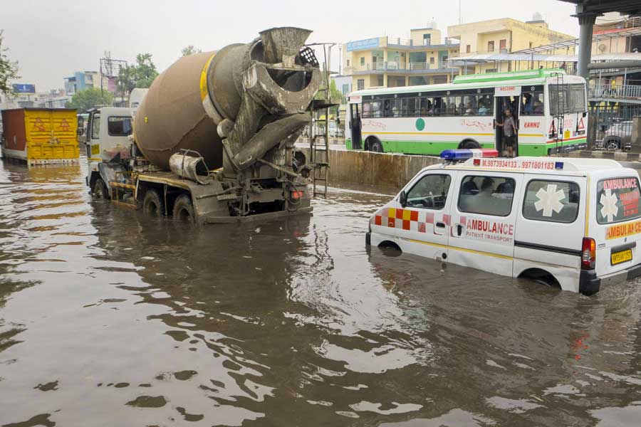
The torrential rain that lashed parts of north India, including the national capital, early Friday, was caused by moisture and wind convergence over the region, fed by both the Arabian Sea and the Bay of Bengal, the weather department said.
It was caused by a mix of weather systems that created conditions for thunderstorms, the India Meteorological Department said.
According to data from the IMD, Safdarjung, Delhi's main weather station, recorded 77 mm of rain in just six hours, between 2.30 am and 8.30 am.
Other areas also saw significant rainfall, with Lodhi Road receiving 78 mm, Pragati Maidan and Pitampura 71.5 mm each, Ridge 59.2 mm, Pusa 50 mm, Palam 45.6 mm, Najafgarh 40 mm, Ayanagar 39.4 mm, and Jaffarpur 67.5 mm.
An upper air cyclonic circulation over southwest Rajasthan and another over northeast Rajasthan and adjoining northwest Madhya Pradesh contributed to the precipitation.
The rain was accompanied by southeasterly winds reaching up to 50 kmph.
"Moisture and wind convergence over the region -- fed by both the Arabian Sea and the Bay of Bengal -- along with persistently favourable synoptic conditions in the lower and middle tropospheric levels, triggered the heavy rain," the IMD said in a statement.
Mahesh Palawat from Skymet, a private weather forecasting agency, explained that as daytime temperatures crossed 40 degrees Celsius in the past few days, moisture levels rose sharply, leading to the formation of thunderclouds -- a common pre-monsoon feature.
"These phenomena generally occur during the early morning or late evening hours," he said.
Similar weather conditions may continue intermittently for about a week, Palwat added.
As a result, temperature is expected to remain below 40 degrees Celsius in Delhi during this period, with no heatwave likely.
A storm hit the capital early Friday, with wind speeds reaching up to 80 kmph, as recorded at Safdarjung at 5.10 am.
"This was followed by a maximum speed of 78 kmph at Pragati Maidan at 5.30 am, and 74 kmph at Palam at 5.19 am," said an IMD official.
The storm brought a sharp drop in temperatures across the city.
An IMD scientist said temperatures fell by 7 to 10 degrees Celsius at most places after the storm.
"For instance, at Lodhi Road, the temperature dropped from 28.2 degrees Celsius at 5.15 am to 20.7 degrees Celsius at 5.30 am.
"Similarly, at Jaffarpur, it fell from 28.4 degrees Celsius to 19 degrees Celsius," said scientist R K Jenamani.
The last time Delhi recorded a heavier 24-hour spell of rain in May was in 2021, when 119.3 mm of precipitation was recorded on May 20 due to the remnants of Cyclone Tauktae.
Since January 1, Safdarjung had recorded only 10.2 mm of rainfall, making Friday's spell an extreme weather event. With the Friday spell, the city has already surpassed the average monthly rainfall for May, which stands at 30.7 mm.
The weather office has predicted a cloudy sky with the possibility of rain or thunderstorms in the national capital over the coming week.
Except for the headline, this story has not been edited by The Telegraph Online staff and has been published from a syndicated feed.