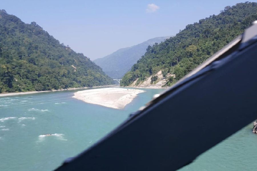
The Bengal irrigation department has drawn up a plan to carry out a morphological study of the Teesta river and its dams, citing rising concerns over the river’s altered behaviour and the impact of hydroelectric projects on its course and banks.
The department has written to the government of neighbouring Sikkim from where the river originates, seeking cooperation for the proposed study to cover 92km of the Teesta basin, stretching from the hills to Mekhliganj in the Cooch Behar district where the river enters Bangladesh.
Manas Bhunia, the state irrigation minister, said the study would look into how the dams changed the Teesta’s flow and the effect it had on the plains of north Bengal, particularly in the districts of Kalimpong, Jalpaiguri and Cooch Behar.
"The findings would be crucial to preparing a detailed project report that we will send the Union jal shakti ministry and the Brahmaputra board. Flood control and the safety of large populations along the banks depend on understanding how the river is shifting. We cannot ignore the damage which is already visible,” said the minister over the phone.
Sources in the state irrigation department said the Teesta had been carrying more debris, boulders and sand from the mountains since October 2023, when the glacial lake outburst flood (GLOF) occurred due to the bursting of the South Lhonak Lake in north Sikkim.
"The disaster damaged hydropower projects in Sikkim state and left a lasting impact on the Teesta’s course in the plains," said an official.
They said the river had been silting up heavily, reducing its capacity to hold water, and forcing its channel to change dangerously in several places.
Vast stretches of riverbank in the Kranti, Mainaguri and Rajganj blocks of Jalpaiguri have already been eroded by the river, which also gobbled up farmland and human settlements.
Krishnendu Bhowmik, the chief engineer of the irrigation department’s northeast division, said the study would focus on measuring the silt load and track how channels were shifting.
“We will assess the river’s reduced water-retention capacity. After the GLOF, the Teesta has grown more aggressive in the plains. We need scientific evidence of what is happening under the surface,” Bhowmik said.
Minister Bhunia stated that Bengal’s requests for cooperation have so far drawn little response from Sikkim.
"The Centre remained silent despite repeated alerts on risks to people in north Bengal. We want Sikkim to carry out its own assessment of hydropower projects or work jointly with us. But we can't keep on waiting. If the Centre ignores our DPR even after we submit it, protests will be the only option left,” he said.
Jayanta Roy, the BJP MP of Jalpaiguri, said engineers of the Brahmaputra Board paid a visit to the region to check out the statue of the Teesta and the changes in it after the GLOF, but there have been no further initiatives from their end.
“The largest stretch of the Teesta in the plains is under my Lok Sabha constituency. If the state government submits a permanent project, I will press for it in Delhi. But if they seek temporary measures just for show, I will be the first to oppose it,” Roy said.
Sources said that the irrigation department intends to begin the survey after the festive season, with teams set to map how the river has changed in both its mountain stretches and the plains.
“The urgency is clear as the stretch of NH10 in Bengal is in crisis because of the river. The river has eroded chunks of land on its right bank near Sevoke. Residents of forest villages have to be shifted elsewhere,” said an engineer of the irrigation department.