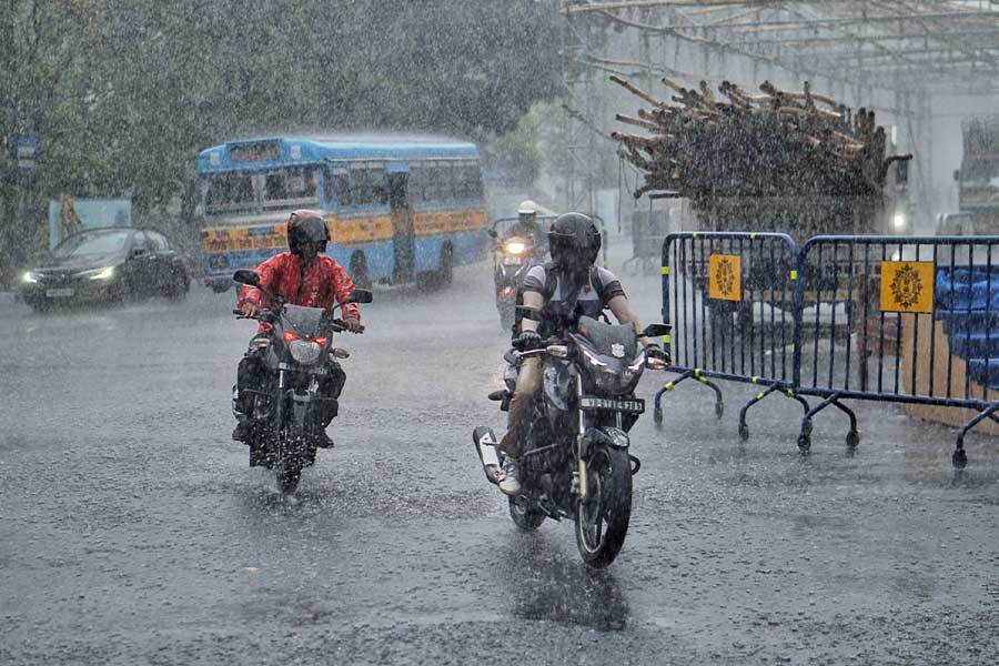
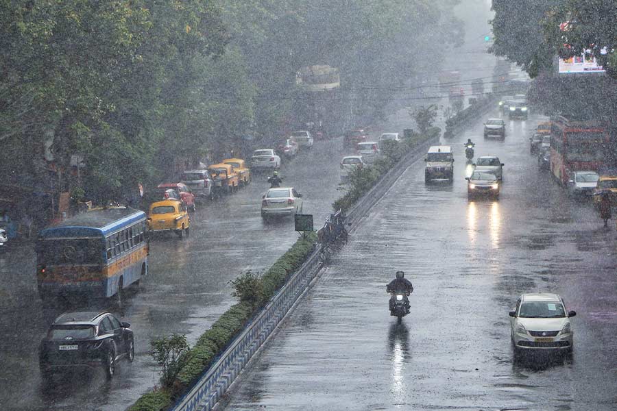
It’s going to be a rainy week ahead for Kolkata and most of West Bengal, according to a bulletin released by the India Meteorological Department (IMD) on Friday. The rain released a bulletin notifying that West Bengal would be receiving rainfall for the next seven days owing to cyclonic circulations.
Kolkata has been receiving rain since May 6 with the highest rainfall of 62.2mm recorded on May 9. Thundersquall with wind blowing at 60-70kmph along with light to moderate rain and lightning occurred in some parts of Kolkata, North 24-Parganas and South 24-Parganas on Thursday evening. Hailstorms also occurred on Thursday at some places in the city.
An east-west trough is running from a cyclonic circulation over northwest Rajasthan to south Assam across Madhya Pradesh, Jharkhand and Gangetic West Bengal at 0.9km above mean sea-level and this can bring rain to Bengal. Another cyclonic circulation lies over north Bihar and its neighbourhood at 3.1km above mean sea-level. A trough runs from above cyclonic circulation over north Bihar to north Odisha across Jharkhand and Gangetic West Bengal at 3.1km above mean sea level. Under these favourable synoptic conditions and strong moisture incursion from Bay of Bengal, there are high chances of thunderstorms with lightning and gusty winds continuing in the districts of West Bengal.
South Bengal is likely to experience thunderstorms with winds reaching a speed of up to 50kmph till May 17. Birbhum, Nadia, Murshidabad, North and South 24-Parganas and East Midnapore are likely to be affected by thunderstorms. Heavy rainfall (7-11 cm) is likely to occur at one or two places in Murshidabad and East Midnapore.
The rainfall over the past few days has brought respite to the state from the month-long heatwave. The maximum temperature in the last two days for Kolkata was between 30ºC and 32°C, while the minimum temperature spanned around 21-25°C. On Friday, the weather was mostly cloudy in the city till afternoon with maximum temperature of 32°C and minimum temperature of 21.9°C. Thundershowers are likely to occur in the evening.
But will the heatwave be back once the cyclonic circulations fade away? S. Banerjee, scientist, IMD, told My Kolkata: “The temperature now is below normal because of the rain. But once this period is over, the temperature will rise again and will be a little above normal. In the next seven days, there are no possibilities of the maximum temperature touching the 40°C-mark but after seven days, the temperature will surely rise.”